The Dingle Way Walking Guide: 8 Days Around Ireland's Wildest Peninsula
Ready to walk it? See our self-guided Dingle Way walking holidays with luggage transfer, hand-picked B&Bs and 24/7 support.
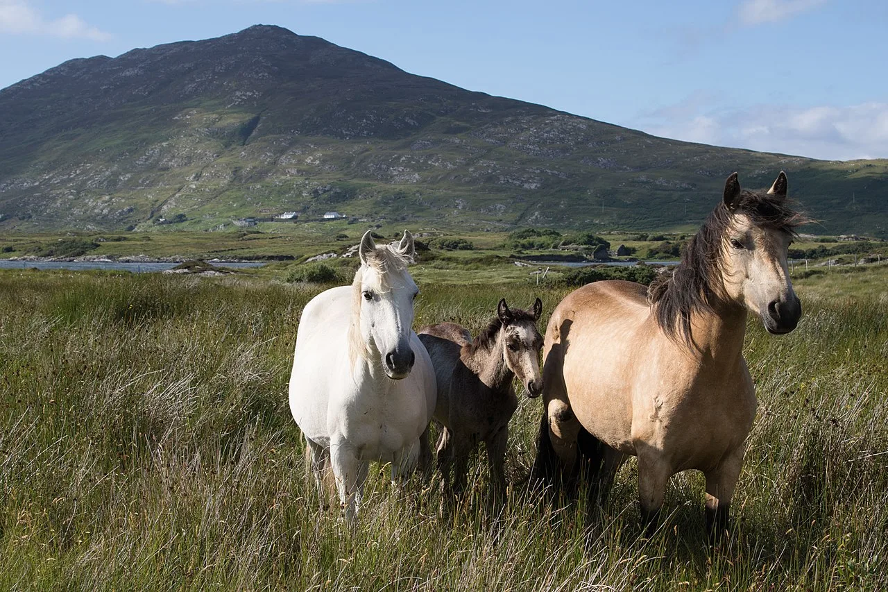
✈ 8-Day Dingle Way Walking Guide
The Dingle Way Walking Guide: Eight Days I Still Talk About
I have walked a lot of Irish trails. The Dingle Way is the one I keep coming back to. This Dingle Way walking guide is the version I wish I had read before my first loop around the peninsula – written after years of sending guests on it, walking sections with them, and listening to what they talked about over dinner each night.
Our eight-day itinerary has changed a few times. The version below is what we run now. It starts in Tralee, takes you down the south side of the peninsula to Annascaul, Dingle and Dunquin, and then turns north and finishes with the big day – Brandon Mountain into Cloghane. It ends where the scenery is at its absolute best, and that is deliberate.
Is the Dingle Way Worth It?
The Dingle Peninsula is a Gaeltacht – an Irish-speaking region – and walking it feels different from walking anywhere else on the island. Shop signs are in Irish first. The man who runs the guesthouse in Dunquin switches between three languages in a single sentence. You pass beehive huts that were built before the Normans ever landed in Ireland.
The walking itself is a mix of coastal lanes, bog, mountain tracks and the occasional quiet road. Most days are 17 to 23 kilometres. The last day is the one that earns the beer. Moderate fitness is enough if you have done a bit of training. You do not need to be a hill walker, but your boots should be broken in before you arrive — I have watched that mistake ruin more walks than bad weather ever has.
The 8-Day Dingle Way Itinerary
Here is the route, stage by stage, with the actual distances and climb from our GPS tracks. No rounding up.
Day | Stage | Distance | Ascent |
|---|---|---|---|
1 | Arrival in Tralee | — | — |
2 | Tralee → Camp | 17.3 km | 421 m |
3 | Camp → Annascaul | 17.8 km | 449 m |
4 | Annascaul → Dingle | 22.5 km | 523 m |
5 | Dingle → Dunquin | 21.3 km | 459 m |
6 | Dunquin → Cuas | 22.8 km | 296 m |
7 | Cuas → Cloghane | 17.3 km | 776 m |
8 | Departure from Cloghane | — | — |
Day 1 — Arrival in Tralee
You start in Tralee, the county town of Kerry. Settle in, collect your maps, waterproof map case and route notes, and get a full briefing on what lies ahead. Evening arrival is fine. Walk around the town, eat in the Roast House, and have an early night. The walking starts tomorrow.
Day 2 — Tralee to Camp (17.3 km, +421 m)
Your first day on the trail is a gentle on-ramp. The route moves through farmland and low rises as you head west onto the peninsula proper. Nothing dramatic. That is the point. Your legs get used to the rhythm of multi-day walking before anything demanding arrives. By the time you drop into camp, the landscape has already started to feel wilder — the farmland is rougher, the hedgerows are lower, and the sky feels bigger.
Day 3 — Camp to Annascaul (17.8 km, +449 m)
You are properly in Dingle country now. The scenery tightens up. You climb away from the camp with the Slieve Mish mountains on one side and Tralee Bay glinting behind you. Annascaul is a small village with real character, and it has the South Pole Inn — the pub founded by Tom Crean, who walked to the South Pole with Shackleton. Sit at the bar, read the framed letters on the wall, then sleep well. Tomorrow is your longest day.
Day 4 — Annascaul to Dingle (22.5 km, +523 m)
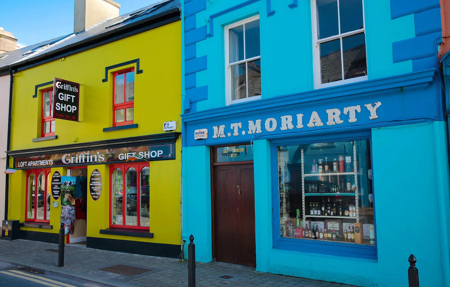
The longest day and one of the best. The route brings you over rolling coastal terrain into Dingle town. Somewhere around Minard the ocean opens up in front of you, and that is it — the Atlantic is with you for the rest of the week. The final drop into Dingle along the old road is a small piece of theatre. You arrive at a working fishing port full of colourful shopfronts, excellent seafood and traditional music sessions that do not feel staged. Eat at Out of the Blue if you can get a table. Have a pint in Dick Mack's afterwards. You earned it.
Day 5 — Dingle to Dunquin (21.3 km, +459 m)
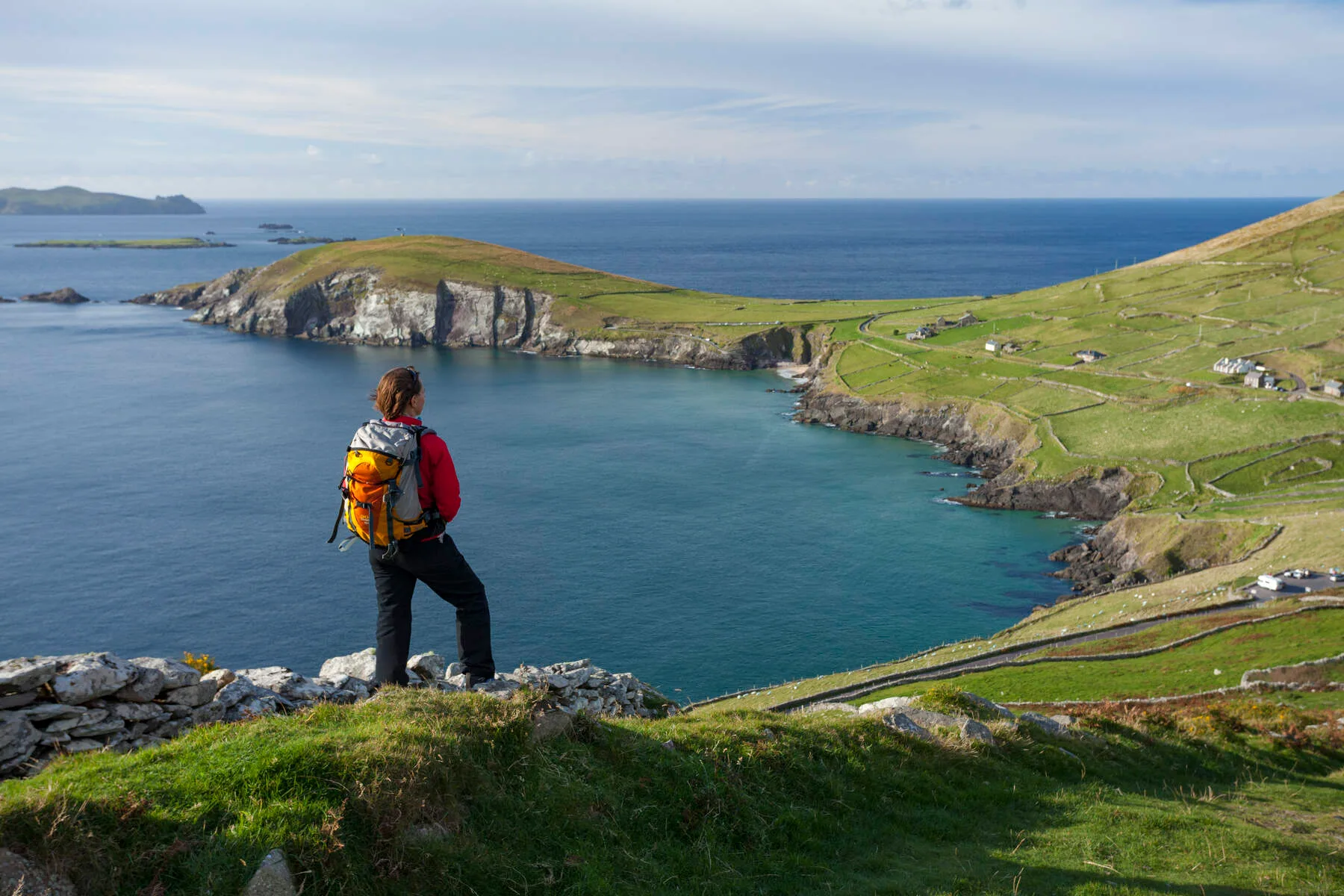
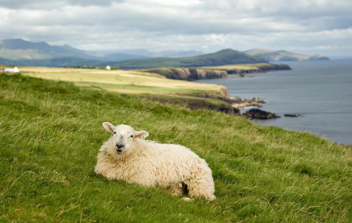
This is the day people come for. You are walking Slea Head rather than driving it. Coastal paths, cliffside views and the Blasket Islands sitting offshore look like something a film crew put there. I have done this stage in June light and in October rain, and I honestly cannot decide which is better. The wind moves the grass in waves. You pass Dunbeg Fort and clusters of beehive huts that have been there since the early Christians. Dunquin itself is tiny — a handful of houses, one shop and a pier that drops down the cliff in switchbacks. Good for a quiet pint and a think.
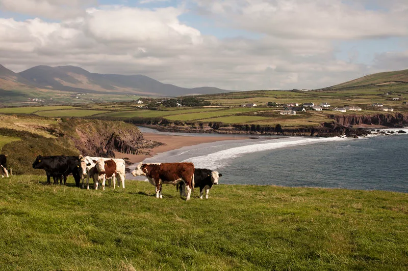
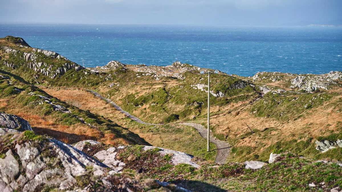
Day 6 — Dunquin to Cuas (22.8 km, +296 m)
The route continues along the northern edge of the peninsula, following coastal paths through land that feels genuinely remote. Ascent is low today, but the distance is not short — 22.8 km with the Atlantic always to your left. You pass Ballyferriter and Gallarus Oratory, a perfectly preserved early Christian church built of dry stone with no mortar. Still watertight after more than a thousand years. Worth stopping for. Cuas is small and quiet, which is exactly what you want before the big day.
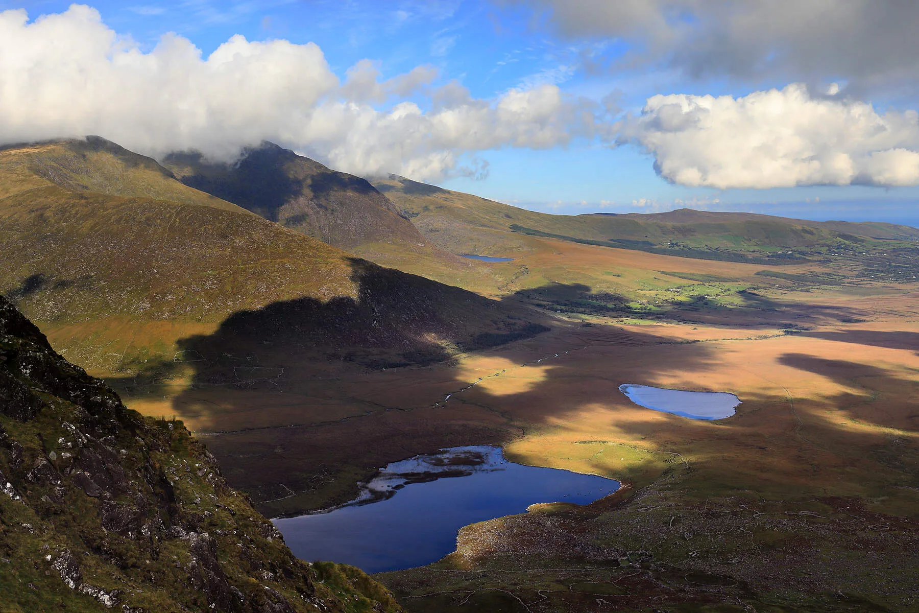
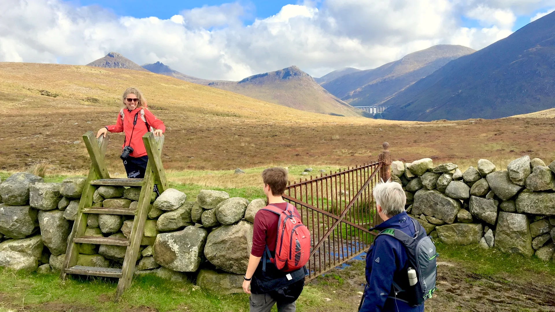
Day 7 — Cuas to Cloghane (17.3 km, +776 m)
This is the tough day. It is also the one you will remember longest. You ascend 776 metres over the flanks of Brandon Mountain, Ireland's second-highest peak at 952 metres, through wild mountain terrain past ancient pilgrim paths. The trail does not take you to the summit, but it does take you high enough that on a clear day the views across the peninsula and out into the Atlantic are the sort you sit down for. I have walked it in sideways rain too, and that has its own kind of glory. Take your time on the descent. Cloghane is a handful of houses clustered by an estuary at the foot of the mountain. Walking into it with tired legs and dirt on your boots is one of the best feelings Irish walking can give you.
Day 8 — Departure from Cloghane
Your walking holiday ends in Cloghane. A coach transfers you back to Tralee, where your adventure began. Tired, content, full of stories, and already thinking about the next one.
When to Walk the Dingle Way
The best months are May, June and September. June has the longest daylight and the wildflowers are at their peak. September has the light — the sun drops lower, the cliffs turn gold in the afternoon, and the peninsula empties out. July and August are fine, but Dingle town is busier. October is possible if you are flexible with the weather. I would not walk it in winter for pleasure unless you really know what you are doing on Brandon in low clouds.
What to Pack
The Dingle Way rewards good preparation. Here is the honest short list:
Broken-in waterproof hiking boots — not new ones, not runners.
Proper waterproof jacket and overtrousers. Atlantic squalls come through fast.
Warm mid-layer — fleece or merino. The wind on Brandon can chill you even in July.
Hat and light gloves. Yes, even in summer.
Merino wool socks, at least two pairs. Cotton will give you blisters.
Day pack of 20–25 litres. Your main luggage is moved between guesthouses each day on our tours, so you only carry what you need for the day.
Water, snacks, sunscreen, blister plasters. Walking poles if your knees thank you for them.
Self-Guided or Guided?
Most of our guests walk the Dingle Way self-guided. That means we book the accommodation, move your luggage between guesthouses each morning, give you detailed route notes and GPS files, and stay on the other end of the phone if anything goes sideways. You walk at your own pace, stop when you want, and eat where you want. For most people it is the right balance of independence and logistics-handled-for-you.
If you are walking the Dingle Way in peak season, book by April at the latest. The good guesthouses fill early, particularly in Dunquin and Cloghane, where there are only a handful of beds.
A Last Thought
People ask me what makes the Dingle Way special. The honest answer is that it is one of the few places left in Ireland where the walking, the landscape and the culture are all pulling in the same direction. The trail is genuinely beautiful. The villages still feel like villages. The language is alive. The food is good. And the last day, coming off Brandon Mountain into Cloghane with the Atlantic behind you, is as good as Irish walking gets.
If you want us to put a Dingle Way walking guide, the logistics and the beds together for you, drop us a line at info@walkingholidayireland.com or WhatsApp +353 87 957 3856. We will sort the rest.
Frequently Asked Questions
Are the trails well-marked?
What kind of boots should I wear?
Where does the Dingle Way start and end?
What are the most essential items to pack for a walking holiday in Ireland?
Photo Gallery