Walking the Wicklow Mountains — A Guide From People Who Know the Trails
Walking the Wicklow Mountains — A Guide From People Who Know the Trails
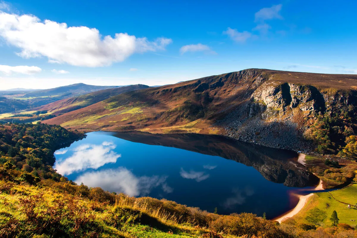
The first time you stand on the ridge above Lough Tay and look down at the white sand beach curving along the far end of the lake, you understand why film crews keep coming back to the Wicklow Mountains. The landscape looks like it was composed: the dark water, the pale sand, and the steep heather slopes rising on all sides, and not a road in sight from up here. It's been used as a Scandinavian fjord, a Scottish highland, and a mediaeval battlefield. It is, in fact, forty minutes from Dublin city centre.
We've been guiding walkers through the Wicklow Mountains on the Wicklow Way for many years. What follows is what we actually know — the things you discover when you walk the same trails season after season, not the things you find by reading a map.
Where are the Wicklow Mountains?
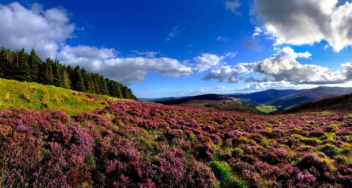
The Wicklow Mountains lie in County Wicklow, beginning roughly 30 kilometres south of Dublin city centre and stretching southward towards County Carlow. They form the largest continuous upland area in Ireland — approximately 500 square kilometres of blanket bog, granite peaks, glacial valleys and ancient oakwood.
Wicklow Mountains National Park was established in 1991 and covers 20,483 hectares at the heart of the range. It protects some of the most intact upland bog landscapes in Europe, as well as the glacially carved valleys — Glendalough, Glenmalure, and Glenmacnass — that provide the Wicklow Mountains their character.
The highest peak is Lugnaquilla at 925 metres. On a clear day from the summit, you can see across all four provinces — the plains of Kildare to the west, the Mourne Mountains to the north, and Snowdonia on an obvious day across the Irish Sea to the east. But the Wicklow Mountains are not primarily a peak-bagging destination. Their character comes from the combination of the valleys, the bogland, the ancient woodland and the extraordinary quality of the light.
The underlying rock is granite — pushed up through the earth's crust around 400 million years ago. The region is geologically significant and visible in everything: the acidic bogland, the clear peaty streams with their faint orange tint, the specific plant communities, and the way the crags above Glendalough catch the late afternoon light. The Wicklows look and feel different from Kerry or the Burren because the geology is different.
The Wicklow Way — Ireland's first long-distance walking trail
The Wicklow Way was established in 1981, making it Ireland's first official long-distance walking trail. It runs 127 kilometres from Marlay Park in south Dublin to the village of Clonegal in County Carlow, and most walkers complete it in six to eight days.
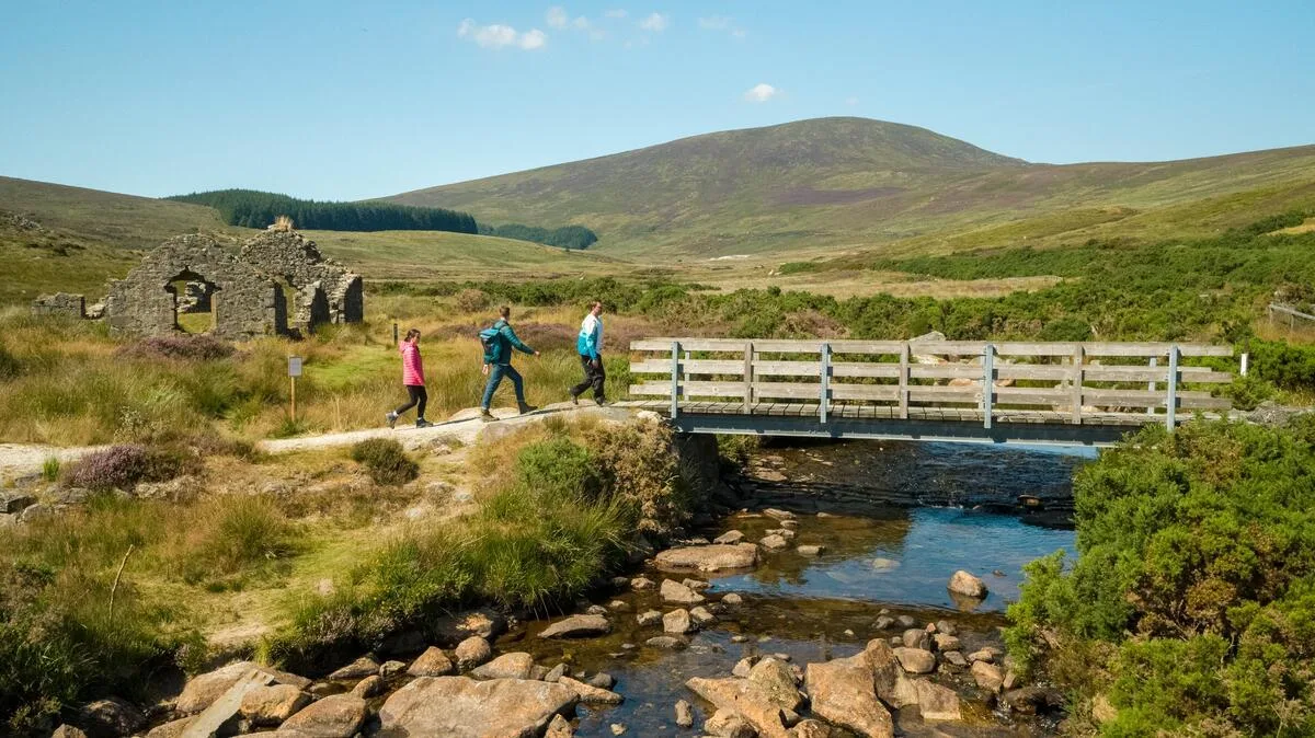
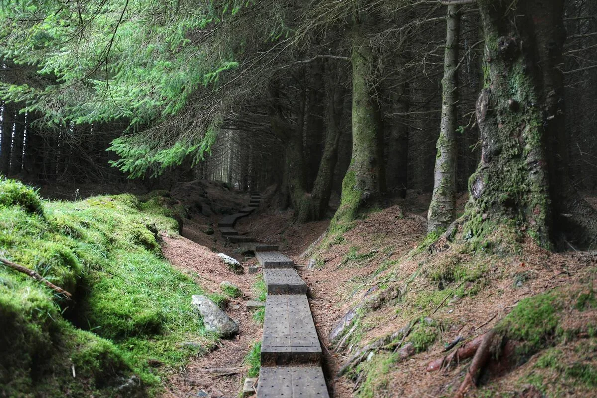
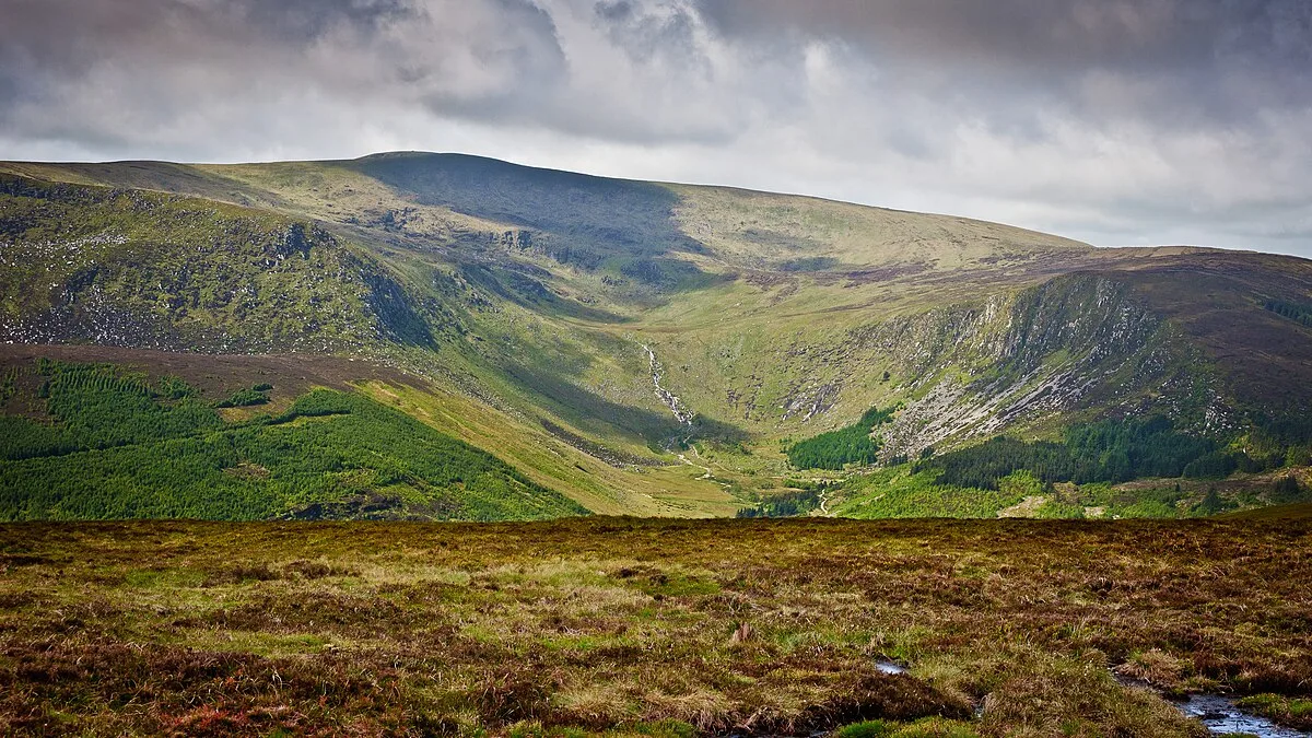
The route divides naturally into two halves. The first four or five days cross the heart of the Wicklow Mountains — climbing out of the Dublin suburbs, traversing the open moorland above Enniskerry and Roundwood, descending into Glendalough, and pushing on through remote bog and forestry to the upper reaches of the Wicklow Mountains National Park. This leg is the dramatic section: exposed ridgelines, sudden valley views, the particular silence of high bogland on a still morning.
The second half descends into the quieter pastoral landscape of south Wicklow and north Carlow — farmland, river valleys, and small villages. It is less dramatic, but it has its rewards: the pace slows, the light softens, and you have time to absorb what you've walked through.
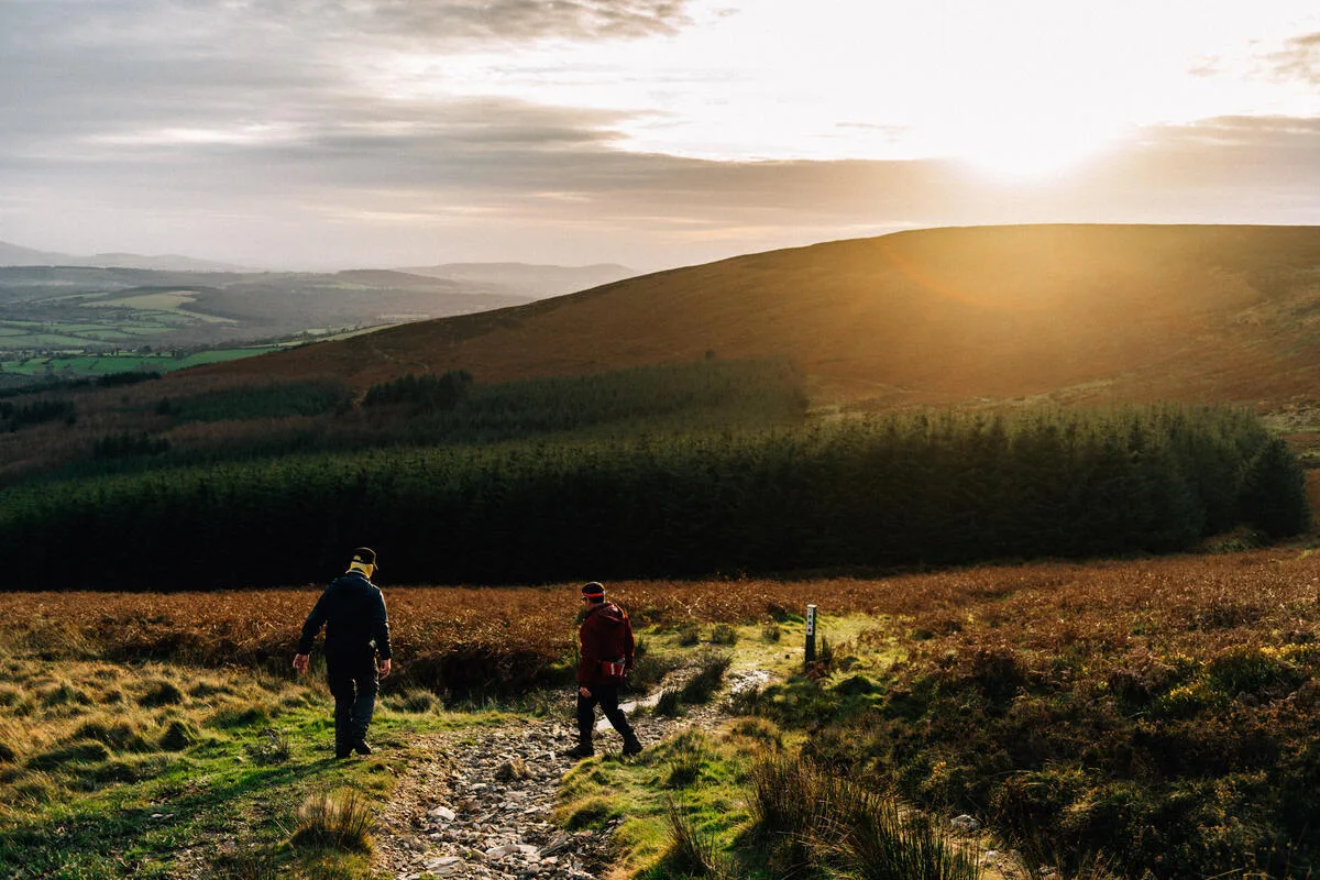
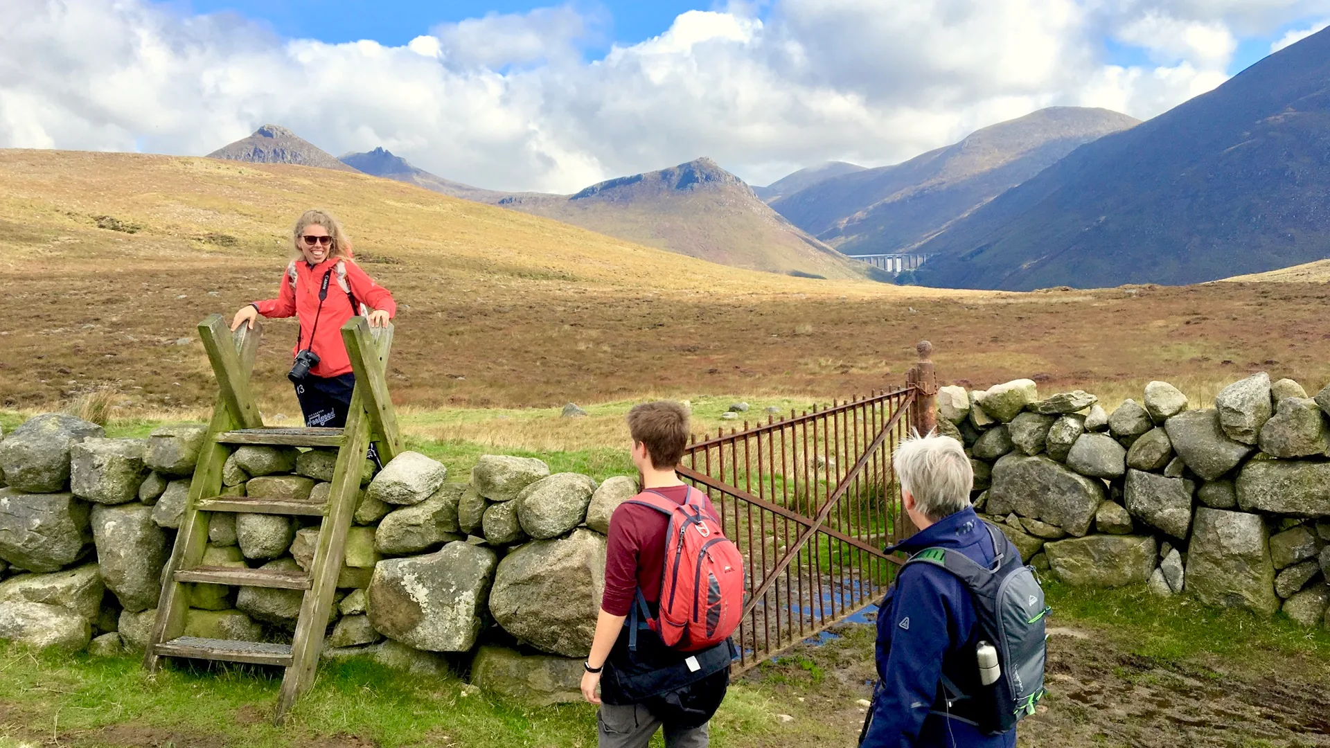
We always tell walkers that the first significant climb — out of Kilmacanogue, up through Crone Wood, onto the open ridge — is when the walk begins. Until that point, you're still in suburban Dublin. After it, you're in mountain country, and the city behind you might as well be on a different continent.
The Wicklow Way is classified as moderate in difficulty. There's no technical climbing, but the cumulative daily elevation can surprise walkers if they have underestimated it. Typical stages run from 17 to 26 kilometres. We recommend splitting the longer stages for first-time long-distance walkers.
What to see in the Wicklow Mountains
Glendalough
Glendalough — the Valley of Two Lakes — is the most visited site in the Wicklow Mountains, and for good reason. A 6th-century monastic settlement founded by St Kevin sits at the eastern end of the valley, its round tower rising above the trees. The monastic complex was one of the great centres of early Christian learning in Europe; pilgrims came here for centuries before the Vikings raided it and, later, the English burnt it.
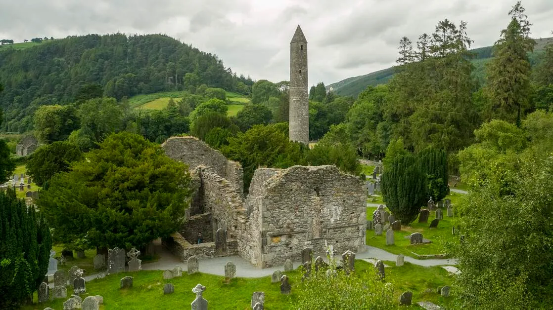
What most visitors see is the lower valley – the car park, the visitor centre, and the graveyard with its round tower. Walkers on the Wicklow Way arrive differently: coming down through the forest from the north; descending to the upper lake first; walking the Miners' Road along the water; and entering the monastic site from above. The approach on foot changes the experience entirely.
The upper lake in early morning mist is one of the most magnificent Irish landscapes. We walked through it in May, when the valley is still and the reflections are perfect, and in October, when the birch trees turn and the light is low and golden. Both are worth the effort to walk to.
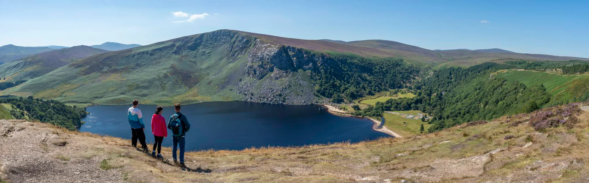
Lough Tay — the Guinness Lake
Lough Tay sits in a steep-sided corrie on the eastern slope of Luggala Mountain, owned by the Guinness family since the 1930s. The white sand beach at the southern end – reputedly brought in by the Guinnesses – provides the lake with its distinctive appearance: dark water, pale sand, and heather slopes rising sharply on three sides.
From the viewing point on the road above, it looks painted. From the ridge above that – the route walkers take on the Wicklow Way – it looks entirely wild, with no roads or buildings visible in any direction.
Lough Tay and Vikings: The lake's dramatic corrie setting was used throughout the History Channel series (2013–2020) as a Scandinavian fjord. The steep heather slopes and dark water read as Nordic on screen, particularly in winter light. The same location appeared in Penny Dreadful.
Powerscourt Waterfall
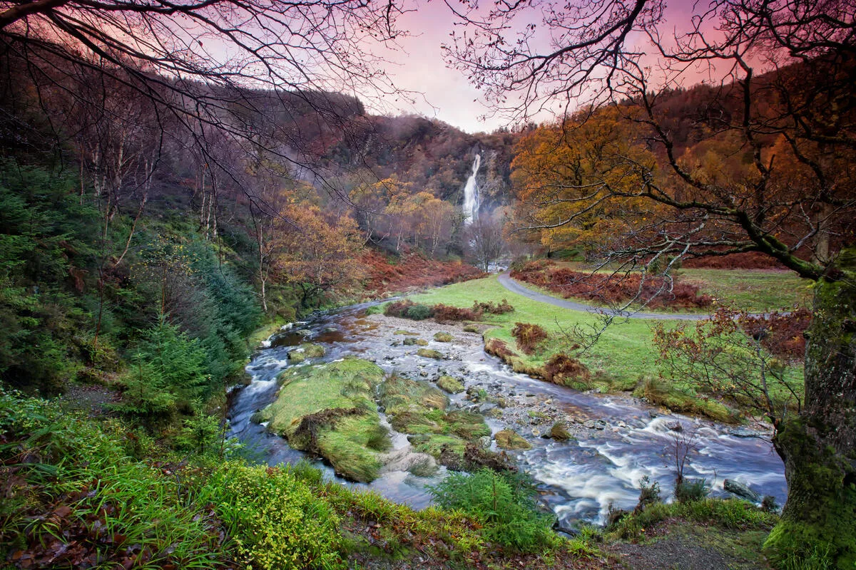
At 121 metres, Powerscourt Waterfall is the highest waterfall in both Ireland and Britain. It falls off a granite shelf into the Dargle River in the western shadow of Great Sugar Loaf. From the estate grounds, it's impressive. From the Wicklow Way trail above, arriving through the forest on your first day of walking, it's something else: a white thread on the dark hillside, audible before it's visible.
Glenmacnass Waterfall
The R115 Military Road — built after the 1798 rebellion to allow British forces access to the mountains — runs through the remote heart of the Wicklow Mountains, past Glenmacnass Waterfall, where the river drops off the plateau in a powerful cascade above the valley. There's almost no development in this part of the range; the road is empty on most mornings, and the landscape feels genuinely remote.
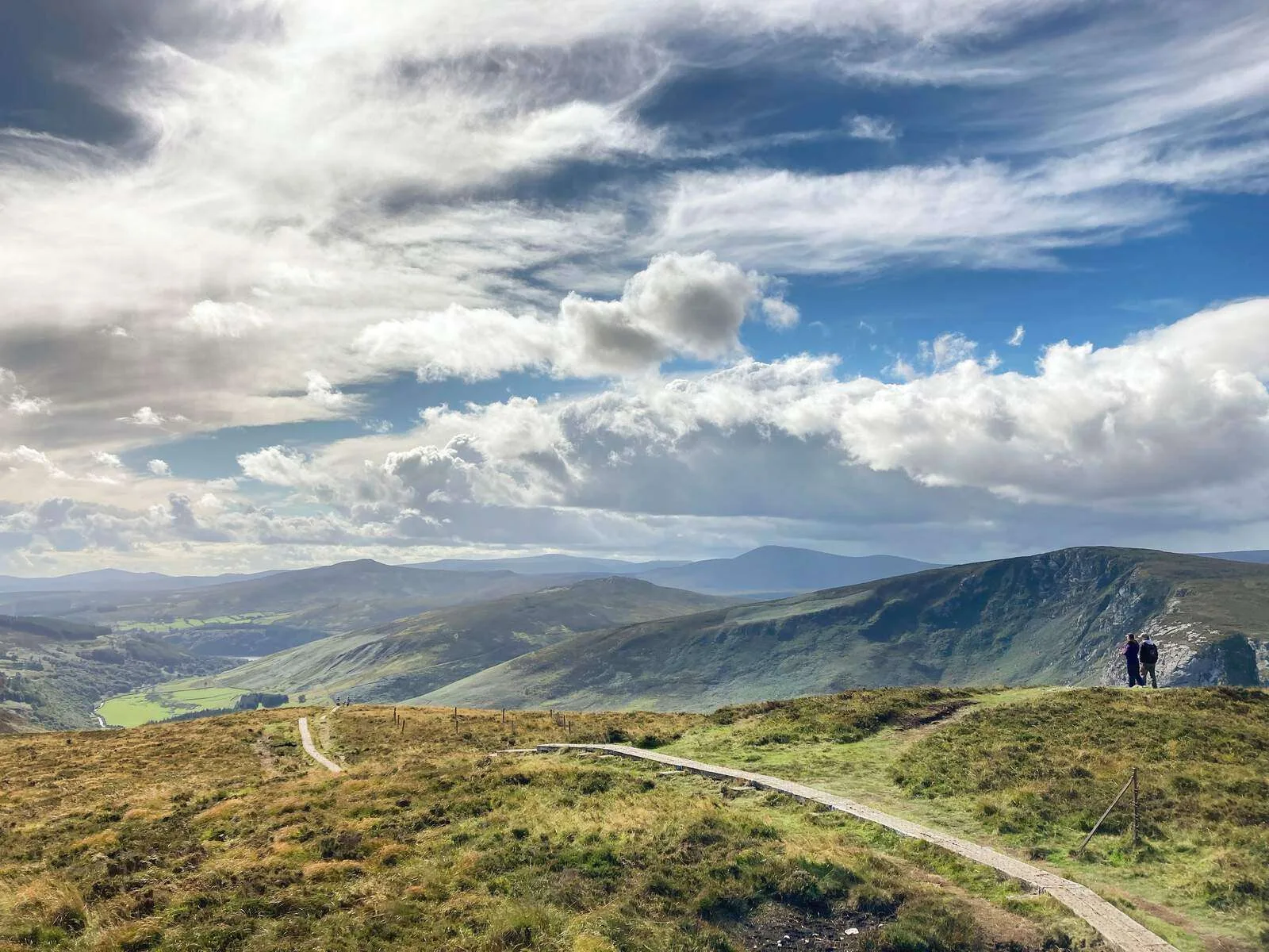
Djouce Mountain
At 725 metres, Djouce is not the highest point in the Wicklows, but it may be the most satisfying summit. The ridge walk from the col above Roundwood gives views east to Dublin Bay and south across the full length of the national park. The ground is firm underfoot by Wicklow standards—less boggy than the plateau sections— and the ascent is short enough to feel accessible.
We've walked it in every month of the year. October is our favourite: the bracken turns rust-red across the lower slopes, the bog cotton has gone, and the air has that particular autumnal sharpness. You can see twenty kilometres in any direction and the whole city-and-coast panorama to the east.
The Wicklow Mountains on screen
The Wicklows have been standing in for somewhere else in films and television for decades. The combination of dramatic landscape, accessible location, and minimal visible infrastructure makes them uniquely useful for productions.
Lough Tay and Vikings: The History Channel series (2013–2020) used the lake's dramatic corrie setting as a Scandinavian fjord. The steep heather slopes and dark water read as Nordic on screen, particularly in winter light. The same location appeared in Penny Dreadful.
Glendalough and P.S. I Love You. The 2007 film used the valley and monastic site for its Irish scenes. The round tower is one of the most recognisable images of early mediaeval Ireland, and the valley provided a visual shorthand for the country that international audiences recognised.
Sally Gap and Bodkin: Netflix's 2024 Irish noir thriller used the plateau landscape of the Sally Gap extensively. The isolation of the high bog—treeless, roadless, visually stark— was exactly what the production needed.
Wicklow Way forestry sections and Wednesday Season 2: Sections of the Wicklow Way corridor near Roundwood were used in the second series, filmed in autumn 2022. Walkers arriving the following spring found the usual evidence: cleared ground, temporary track markings, and the occasional piece of forgotten kit wedged in a ditch.
Braveheart (1995): Several battle scenes were filmed in the flat bogland near Blessington. The production used several hundred Irish Army extras; the logistics involved temporarily closing sections of road that are now well-known walking routes.
The filming locations have become a draw in themselves. But the honest advice is: walk the Wicklow Way for the landscape, and treat the filming locations as a bonus. The mountains are worth the walk, no matter what people have shot here.
Wildlife in the Wicklow Mountains
The national park supports one of Ireland's most significant wildlife populations, and walkers on multi-day routes have a genuine advantage over day-trippers — you cover more ground, at a slower pace, at the hours when wildlife is most active.
Red deer: The Wicklow Mountains have the largest surviving wild red deer herd in Ireland — approximately 1,000 animals. They're most reliably seen at dawn and dusk in the Glendalough and Glenmalure valleys, particularly in autumn during the rut. We've had walkers arrive for a quiet evening and find twenty stags on the valley floor.
White-tailed eagles: Reintroduced to Ireland in 2007, white-tailed eagles have established breeding territories in Wicklow. The wingspan reaches 2.5 metres — they are unmistakable overhead, and there's a genuine chance of a sighting on the ridgeline sections of the Wicklow Way. The appearance of a buzzard (common in Wicklow) is sometimes the first alert that an eagle is in the area — the buzzards make a lot of noise.
Peregrine falcon: Nests on the granite crags above Glendalough in most years; visible from late spring through summer. The stoop – a vertical dive at speeds of up to 300 km/h – is visible from the valley floor if you're in the right place at the right time.
Red squirrel: Present in the Crone Wood section at the start of the Wicklow Way. The forestry above Enniskerry has a healthy population; we spot them most often in the morning before walkers have filled the trails.
The bogland itself is ecologically significant. Sphagnum moss, cottongrass, bog rosemary and sundew (a carnivorous plant) are the dominant species; the peat beneath them was laid down over 10,000 years and stores carbon at a density comparable to old-growth forests. Walking across blanket bog feels like walking on a living sponge — because it more or less is.
Planning your walk in the Wicklow Mountains
When to go
May to September offers the best walking conditions — long daylight hours, reasonable weather probability, and the mountain flora at its best. June and July give the longest days; September offers quieter trails and turning bracken. April is beautiful but cold on the high ground; October is still walkable, but the days are shortening quickly.
January and February are possible for experienced walkers, but the days are short, the ground is wet, and the exposed sections can carry ice. We don't recommend them for first-time visitors.
What the weather actually does
The Wicklow Mountains create their own weather — a fact that surprises walkers arriving from Dublin on a fine morning. The plateau acts as a barrier for Atlantic fronts and generates clouds even when the coast is clear. Always carry full waterproofs regardless of the morning forecast. Someone standing on the ridge above Lough Dan almost certainly coined the expression "four seasons in one day."
The compensation for the rain is the light. After a shower, when the sky clears and the sun hits wet heather, the quality of light in the Wicklow Mountains is something we can only describe adequately to those who have been there. You can photograph it, but the photograph never quite captures it.
Getting there
The Wicklow Way begins at Marlay Park in south Dublin, which is reachable by Dublin Bus from the city centre in about 30 minutes. No car is needed for a point-to-point walk — and in fact, walking without a car is the natural way to do it. Your luggage travels by van to each night's accommodation; you carry only what you need for the day.
For walkers arriving by air, Dublin Airport to Marlay Park is straightforward on public transport. We provide full transfer instructions with every booking.
Self-guided or guided?
Most of our walkers choose the self-guided option — you have detailed route notes, accommodation booked at each overnight stop, and luggage transfers arranged, but you walk at your pace without a guide alongside. This format suits people who want the freedom of the mountains and the confidence that someone else handles the logistics.
Our Wicklow Way self-guided walking holiday typically runs six to eight days, with a range of start points and finishing options depending on how much of the route you want to walk.
Other trails in the Wicklow Mountains
The Wicklow Way is the spine of the range, but there are excellent day walks throughout the national park for visitors who aren't walking the full route.
Glendalough loop trails: Four waymarked routes from 4 km to 11 km, all starting from the Glendalough visitor centre. The Green Road walk along the upper lake is the most scenic and one of the most accessible; the Poulanass loop climbs above the valley through oak woodland. These are well-maintained and signposted, making them suitable for walkers who wouldn't attempt the Wicklow Way.
Lugnaquilla from Glenmalure: A serious mountain day for experienced walkers — six to seven hours return from the valley. The approach through Fraughan Rock Glen is one of the finest mountain routes in Leinster. The summit is a flat, boggy plateau with no shelter; navigation in poor visibility requires a compass and the confidence to use it.
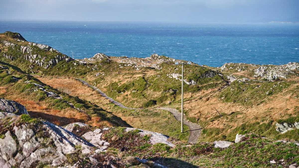
Bray Head coastal walk: On the eastern edge of the Wicklows, the cliff-top path from Bray to Greystones is one of the most accessible dramatic walks in the region — 7km one way, easily reached by DART from Dublin, and spectacular in any weather.
Vale of Avoca: Thomas Moore's "The Meeting of the Waters" sits at the southern end of the Wicklow Mountains, where two rivers converge in a wooded valley. It's a gentle, beautiful landscape that feels a world away from the high bog. It is a good way to end a week in the mountains.
If you're thinking about where to walk next after the Wicklow Mountains, the trails of Killarney National Park offer a very different Irish landscape — the sandstone peaks of Kerry, ancient oak woodland, and three lakes — and are well worth comparing.
Walking the Wicklow Way
If this makes you want to spend a week in these mountains, that's the right instinct. The Wicklow Way is one of the great Irish walks, and it's more accessible than many people assume: you don't need to be an experienced mountaineer, you don't need a tent, and you don't need a car. You need comfortable boots, a decent waterproof, and a willingness to let Ireland's weather do what it wants.
We take care of everything else. Browse our self-guided walking holidays or get in touch — we're delighted to talk through the route, the timing, and what a week in the Wicklow Mountains actually looks like on the ground.
Frequently Asked Questions
What is the Wicklow Mountains famous for?
How long does it take to walk the Wicklow Way?
What is the highest peak in the Wicklow Mountains?
Are the Wicklow Mountains worth visiting from Dublin?
Photo Gallery