Glendalough Walks Guide: 5 Essential Trails in Wicklow
A practical Glendalough walks guide from a team that has been putting independent walkers onto Wicklow trails for fifteen years — five marked loops, two easy extras, when to go, where each one starts, and how to get there without a car.
Glendalough — the Glen of the Two Lakes — sits in the heart of Wicklow Mountains National Park, just over an hour south of Dublin. It is the busiest day-walking spot in the country for a reason: the glacial valley, the round tower of Saint Kevin's monastic city, and the loop trails climbing straight off the valley floor are some of the finest short walks in Ireland.
This Glendalough walks guide covers the five waymarked loops that leave the National Park visitor centre and the Upper Lake car park, plus two easy walks from the monastic city. They range from a gentle stroll past the Round Tower to a serious half-day mountain walk on the Spinc ridge. Pick the one that matches your time, fitness and weather — and treat the colour-coded arrows as the second source of truth, after this guide. If you'd like the story behind the place before you go, read our piece on St Kevin of Glendalough.

1. The Spinc & Glenealo Valley (White Route, 9 km)
If you only have one day in Wicklow and you read this Glendalough walks guide for one trail, this is it. The Spinc (from An Spinc, "the pointed hill") is the boardwalked ridge that runs along the south side of the Upper Lake, 380 metres above the water.
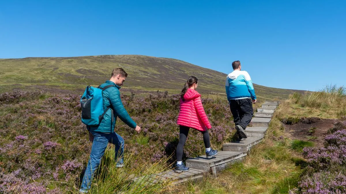
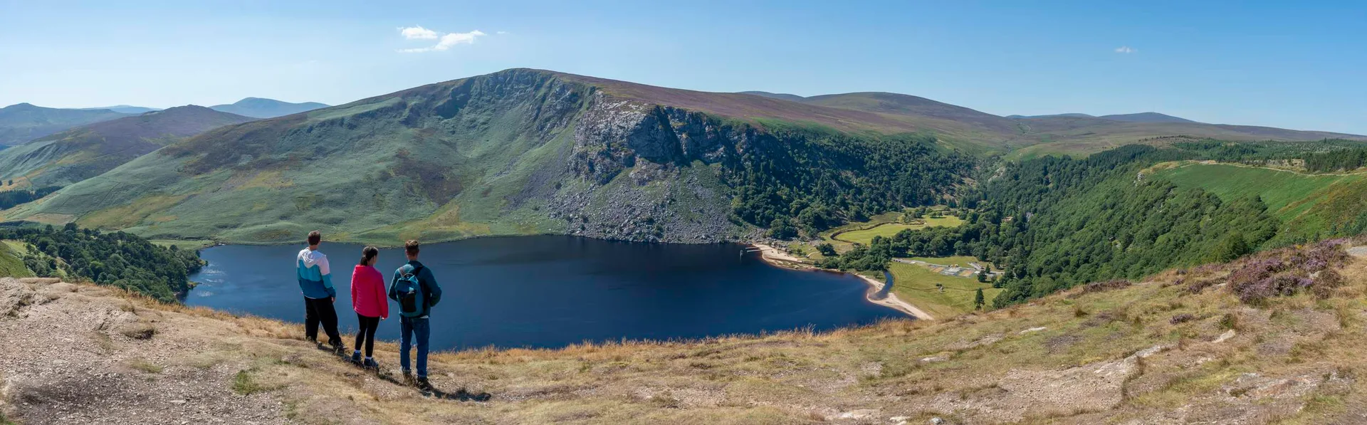
From the Upper Lake car park, follow the white arrows up through woodland and onto the railway-sleeper boardwalk. The climb is brisk — about six hundred steps — and once you crest the trees the view straight down on the Upper Lake opens out; on a clear day you can see over both lakes and out towards the Irish Sea. The boardwalk continues along the ridge, then drops west into the wild upper Glenealo Valley with its waterfalls and old miners' tracks. You return along the lake shore. Walked this way round — clockwise, as most people do it — you get the gentler descent.
Allow three to four hours. The boardwalk is narrow in places and slippery when wet — a good pair of walking boots is non-negotiable. In strong wind on the ridge, turn back; the view will still be there next time.
2. Poulanass Waterfall (Yellow Route, 1.7 km)
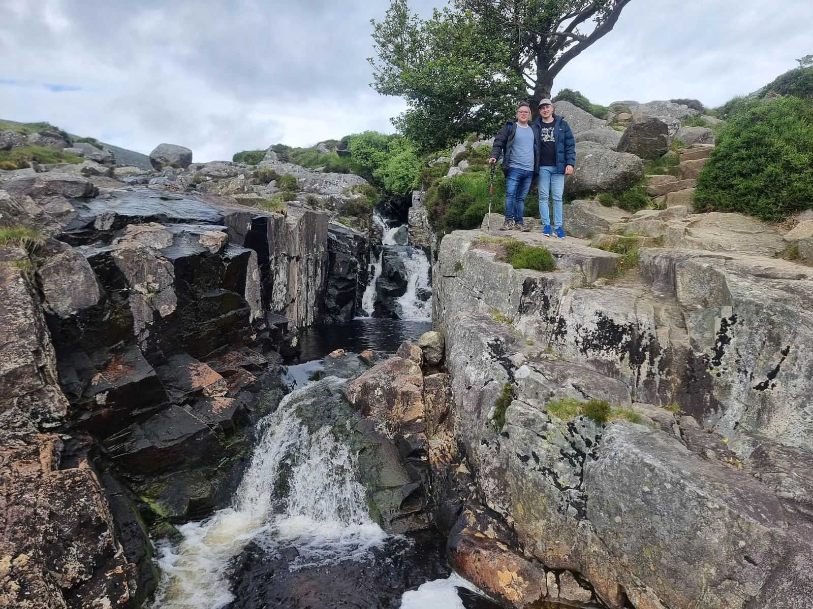
The shortest waymarked loop in this Glendalough walks guide, but a beautiful one. From the Upper Lake car park, the yellow arrows lead you up beside the Poulanass River — Poll an Eas, "hole of the waterfall" — through dense oak woodland and up to a pretty cascade. From the top of the falls you double back through the National Park forester's tracks to the car park.
Forty-five minutes at a gentle pace, with one short uphill section. It's perfect with children, or as a leg-stretch after the drive from Dublin. In autumn the woodland turns the trail gold and copper.
3. Derrybawn Woodland (Blue Route, 6 km)
Quieter than the Spinc by some margin, the Derrybawn loop climbs through a stand of mature beech and oak south of the Lower Lake. The blue arrows take you up to the open shoulder of Derrybawn Mountain (474 metres), where you get a clean side-on view of the whole Glendalough valley with the round tower miniature in the distance.
Two and a half to three hours. The descent through the woodland is one of the most underrated paths in the National Park — almost no one walks it on a busy weekend.
4. Miners' Road & Upper Lake (Green Route, 4 km)
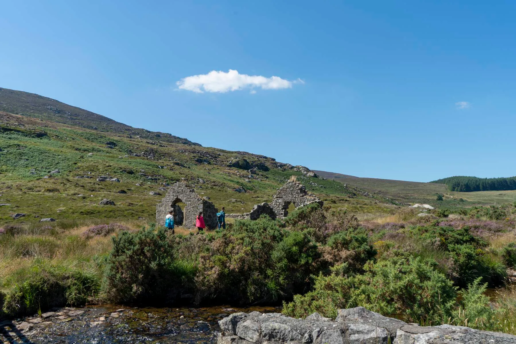
The flat option in this Glendalough walks guide, and the right call on a heavy weather day or when you're walking with anyone who'd rather not climb. The green route hugs the north shore of the Upper Lake on the old Miners' Road, the track laid down to bring lead and zinc out of the upper valley in the nineteenth century.
Pass the ruins of the old mining village at the western end of the lake before turning back. The whole loop takes about an hour, longer if you stop to sit on the lake shore. Look up at the Spinc boardwalk above you and you'll have a quiet smile about choosing the easy day.
If you'd like more without the big climb, carry on past the mining village into the Glenealo Valley itself. It's wilder and far less trodden than the lake shore: the river keeps you company, the old stone mine buildings sit abandoned along the path, and you can walk for long stretches without meeting anyone. Going out and back from the Upper Lake it's about 6 km, mostly level with a few rocky sections.
5. The Long Spinc & Lugduff (Red Route, 11 km)
For experienced hill walkers only — the advanced loop in this Glendalough walks guide. The red route extends the white Spinc loop south-west over the open mountain to Lugduff (652 metres) and along the high ridge before descending into Glenealo and back to the car park. Five to six hours, weather-exposed and with no shelter on the ridge.
Map and compass essential — the boardwalk ends and you're navigating across open blanket bog, frequently in poor visibility. Save this one for a settled day in May or September. On the right day it is the finest of the Wicklow loop walks.
Two more easy walks: the Lower Lake Loop and Glendalough to Laragh
These two start down at the visitor centre and the monastic city, and you don't need to be a serious walker to enjoy either.
The Glendalough Lower Lake Loop and monastic city (3 km)
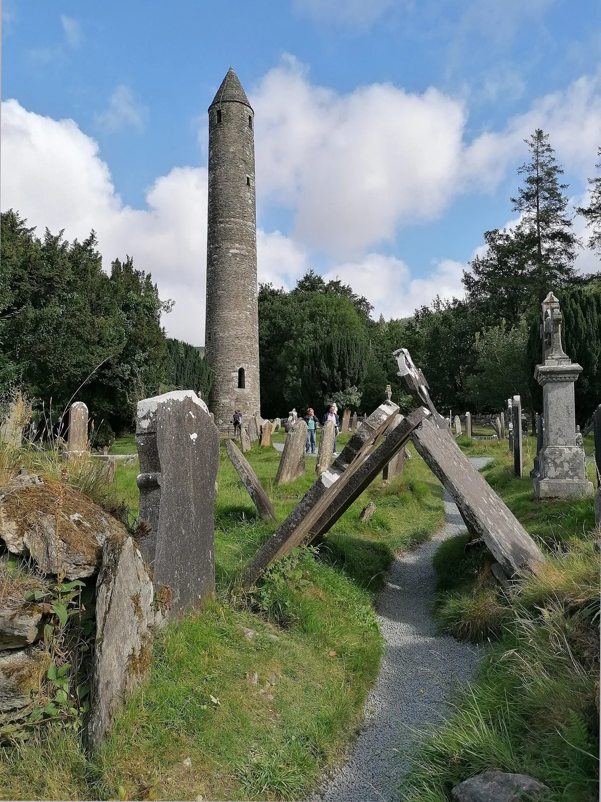
A gentle 3 km meander through woodland and along the water's edge of the Lower Lake, passing St Kevin's monastic city — the Round Tower, the stone gateway that was once the entrance to the monastery, and several medieval churches. Allow an hour to an hour and a half. It's flat and easy, ideal for families, first-time visitors, or anyone who wants to soak up the valley's history as much as its hills. Come early in the morning or late in the afternoon, when the light is soft on the tower and the coach groups have gone. For the wider landscape around the valley, see our guide to Wicklow Mountains National Park.
Glendalough to Laragh: a woodland wander to the pub
A short connector path of about 2 km links the visitor centre with Laragh village — roughly 25 to 30 minutes through woodland, ending at a pub or café. Nothing dramatic, but peaceful, and just what you want after the Spinc. It's also handy if you've come on the St Kevin's Bus and are staying in Laragh: you can reach your guesthouse without walking on the road.
Planning your visit — what this Glendalough walks guide doesn't tell you on the trail signs
Where to start
There are two car parks. The Upper Lake car park is paid (around €4 for the day) and has the best access to all five loops. The Visitor Centre car park down at the monastic city is free but adds 1.5 km of walking each way. On weekends the Upper Lake car park fills by mid-morning, and on bank holidays both fill by 11 a.m. — arriving around 8.30 a.m. makes all the difference. There are toilets at the visitor centre and at the Upper Lake car park, and none out on the trails.
Getting to Glendalough without a car
No car? No problem. The St Kevin's Bus runs daily from St Stephen's Green in Dublin and takes about 90 minutes, dropping you at the Glendalough Visitor Centre. It's reliable and popular with both locals and walkers, and on summer weekends seats go quickly, so book ahead in high season. Timetables are reduced in winter — check current times at stkevinbus.com.
Once you're in the valley, the trails link up on foot, so point-to-point walks are perfectly practical. If you're walking the Wicklow Way, there are bus connections at various points along the route, and we're always glad to help our guests work out the logistics.
When to come: the best time to walk Glendalough
May, June and September are the best months: long evenings, the bluebells and rhododendrons in flower, and a chance of dry rock on the Spinc boardwalk. Weekdays in the shoulder season are blissfully quiet. Month by month, this is how it plays out:
- May: the greenest hills of the year, bluebells in the woods and very long days, with manageable crowds.
- June to August: the most settled weather and the longest days, but also the fullest car parks. If you start at 8 a.m. you'll have the white route to yourself for the first hour; the Spinc is at its busiest in the middle of the day.
- September: golden light and tranquil mornings once the summer holidays are over — one of our favourite times in the valley.
- October and November: the woods turn amber and copper. Trails get muddier, but the valley empties out.
- December to February: short days (sunset around 4.30 p.m. in December), mud and sometimes ice, but mist on the lakes and a good chance of having the Spinc to yourself. Best for seasoned walkers.
- Bank holiday weekends (Easter, St Patrick's Day and August): avoid them unless you're out at dawn — the car parks and visitor centre get genuinely busy.
What to bring
Proper walking boots with ankle support — runners on the Spinc are how people sprain ankles, and the trails can be wet even in midsummer. A waterproof jacket regardless of the forecast, and a warm layer for the ridge. Two to three litres of water in summer (no taps on the trails), plus snacks — once you're out on the Spinc or in the Glenealo Valley, there's nowhere to buy anything. A simple map of the National Park is sold at the visitor centre for €3; pick one up if you're attempting the red route. For the open mountain, the OSI Discovery Series Sheet 56 is the paper map to carry.
Weather, safety and navigation
Never underestimate Wicklow weather. Conditions on the hills can change within twenty minutes and fog is common on the ridges, so check the forecast on Met.ie before you set out. Charge your phone, but don't rely on it: coverage is weak beyond the Upper Lake, so download offline maps or bring the paper map. Stay on the marked trails, keep dogs under control and leave no trace — the valley is part of Wicklow Mountains National Park for a reason.
Where to stay
Laragh village, about 2 km from the visitor centre along the woodland path, is the main base for walkers, with a small cluster of guesthouses, B&Bs and pubs that know how to handle muddy boots and early breakfasts. Booking ahead from May to September, and for bank holidays, is sensible — Laragh is small and the good places fill quickly. There's also the Glendalough Hostel if you're on a tighter budget, and a few self-catering options nearby if you're staying longer. If you want to walk Glendalough as part of a longer Wicklow trip, our 5-day Wicklow Way walking holiday takes you over the Spinc and Glenealo on day three, with luggage moved between guesthouses we've chosen and checked ourselves.
Glendalough on the Wicklow Way
Glendalough isn't just a day-walking destination — it's the stage most people remember on the Wicklow Way, Ireland's oldest long-distance trail. The Way runs 131 km from Marlay Park in Dublin to Clonegal in County Carlow. The typical stage in comes from Roundwood (about 18 km), dropping through forest and bog with mountain views most of the way, and the arrival at the Upper Lake after the long wooded descent — lakes shining, the Round Tower standing over the valley — is a moment walkers don't forget.
On our Wicklow Way holidays we always plan a night in Laragh or Glendalough, so you have time to rest, explore the monastic city and enjoy the valley properly before heading south towards Tinahely. Our complete guide to the Wicklow Way covers every stage, and you can see all our Wicklow Way walking holidays here.
Walk Glendalough as part of a Wicklow Way holiday
The Spinc, Glenealo Valley and the monastic city are day three of our self-guided Wicklow Way trips. We pre-book the guesthouses, transfer your bags between stops, and give you the route notes — you walk. It's the easiest way to do Glendalough properly without renting a car.
FAQs — the questions we get asked most about our Glendalough walks guide
Which Glendalough walk has the best view?
The white-route Spinc & Glenealo Valley loop. The boardwalk along the ridge gives you the iconic top-down view of the Upper Lake that you'll have seen on every postcard of Wicklow. The Derrybawn blue route is a close second for the side-on view of the whole glen.
How long does it take to walk the Spinc at Glendalough?
Three to four hours for the full 9 km white loop, including the descent through the Glenealo Valley. Allow longer if it's wet — the boardwalk steps are slow going in the rain. Most walkers leave the car park around 10 a.m. and are back by lunch.
Are the walks at Glendalough suitable for children?
The yellow Poulanass loop, the green Miners' Road and the flat Lower Lake Loop past the monastic city are all family-friendly with steady children of seven or older. The white Spinc has a long, steep climb and a narrow boardwalk that can be intimidating for younger kids. The red Lugduff loop is for fit hill walkers only.
Do I need to book to walk in Glendalough?
No — the trails are free and open year-round. The Upper Lake car park is pay-as-you-go. If you're driving from Dublin on a summer weekend, arrive before 10 a.m. or take the St Kevin's Bus to avoid being turned away when the car parks are full.
Can I get to Glendalough from Dublin without a car?
Yes. The St Kevin's Bus runs daily from St Stephen's Green in Dublin to the Glendalough Visitor Centre in about 90 minutes. Book ahead on summer weekends and check the current timetable at stkevinbus.com, as there are fewer services in winter.
Can I walk Glendalough in winter?
Yes, and on a clear winter day it's superb. Daylight is short (sunset around 4.30 p.m. in December), the boardwalk can be icy, and the open mountain on the red route is a serious undertaking. Stick to the green and yellow loops if conditions look hard.
Is Glendalough on the Wicklow Way?
Yes. The 131 km Wicklow Way passes through Glendalough, usually arriving from Roundwood (about 18 km), and for most walkers it's the highlight of the trail. On our self-guided Wicklow Way holidays we always plan an overnight in Laragh or Glendalough.
Is there food and water on the trails?
No taps and no shop on the trails themselves. Carry your water from the visitor centre. The Wicklow Heather restaurant in Laragh and the Glendalough Hotel both do good lunches before or after a walk.
Photo Gallery