Ireland's National Waymarked Ways: The Complete Guide
We've walked all of them. From the misty ridgelines of the Wicklow Mountains to the sun-bleached limestone of the Burren, from the wild Atlantic edge of the Beara Peninsula to the quiet towpath of the Grand Canal — between us, the Walking Holiday Ireland team has covered every National Waymarked Way on this island. And we're still not done talking about them.
Ireland is one of the world's great walking destinations. The network of National Waymarked Ways covers over 4,000 kilometres of long-distance trails, threading through every province, every landscape type, and most of the country's most spectacular scenery. Whether you want a gentle riverside stroll lasting a few days or a serious multi-week adventure across two provinces, there's a waymarked trail for you.
This guide covers every National Waymarked Way in Ireland — what each trail is like, who it suits, how long it takes, and whether Walking Holiday Ireland offers a self-guided holiday on that route. Bookmark it, or use it to start a very enjoyable argument with your walking companions about which trail to do first. And if you're torn between the big two, our Wicklow Way vs Kerry Way comparison weighs them up side by side.
What Are the National Waymarked Ways?
Ireland's National Waymarked Ways are a network of long-distance walking routes, maintained by Mountaineering Ireland and marked with distinctive yellow arrows and a walking figure symbol. The network was formally established in the 1980s, with the Wicklow Way — Ireland's first long-distance walking route — opening in 1981.
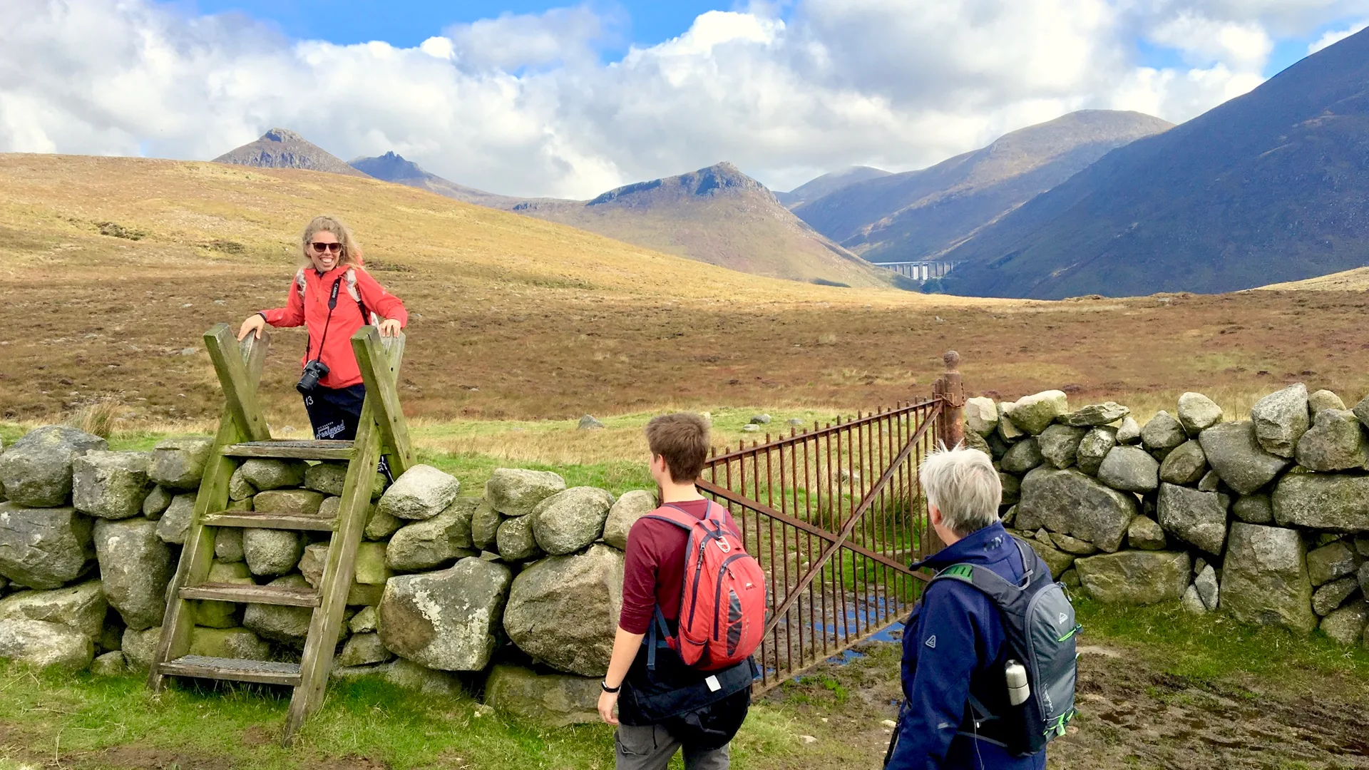
Unlike many European long-distance trails, the Waymarked Ways are almost entirely self-guided. There are no checkpoints, no mandatory stages, and — apart from the busy Wicklow Way in summer — rarely any crowds. You walk at your own pace, on your own schedule, through landscapes shaped by 5,000 years of Irish history.
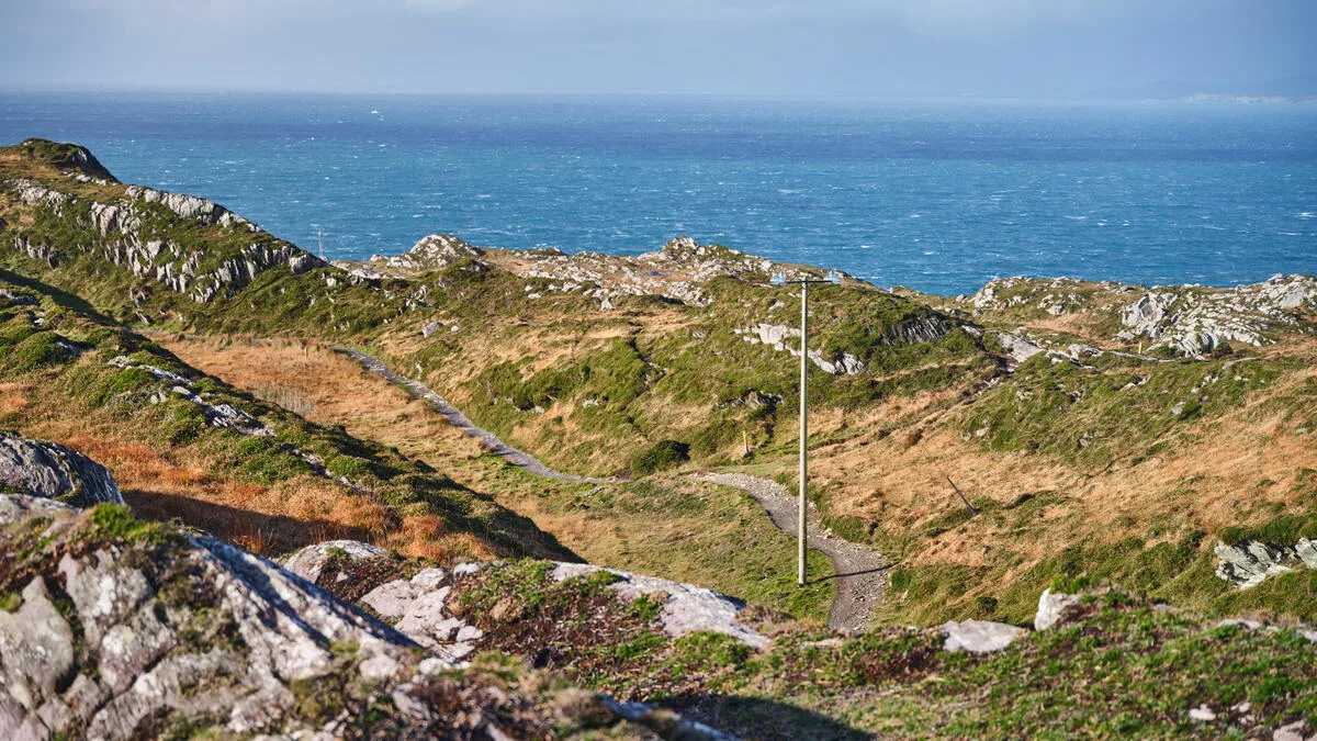
Most routes are waymarked to a high standard, but conditions vary. Some trails follow well-maintained gravel paths; others cross open mountain terrain where good navigation is an advantage. We flag the key differences in each individual trail guide in this series.
All Ireland's Waymarked Ways at a Glance
Here is every trail in the network, with key facts to help you compare:
| Trail | Province | Distance | Difficulty | WHI Tour |
|---|---|---|---|---|
| Wicklow Way | Leinster | 132 km | Moderate–Challenging | Yes |
| Kerry Way | Munster | 214 km | Moderate–Challenging | Yes |
| Dingle Way | Munster | 162 km | Moderate | Yes |
| Barrow Way | Leinster | 114 km | Easy | Yes |
| Beara Way | Munster | 200 km | Moderate–Challenging | Yes |
| Sheep's Head Way | Munster | 88 km | Easy–Moderate | Yes |
| Slieve Bloom Way | Leinster/Munster | 77 km | Moderate | Yes |
| East Munster Way | Munster | 70 km | Easy–Moderate | Yes |
| Wexford Coastal Path | Leinster | 220 km | Easy–Moderate | No |
| Tain Trail | Leinster/Ulster | 130 km | Moderate | No |
| Western Way | Connacht | 179 km | Moderate–Challenging | No |
| Bangor Trail | Connacht | 45 km | Challenging | No |
| North Mayo Greenway | Connacht | 42 km | Easy | No |
| Beara-Breifne Way | Munster–Ulster | 500 km | Moderate–Challenging | No |
| Burren Way | Munster | 123 km | Easy–Moderate | No |
| Lough Derg Way | Munster | 68 km | Easy | No |
| Blackwater Way | Munster | 168 km | Moderate | No |
| Grand Canal Way | Leinster | 145 km | Easy | No |
| Royal Canal Way | Leinster | 130 km | Easy | No |
| Leinster Way | Leinster | 128 km | Easy–Moderate | No |
| Cavan Way | Ulster/Connacht | 26 km | Moderate | No |
| Ulster Way | Ulster (NI) | 900+ km | Varies | No |
Munster: Ireland's Walking Heartland
If Ireland has a walking heartland, it is Munster. The province is home to the Kerry Way — the longest Waymarked Way in the Republic — as well as the Dingle Way, the Beara Way, the Sheep's Head Way, the Burren Way, the Blackwater Way, the East Munster Way, and the Lough Derg Way. Eight trails, ranging from the dramatic peaks of the Macgillycuddy's Reeks to the strange, flat limestone pavements of County Clare.
For walkers coming to Ireland for the first time, a Munster trail is usually the right choice. The Kerry Way is the gold standard: 214 kilometres of the most varied and beautiful scenery in the country, starting and finishing in Killarney. The Dingle Way circles the Dingle Peninsula in about a week — compact, spectacular, and manageable for most walkers. The Sheep's Head Way is West Cork's best-kept secret: shorter, quieter, and utterly beautiful.
Leinster: From Dublin's Mountains to the River Barrow
Leinster is home to the Wicklow Way — Ireland's oldest and most popular long-distance walk — plus a quieter collection of trails that often get overlooked in favour of the west. The Barrow Way is a particular favourite of ours: 114 kilometres of flat towpath following the River Barrow from Athy in Kildare to St. Mullins in Carlow. No mountain drama here — just wide rivers, medieval abbeys, and the unhurried pleasure of going exactly where the water takes you.
The Grand Canal Way and Royal Canal Way offer similar towpath walking, heading west from Dublin towards the River Shannon. For something with more elevation, the Slieve Bloom Way circles the surprisingly remote Slieve Bloom Mountains on the Laois-Offaly border — a trail that sees far fewer walkers than it deserves.
Further south-east, the Wexford Coastal Path traces 220 kilometres of Ireland's sunniest corner — long strands, dunes, fishing harbours and the wide sweep of the south-east coast. It is one of the flattest and most approachable long walks in the country, and still one of the least walked.
North of Dublin, the Táin Way loops the Cooley Peninsula in County Louth — mountain, forest and sea, following the route of the Táin Bó Cúailnge, Ireland's great epic. It is a short trail by the standards of this list, and one of the most atmospheric.
Connacht: Wild, Remote, and Rewarding
Connacht's trails are for walkers who want to get properly away from it all. The Western Way crosses Galway and Mayo through some of the most remote countryside in Ireland — bogs, mountains, and coastline with barely a town between trailheads. The Bangor Trail in north Mayo is one of the most challenging walks in the country: 45 kilometres of open mountain and blanket bog. Not for beginners, but unforgettable for those who make it.
Ulster: The Ulster Way and Beyond
Northern Ireland's Ulster Way is the most ambitious trail on the island: over 900 kilometres circling the entire province, taking in the Mourne Mountains, the Causeway Coast, the Glens of Antrim, and the Sperrins. Individual sections — particularly the Mournes and the Causeway Coast — rank among the finest day and multi-day walks anywhere in Ireland or Britain. The Cavan Way, at just 26 kilometres, is the shortest National Waymarked Way — a gentle two-day walk through the drumlin country of County Cavan.
How to Choose Your Trail
With over 20 trails to choose from, a few questions help narrow things down quickly.
How much time do you have? Most walkers plan four to eight days on a single trail. The Sheep's Head Way, East Munster Way, and Cavan Way suit shorter trips. The Kerry Way, Beara Way, and Western Way reward those with more time to spare.
How fit are you? The canal and river paths (Grand Canal Way, Royal Canal Way, Barrow Way) are flat and accessible to almost any walker. The Kerry Way, Wicklow Way, and Bangor Trail involve significant elevation gain and need appropriate fitness and footwear.
What landscape do you want? Coastal drama: Kerry Way, Dingle Way, Beara Way, Sheep's Head Way. Mountains: Wicklow Way, Bangor Trail, Western Way. River and canal: Barrow Way, Grand Canal, Royal Canal. Limestone and wildflowers: Burren Way.
Do you want logistical support? Walking Holiday Ireland offers fully supported self-guided holidays on eight of these trails — handpicked accommodation, luggage transfers, route notes, and a support line. You walk; we handle the rest.
Your Trail-by-Trail Guide
Over the coming months, we are publishing an in-depth guide to every trail in this series — including the ones we do not operate ourselves. Each guide covers the route in detail, the best sections to walk, what to expect underfoot, where to stay, and how to get there. You will find each guide here in the Irish Waymarked Ways section of our blog.
Ready to start planning? Browse our self-guided walking holidays — eight of Ireland's finest trails, fully supported from start to finish.