Barrow Way Walking Guide: Ireland''s Flattest Long-Distance Trail
Ready to walk it? See our self-guided Barrow Way walking holidays with luggage transfer, hand-picked B&Bs and 24/7 support.
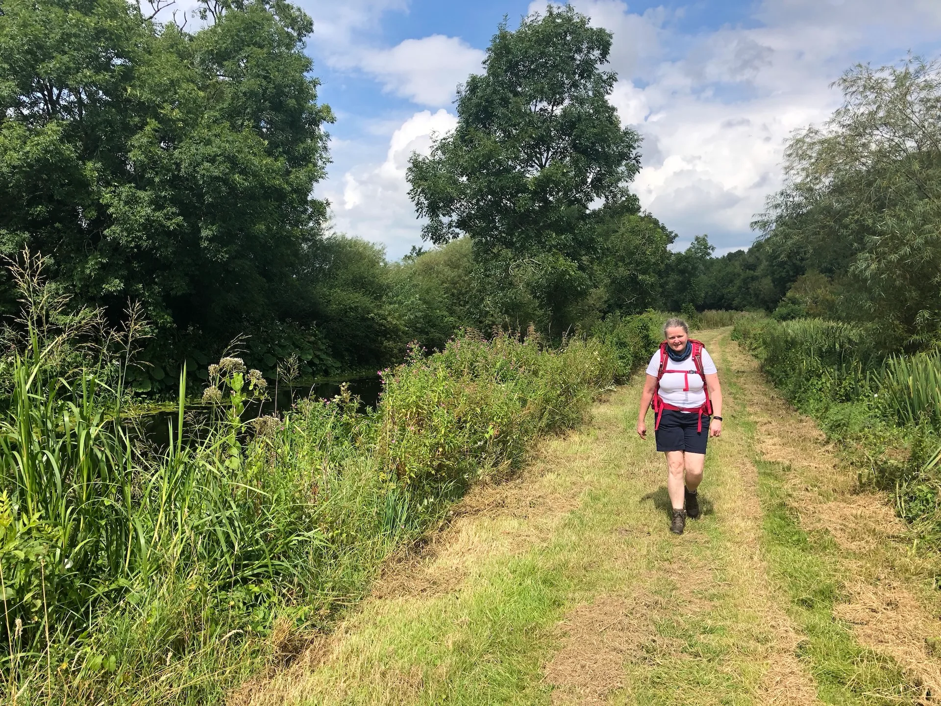
I'll never forget the moment I realised the Barrow Way might be Ireland's best-kept walking secret. I was standing on a towpath in County Carlow, not a hill in sight, watching a heron fish in the still water while canal boats drifted past ancient locks. No scrambling. No navigation anxiety. Just pure, flat, meditative walking along the River Barrow and Grand Canal. After years of guiding people up steep mountainsides, I'd stumbled onto something special: a trail perfect for everyone—from walkers who think they can't do long distance to those who want genuine rest without sacrificing adventure. The walking guide I've pieced together over several trips has convinced me this trail deserves far more attention than it gets.
This is Ireland's flattest long-distance trail, and that simplicity is its greatest strength. Stretching 114 km from Lowtown in County Kildare to St. Mullins in County Kilkenny, the trail follows towpaths and riverside paths so gently that most walkers complete 20+ kilometres a day without fatigue. I've guided walkers in their 70s, couples recovering from injuries, and families with teenagers on this route, and everyone finishes exhilarated rather than exhausted. If you've ever thought a long-distance walk wasn't for you, the path-walking guide in my head would tell you: this route is the trail that changes minds.
What Makes the Barrow Way Special
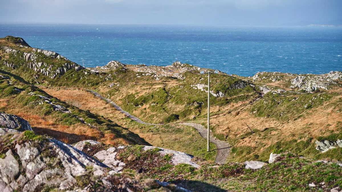
The trail isn't dramatic. There are no mountain vistas, no adrenaline-pumping ridge walks, no sense of conquest at the summit. What it offers instead is something increasingly rare: meditative space. The trail follows two waterways—the Grand Canal from Lowtown to Athy, then the River Barrow southward to St Mullins. Walk the route, and you're not battling terrain; you're surrendering to it. Flat gravel towpaths that dry quickly even after rain. Stone bridges that have stood for centuries. Herons, kingfishers, and the occasional fisherman casting into calm water.
The riverside trail geography makes it unique. Counties Kildare, Laois, Carlow, and Kilkenny roll past in gentle succession—a landscape of rural villages, lock-keepers' cottages, and farmland that feels both timeless and welcoming. Unlike busy trails, you'll discover stretches where you walk for hours seeing only swans and the occasional angler. The northern section (Lowtown to Athy) follows the canal itself, with charming locks and the Bog of Allen visible in the distance. The southern section (Carlow onwards) becomes progressively more scenic as this walk winds through a wooded riverside—the real jewel of the walk.
Why the Barrow Way Suits Everyone
I've led dozens of walking groups, and I can tell you with certainty: the walking guide conditions are perfect for walkers typically excluded from long-distance trails. There's almost no elevation gain—the entire 114 km sits in flatland, following water that naturally finds the easiest path. Surface conditions are consistently excellent; you're on maintained towpaths and riverside tracks, not scrambling over bog or loose mountain scree. The pace is dictated by water, not topography, which means you can chat while walking without gasping for breath.
This accessibility doesn't mean boring. The riverside path reveals Ireland's quieter history—mediaeval monasteries, Norman castles, centuries-old lock systems, and riverside villages where time moves slower. Graiguenamanagh and Borris are artistic communities with excellent cafés and pubs. St Mullins sits at the trail's end in a landscape of genuine wildness. The trail passes through real Ireland, not tourist attractions dressed up for hikers.
The Route: Day by Day
Most walkers tackle the Barrow Way in 6-8 days, covering 14-22 km daily. The trail is waymarked and straightforward—you follow water the entire way, making navigation stress nonexistent. Here's how a typical week on the riverside path unfolds:
Day | Route | Distance | Highlights |
|---|---|---|---|
1 | Lowtown to Robertstown | 16km | Canal locks, bog views, first lock-keeper's cottage |
2 | Robertstown to Monasterevin | 14km | Aqueduct crossing, rural canal stretches, quiet villages |
3 | Monasterevin to Athy | 18km | Transition from canal to river, Athy market town, medieval bridge |
4 | Athy to Carlow | 20km | River Barrow begins in open countryside, Carlow town facilities |
5 | Carlow to Bagenalstown | 19km | Leighlinbridge castle, woodland deepens, Bagenalstown riverside charm |
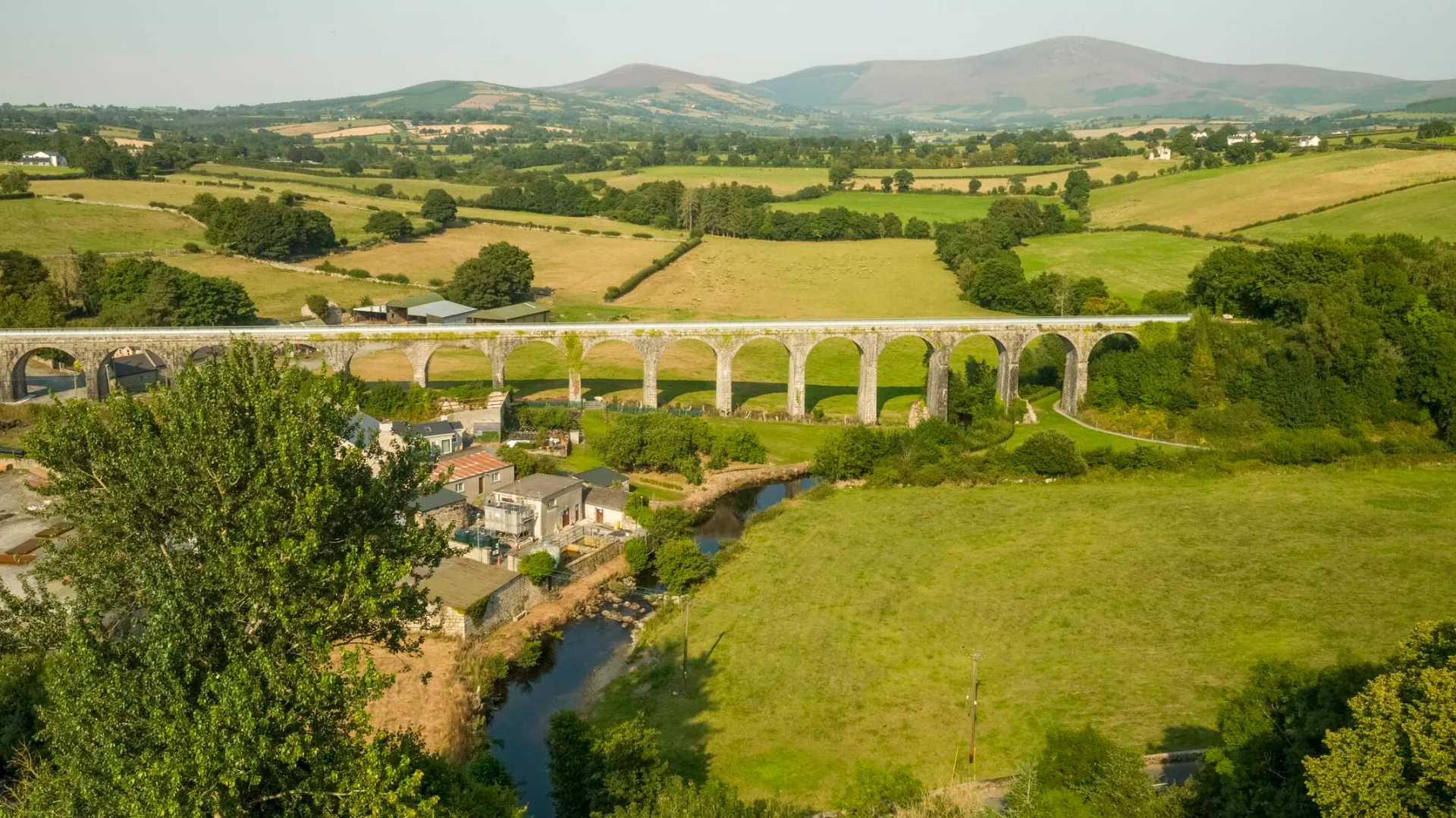
6 | Bagenalstown to Graiguenamanagh | 22km | Borris village, wooded river sections, monastery views, artisan town |
7 | Graiguenamanagh to St Mullins | 16km | Most scenic section, riverside woodland, Brandon Hill views, trail end |
Key Towns Along the Barrow Way
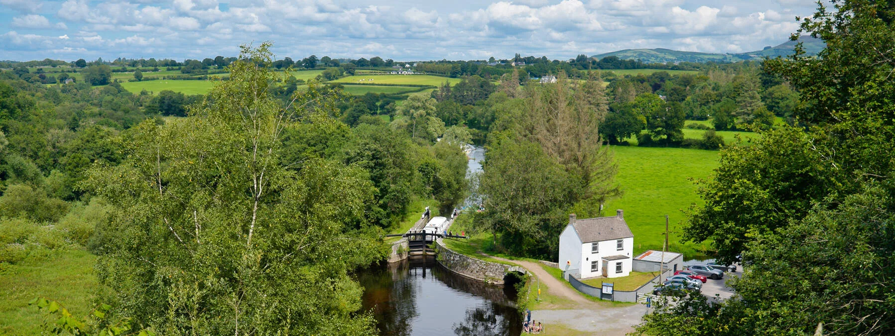
Lowtown to Robertstown: You begin where the Grand Canal and Barrow emerge together near Lowtown. Robertstown is the trail's first real stop—a charming canal village with a working aqueduct and several pubs where you'll meet other walkers.
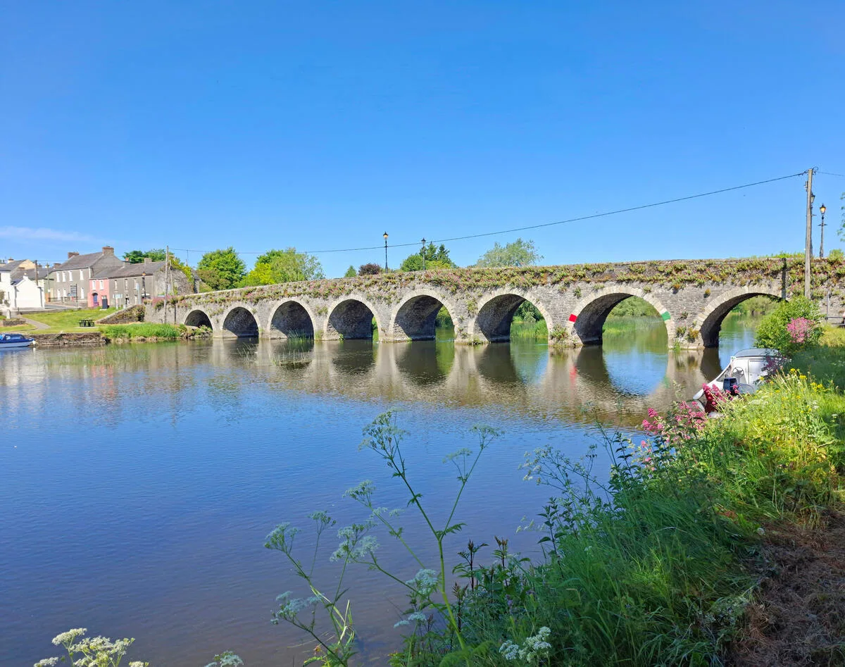
Monasterevin and Athy: These towns mark the canal section's heart. Monasterevin sits at a crucial junction where this walk follows impressive engineering. Athy feels like stepping back in time—a proper market town with mediaeval history and the Woodstock Estate nearby. Both offer excellent accommodation and grocery shops.
Carlow: The guide notes that Carlow is where the trail transitions from canal to river. It's a larger town with restaurants, pubs, and the impressive Carlow Castle ruins. Many walkers use Carlow as a resupply point.
Bagenalstown (Muine Bheag) is a riverside gem that epitomises the path's charm. This small village sits directly on the river with excellent pubs and a real walking community. The riverside path becomes progressively more wooded here, and the landscape shifts toward genuine woodland riverside scenery.
Graiguenamanagh: The artistic heart of the riverside path. This village is packed with galleries, studios, and excellent cafés—it's where walkers often linger an extra day. The mediaeval Duiske Abbey dominates the riverside, and the surrounding landscape is the most scenic of the entire route.
St Mullins: The trail's southern terminus sits at the confluence of the Barrow and Derry rivers, surrounded by woodland and Brandon Hill. It feels like reaching the edge of civilisation—isolated, wild, and somehow perfectly Irish.
Practical Information for the Barrow Way
When to Walk: April through October are ideal. May and September offer warm weather without summer crowds. The walking guide works year-round, but winter means shorter daylight and muddy sections.
Difficulty and Pace: This walk is graded as easy. There's virtually no elevation gain, and the surface is consistently walkable. Most walkers cover 18–20 kilometres daily without struggle, though slower paces are equally valid. The towpath trail rewards lingering—stop for coffee, explore villages, and sit by the river.
What to Bring: Good waterproof jacket (Irish weather), comfortable walking shoes with ankle support, sun protection, and a small daypack. The gravel towpath drains well, but sections can be muddy after rain. Walking poles aren't necessary, but they help on longer days.
Accommodation: Towns along the route have guesthouses, small hotels, and B&Bs. Book ahead in summer. Camping is possible near some villages. Many walkers use WHI's guided packages, which handle logistics while you focus on walking.
Navigation: The path is well-waymarked. Follow the river and canal—you cannot get lost. A simple map or phone GPS provides backup, but the route itself is foolproof.
Food and Supplies: Every major town has shops. Smaller villages have pubs and cafés. Pack snacks, but resupply opportunities are regular. The guide route passes through a working agricultural landscape, so supplies are more reliable than on remote mountain trails.
Why I Recommend the Barrow Way
The walking guide philosophy is simple: long-distance walking should be accessible. It should challenge you mentally and physically without breaking you. It should reveal Ireland's real character—not postcard landscapes, but genuine communities, working waterways, and centuries of history. This walk does all this while remaining genuinely easy.
I've walked hundreds of kilometres across the Irish Hills, and I keep returning to the riverside path. There's something about flat terrain that paradoxically deepens your connection to landscape. Without fighting gravity, you notice details: how light hits the water at different hours, the territorial calls of kingfishers, the precise angle of ancient stone bridges, and conversations with locals in riverside pubs. The towpath strips away ego and reveals walking's real purpose—moving through landscape with time to actually experience it.
Frequently Asked Questions
Is this route suitable for beginners?
Absolutely. The trail is Ireland's most beginner-friendly long-distance trail. With virtually no elevation gain, consistent surface conditions, and well-marked waypoints, it's perfect for walkers completing their first multi-day hike. The flat terrain means you can comfortably cover 18–20 kilometres daily without the fatigue associated with hill walking.
Can older walkers and families do the route?
Yes. I've guided people in their 70s and 80s on the riverside trail with complete success. The flatness and easy surface make it ideal for those with mobility considerations. Families with teenagers also find this walk perfect—it's long enough to feel like a genuine adventure, but not so difficult that younger walkers struggle or lose interest.
What's the best time to walk the towpath?
May, June, September, and October offer ideal conditions: warm weather, longer daylight, and fewer midges. July and August are walkable but busier with tourists. April and November work if you're comfortable with cooler temperatures and variable weather. The path is walkable year-round, but winter brings shorter days and occasional muddy stretches.
Do I need navigation equipment for this route?
No. The trail is waymarked throughout, and you're following water the entire way—it's impossible to get lost. A simple map provides confidence, and a phone with offline maps or GPS adds backup, but neither is essential. The simplicity of navigation is one of the route's greatest strengths.
Can I do a shorter version of the riverside trail?
Yes. While the full length of this walk is 114km, you can walk sections. Popular options include Lowtown to Athy (3-4 days), Athy to Carlow (2-3 days), or the scenic southern section from Carlow to St Mullins (4-5 days). The riverside path sections are equally rewarding whether you tackle the full trail or focus on specific stages.
Start Your Barrow Way Adventure
The pathwalking guide I've shared is really just an invitation: come walk Ireland's flattest long-distance trail and discover what meditative movement through landscape feels like. Whether you're a beginner testing your limits, an experienced walker seeking something gentler, or simply someone who wants to slow down and really see Ireland, this route delivers.
Walking Holiday Ireland offers guided and 6-day Barrow Way tours as well as 7-day itineraries that handle logistics while you focus on the walk. If you prefer self-guided exploration, our self-guided walking holidays guide covers everything you need. If you're new to multi-day walking, our backpacking checklist guarantees your preparedness.
The riverside path isn't about conquering mountains or pushing yourself to breaking point. It's about discovering that walking's real power lies in simplicity, consistency, and presence. Come walk the Barrow Way. Let the flat towpaths and gentle river rhythm show you what you've been missing.
Questions about fitness, pacing, or logistics? Get in touch—I'm always eager to discuss the Barrow Way and help you plan your walk.
The Barrow Way is one of Ireland's National Waymarked Ways. See how it compares with every other long-distance trail in our complete guide to Ireland's National Waymarked Ways.