Best Hikes in Killarney National Park: Complete Guide
Ireland's oldest national park holds 10,236 hectares of Killarney National Park hiking routes connecting three glacial lakes, native oakwood, and MacGillycuddy's Reeks—the country's highest mountains. I've walked every route in Killarney dozens of times, and I can tell you this: the best hikes in Killarney National Park deliver genuine wilderness within reach of comfortable accommodation and proper pubs.
Whether you're planning a single-day excursion from Killarney town or a week-long walking tour through County Kerry, this guide details the trails that matter—from gentle lakeside circuits to exposed ridge walks above 1,000 metres.
Why Killarney Delivers Ireland's Best Mountain-and-Lake Walking
Killarney became Ireland's first national park in 1932 when the Muckross Estate was donated to the state. That legacy matters today—the park protects Ireland's largest remaining native oakwood, the only wild red deer herd in the country, and a collection of trails that show you precisely why this landscape earned protection.
The geology creates the drama. During the last ice age, glaciers carved three lakes—Lough Leane (the Lower Lake), Muckross Lake (the Middle Lake), and the Upper Lake—into a valley surrounded by sandstone and limestone mountains. The result is a landscape of contrasts: flat lakeside paths beside vertical mountain routes, all within a 20-minute drive.
I base most of my Kerry Way tours here for a simple reason: the variety of Killarney National Park hiking routes means you can walk eight days without repeating a trail.
Planning Your Killarney Walking: What You Need to Know
Best Time to Walk Killarney
Spring (April–May) brings wildflower blooms and moderate crowds. Summer (June–August) offers 17-hour daylight but fills the popular trails. Autumn (September–October) delivers the year's best light and manageable numbers. Winter (November–February) is quieter but demands experience with Irish weather—wind, rain, and short days are standard.
I prefer May and September. The weather is stable enough for mountain routes, but you'll still find solitude on weekday mornings.
Where to Stay
Killarney town sits 1.5 kilometres from the park gates and offers everything from budget hostels to country-house hotels. For quieter bases, Muckross Village puts you inside the park, whilst Glencar (15 kilometres west) offers mountain proximity.
Trail Grading and Fitness
I've grouped these Killarney walking trails using our standard grading system:
Easy: flat terrain, under 2 hours, suitable for families
Moderate: some elevation gain (200–400m), 2–4 hours, good fitness required
Challenging: significant elevation (400m+), exposed terrain, navigation skills essential
Killarney National Park Hiking Routes: Complete Trail Guide
Muckross House and Gardens Circuit (5km, 1.5 hours)
| Distance | Duration | Elevation | Difficulty | Best For |
|---|---|---|---|---|
| 5km loop | 1.5 hours | Minimal | Easy | Families, first-time walkers, estate architecture |
This route circles the Victorian Muckross House estate, combining manicured gardens with wild lake shoreline. The trail descends through beech woodland to Muckross Lake, then follows the water's edge beneath mature trees.
The eastern viewpoint—where the lake extends toward the mountains—offers one of Killarney's most photographed scenes. On calm mornings, the water reflects Torc Mountain and the Mangerton ridge perfectly.
The path is fully maintained and accessible to wheelchairs for the first 2 kilometres. Allow extra time if you're visiting the house interior (€10 adult entry).
Seasonal note: Spring offers rhododendron blooms in the gardens; autumn brings beech-leaf colour. Summer weekends attract coach tours—arrive before 10:00 to avoid crowds.
Torc Mountain (535m) via the Standard Route (4.3km, 2 hours)
| Distance | Duration | Elevation | Difficulty | Best For |
|---|---|---|---|---|
| 4.3km out-and-back | 2 hours | 270 metres | Moderate | First mountain walk, lake views, accessible summit |
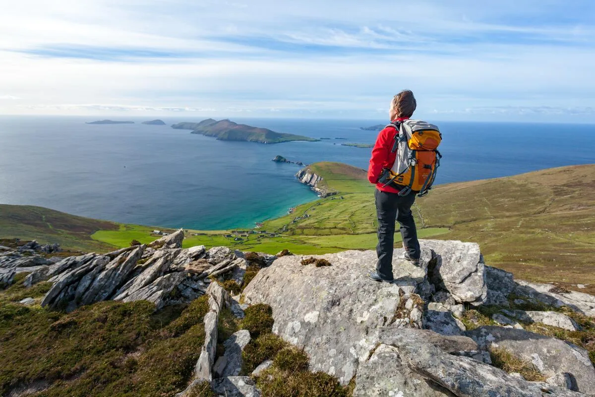
The Torc Mountain hike Killarney offers is the park's most popular summit for good reason: you earn 360-degree views across all three lakes and toward Ireland's highest mountains without technical scrambling.
The route ascends from the Torc Waterfall car park (€4 parking) through commercial forestry. The first 45 minutes climb steadily through spruce plantation—not scenic, but necessary. Breaking above the treeline, the landscape opens suddenly: moorland, heather, and views extending west toward Dingle Peninsula.
The final 150 metres involve some hands-on scrambling over sandstone boulders, but nothing that requires climbing experience. The summit cairn sits atop exposed rock, with views stretching to the Atlantic on clear days.
Most walkers descend the same route. Experienced navigators can loop via Torc Waterfall (adding 20 minutes), which is particularly impressive after rain.
Navigation note: The main trail is clear in good visibility. If cloud descends on the moorland section, carry a Killarney walking route map and compass—the treeless terrain offers few landmarks.
Gap of Dunloe Linear Walk (9km, 3–4 hours)
| Distance | Duration | Elevation | Difficulty | Best For |
|---|---|---|---|---|
| 9km one-way | 3–4 hours | 300 metres | Moderate to challenging | Dramatic scenery, mountain-pass walking, solitude |
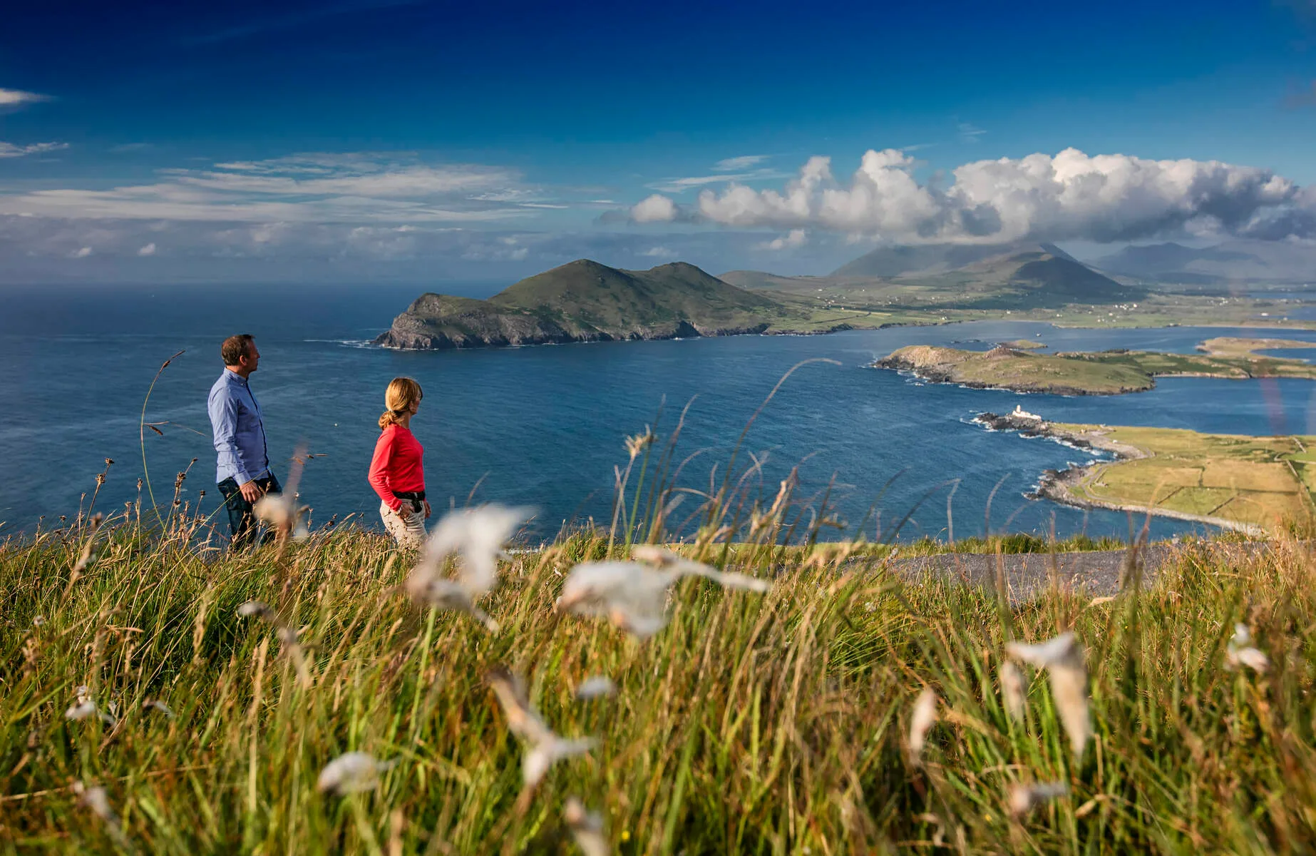
The Gap of Dunloe is one of Ireland's iconic walks—a glacial valley carved between Purple Mountain and the Tomies. Most visitors see it from a jaunting car (horse-drawn carriage); walking it reveals the landscape properly.
The traditional route enters at Kate Kearney's Cottage (south) and exits at Lord Brandon's Cottage (north), climbing gradually through the pass. Mountain walls rise steeply on both sides; five small lakes punctuate the valley floor.
Water defines this route. You'll cross streams multiple times, and after heavy rain the valley becomes genuinely challenging—I've seen the main path turn into a running stream in October storms.
The isolation is what I value most. Even in July, you'll walk long sections alone—a rare experience in Ireland's most visited national park.
Logistics: This is a linear walk requiring shuttle transport. Either arrange a pick-up at Lord Brandon's Cottage, or loop back via the longer Black Valley route (adding 3 hours and 400m elevation).
Carrauntoohil (1,038m) via Devil's Ladder (5.5km, 3.5–4 hours)
| Distance | Duration | Elevation | Difficulty | Best For |
|---|---|---|---|---|
| 5.5km out-and-back | 3.5–4 hours | 1,038 metres | Challenging | Experienced mountain walkers, Ireland's highest summit |
Carrauntoohil is Ireland's highest mountain and a genuine hill walk—exposed, steep, and demanding proper mountain experience. This isn't an extended stroll; it's a full day in serious terrain, representing one of the most challenging hiking Killarney Ireland tips I can offer.
The Devil's Ladder route (the most direct line) ascends from Cronin's Yard car park through steep, rocky ground. The ladder section—a loose scree gully—earns its name. Reaching the ridge above, the terrain eases but remains exposed.
The summit ridge offers views across County Kerry to the Atlantic. On clear days, you can see Slieve League 250 kilometres north. In cloud, the ridge becomes a navigation challenge requiring map, compass, and confidence.
Most walkers descend via the same route. Experienced scramblers sometimes continue along the Beenkeragh ridge (adding 2 hours and Grade 2 scrambling).
Safety essential: Carrauntoohil has claimed lives. Understanding Killarney park trail difficulty is crucial—proper boots, waterproofs, navigation tools, and realistic fitness assessment are non-negotiable.
Ladies View Circular Walk (5.5km, 2.5 hours)
| Distance | Duration | Elevation | Difficulty | Best For |
|---|---|---|---|---|
| 5.5km loop | 2.5 hours | 250 metres | Moderate | Panoramic views, quieter trails, progressive scenery |
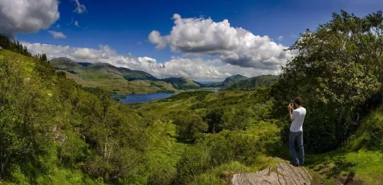
Ladies View is famous as a Ring of Kerry viewpoint—a car park offering one of Ireland's most photographed vistas. Walking the surrounding hills instead of viewing from the tarmac transforms the experience entirely.
The loop begins near the viewpoint and climbs through moorland with the panorama expanding progressively. Rather than the compressed postcard view from the car park, you experience the landscape revealing itself—valleys opening, peaks emerging, genuine three-dimensional geography.
The trail is moderately demanding—not steep but sustained. The reward is solitude. Whilst 50 tourists photograph the view from the car park, you'll have the surrounding hills largely to yourself.
Navigation consideration: This route is less well-marked than Torc Mountain. Carry map and compass; downloading GPS tracks is recommended.
Moll's Gap to Torc Ridge Walk (12km, 5–6 hours)
| Distance | Duration | Elevation | Difficulty | Best For |
|---|---|---|---|---|
| 12km one-way | 5–6 hours | 600 metres | Challenging | Extended ridge walking, full-day mountain immersion |
This extended ridge traverse connects Moll's Gap with Torc Mountain via high moorland—a full day in genuinely wild terrain. The route offers extended solitude and immersion in mountain landscape rather than quick summit-and-descend walking.
Starting at Moll's Gap (on the Ring of Kerry road), the route climbs to the ridge, then traverses eastward toward Torc. You spend hours above 400 metres, crossing open moorland with views extending across County Kerry.
This walk demands good fitness, navigation skills, and appropriate equipment. Weather changes rapidly at these elevations—what starts as clear morning can develop wind and cloud within hours.
Logistics: Linear route requiring shuttle transport or a long road walk back to your start point.
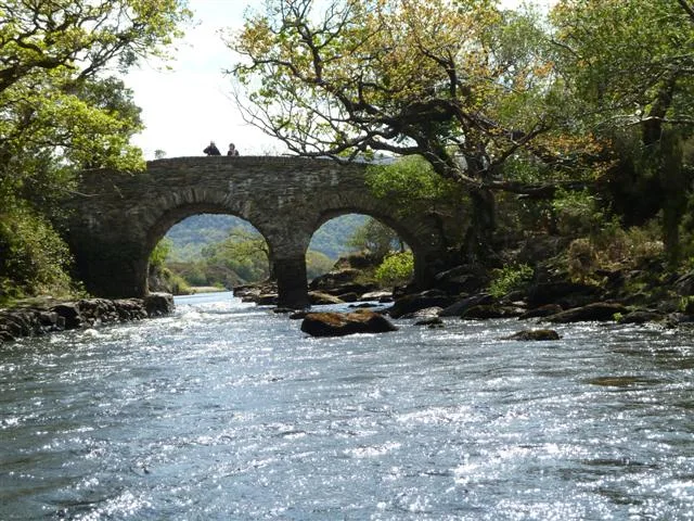
Dinis Cottage and Muckross Lake Loop (6km, 2.5 hours)
| Distance | Duration | Elevation | Difficulty | Best For |
|---|---|---|---|---|
| 6km loop | 2.5 hours | Minimal | Easy to moderate | Lake-level walking, wildlife observation, forest paths |
This often-overlooked Muckross Lake walking route follows the shoreline around Dinis Island—one of Ireland's most intimate lake walks. You're observing water-level ecosystems in detail: waterbirds, fish activity, native oakwood meeting water.
The trail combines maintained paths with wilder lakeside sections. The terrain is occasionally muddy; in winter, expect wet ground. But for walkers seeking peaceful water connection rather than summit views, this delivers something special.
The native oakwood here is part of Ireland's largest remaining ancient woodland. Look for red deer—Killarney holds Ireland's only remaining wild herd.
Upper Lake and Black Valley (7km, 2.5–3 hours)
| Distance | Duration | Elevation | Difficulty | Best For |
|---|---|---|---|---|
| 7km out-and-back | 2.5–3 hours | 200 metres | Moderate | Remote valley walking, waterfall scenery, solitude |
The Upper Lake route follows the stream valley toward the Black Valley—Killarney's most remote section. The path traces the valley upward, with waterfalls emerging from the surrounding slopes.
The final approach involves some scrambling and requires comfort with water crossings. In winter or after heavy rain, assess stream conditions honestly before attempting crossings.
This trail is significantly less crowded than Torc or the Gap. I've walked it on summer weekends and met nobody beyond the first kilometre.
Practical Walking Information
What to Pack
For all Killarney walks, carry:
Waterproof jacket and trousers (essential year-round)
Proper walking boots with ankle support
Map and compass (plus knowledge to use them)
Water (1 litre minimum) and snacks
Mobile phone with emergency numbers saved
Basic first-aid kit
For mountain routes (Carrauntoohil, Torc, extended ridges), add:
GPS device or smartphone with offline maps
Extra layers (fleece and insulated jacket)
Hat and gloves
Head torch
Emergency shelter
See our complete backpacking checklist for detailed packing advice.
Weather and Conditions
Irish weather is famously changeable. Check Met Éireann forecasts before mountain walks, and understand that conditions above 500 metres can differ dramatically from valley weather.
Wind is the biggest factor on exposed ridges. A moderate valley breeze becomes a challenging gale on Carrauntoohil's summit. If the forecast shows winds above 40 km/h, consider lower-level alternatives.
Read our guide to weather preparation for Irish hiking for detailed safety information.
Guided vs. Self-Guided Walking
Killarney's hiking routes are generally well-marked, making self-guided walking straightforward on popular trails like Torc Mountain and the Muckross circuits—though carrying a Killarney walking trails guide adds valuable context.
However, local guides offer valuable knowledge—ecological details, historical context, and navigation expertise that enhance the experience significantly. For mountain routes like Carrauntoohil or the extended ridges, a guide provides essential safety support.
Our Kerry Way walking tour includes guided options through Killarney's best trails, with full logistical support and expert local knowledge.
Multi-Day Walking in Killarney
Killarney works brilliantly as a base for 3–7 day walking holidays. The combination of varying difficulty trails, excellent accommodation, and proper restaurant infrastructure creates ideal conditions for extended stays.
A typical 5-day itinerary might include:
Day 1: Muckross House circuit (easy acclimatisation)
Day 2: Torc Mountain (moderate summit)
Day 3: Gap of Dunloe (challenging distance)
Day 4: Dinis Island loop (easy recovery day)
Day 5: Carrauntoohil or Ladies View (challenging finale)
Many walkers combine Killarney with the nearby Kerry Way for extended walking experiences. Our Kerry Way tour includes Killarney's best trails as part of an 8-day circuit.
Beyond Killarney: Kerry's Other Walking Areas
Killarney forms part of County Kerry's exceptional walking landscape. Consider combining your visit with:
The Dingle Way—8 days around Ireland's most westerly peninsula
The Beara Way—remote coastal and mountain walking
MacGillycuddy's Reeks ridge—Ireland's highest mountain range
Summary: Choosing Your Killarney Walk
If You Want... | Walk This |
|---|---|
Easy family walk with lake views | Muckross House Circuit |
First mountain summit | Torc Mountain |
Dramatic mountain-pass scenery | Gap of Dunloe |
Ireland's highest summit | Carrauntoohil |
Panoramic views without crowds | Ladies View Loop |
Full-day ridge walking | Moll's Gap to Torc |
Quiet lake-level walking | Dinis Cottage Loop |
Remote valley exploration | Upper Lake and Black Valley |
Start Your Killarney Walking Adventure
Killarney National Park hiking routes have delivered exceptional walking since 1932. The balance between protection and access, between wild nature and comfortable infrastructure, makes this Ireland's most accessible mountain-and-lake walking destination.
Whether you choose the gentle Muckross circuit, the challenging Carrauntoohil ridge, or anything between, these trails offer genuine connection with Ireland's mountain landscape.
I've designed our walking tours to showcase the best hikes in Killarney National Park with full logistical support—accommodation, luggage transfer, detailed route notes, and local expertise. We handle the details; you focus on the walking.
Contact us to plan your Killarney walking holiday, or browse our walking tours to find the itinerary that matches your interests and fitness level. Our team knows every trail in this guide personally and will help you choose the routes that deliver what you're seeking.
Frequently asked questions
What's the hardest hike in Killarney National Park?
Carrauntoohil, Ireland's highest peak at 1,038 metres, is the most challenging hike in the area. The Devil's Ladder route is particularly steep and exposed, taking 4–6 hours depending on fitness. Most walkers need scrambling skills and good weather for a safe ascent.
Is there an easy, family-friendly walk?
Yes. The Old Boathouse Loop around Lough Leane is flat, scenic, and takes just 45 minutes. The Mangerton Mountain viewpoint trail is also popular—a steady 3-hour walk suitable for older children and those wanting views without serious challenge.
Where do I park?
The main visitor centre car park at Killarney House is free and has good facilities. For Muckross walks, there's a large car park near the house and gardens. For Carrauntoohil, park at the Cronin's Yard car park near Beaufort. All are clearly signposted from Killarney town.
Are dogs allowed on trails?
Dogs on leads are permitted on most park trails. The Muckross estate has restrictions in walled gardens and near livestock, so check current rules at the visitor centre. Keep dogs away from lake edges and streams where they can disturb wildlife.
How many days do I need to explore Killarney properly?
Two to three days is ideal. One day gives you a quick valley walk, but you'll miss higher viewpoints. Three days lets you tackle one big peak (Torc or Mangerton), do lake walks, and explore Muckross without rushing.
Continue exploring
Three companion guides for planning your Kerry trip.
- Best time to walk the Kerry Way
- Ireland's national parks for walking
- Walking holidays in Ireland 2026
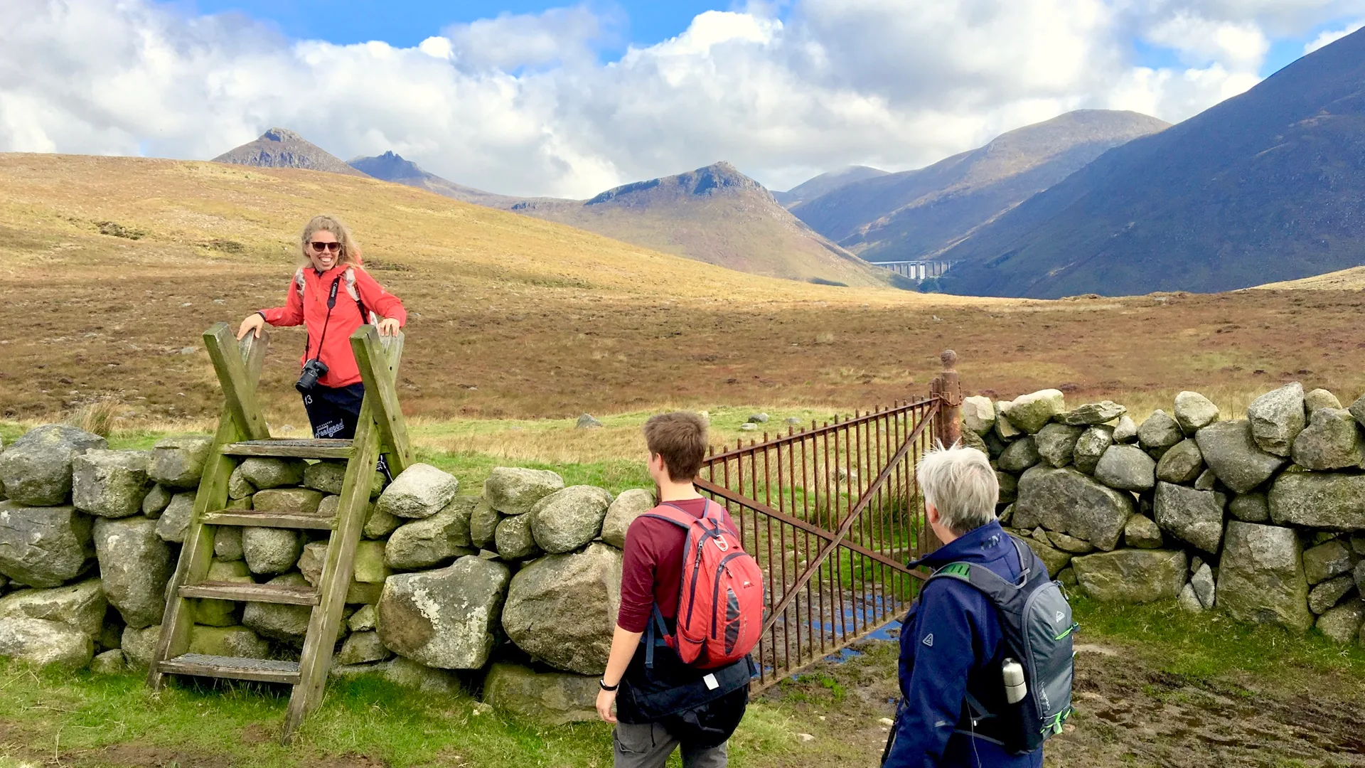
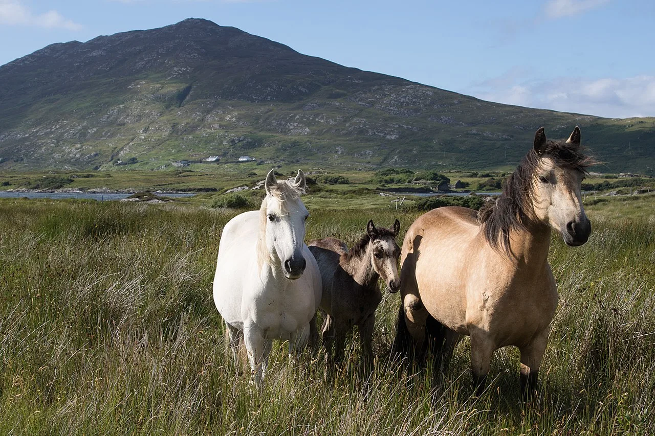
Photo Gallery