Best Handheld GPS for Hiking in Ireland (2026)
The Best Handheld GPS for Hiking in Ireland (2026): An Honest Guide
We run walking holidays on Ireland's waymarked trails, and every year a few guests write to us before they travel with the same worry: which GPS device do I need to buy?
The honest answer, most of the time, is none.
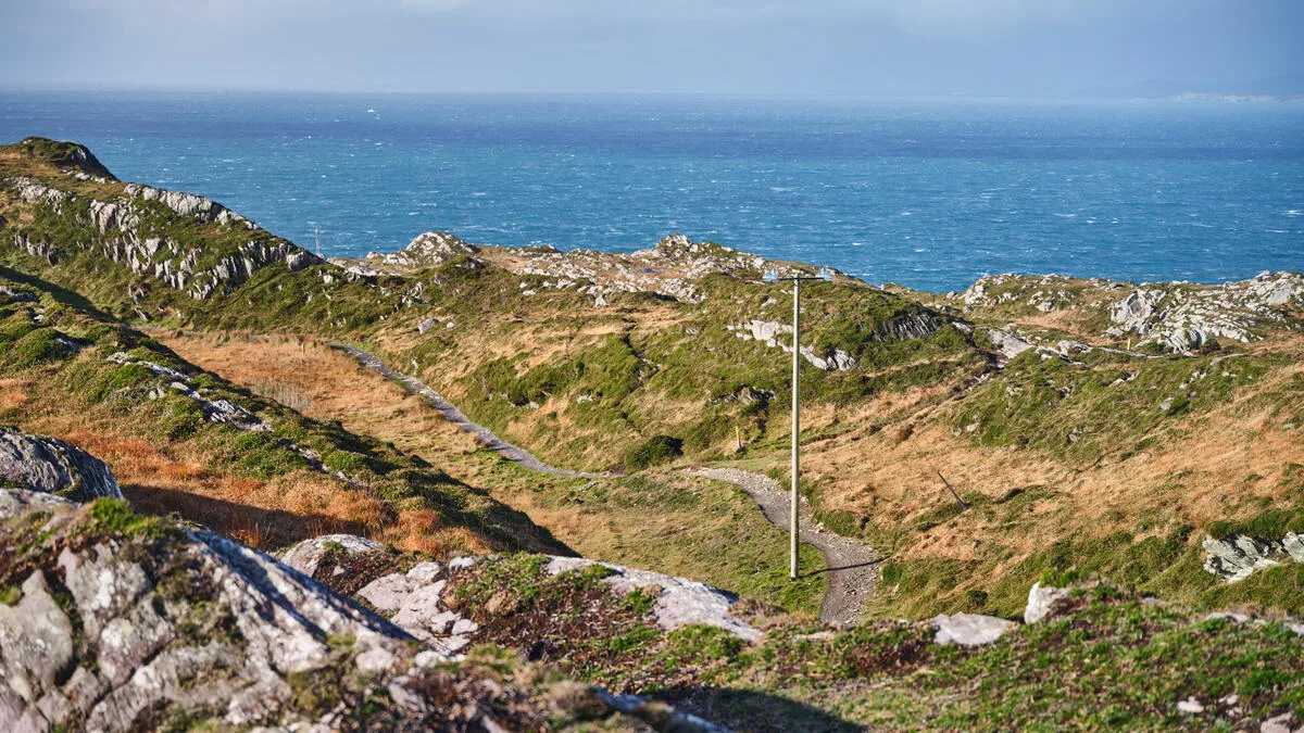
The Kerry Way, the Dingle Way and the Wicklow Way are waymarked routes. You follow a yellow walking man on a black background, and for the great majority of the walking, that is genuinely all you do. A dedicated handheld GPS is not what keeps you on the trail. It is a backup — and a backup that sits some way down the list behind a paper map, a compass, and the knowledge of how to use them.
That said, plenty of walkers want one anyway, and some genuinely benefit. So here is what actually exists in 2026, what it really costs, and what we would carry ourselves. Everything below is checked against the manufacturer. Where we have an opinion, we say so plainly — we haven't run a lab test, and we won't pretend otherwise.
First, the thing nobody tells you: there is no official GPX file
Before you spend €650 on a device, spend a moment on the route file, because that is the part most people get wrong.
A GPX file is simply the route, saved as a file. Load it into a phone app or a handheld and the trail draws itself on your screen. It is far more useful than the hardware it runs on. And here is the surprising bit:
Sport Ireland — the state body responsible for the national waymarked ways — does not publish a GPX file for the Kerry Way, the Dingle Way or the Wicklow Way. The Kerry Way, Dingle Way and Wicklow Way pages offer PDF maps and route descriptions, and that is all. It isn't a website glitch — Sport Ireland does host GPX files for other Irish trails. These three simply don't have one.
The sites that look official often aren't. Several of the trail-named domains you'll find in a search are commercial sites carrying tour-operator advertising, not the trail authority.
So a walker who buys a €650 handheld and then goes looking for the official Kerry Way route to load onto it will come away empty-handed. The device is the easy part. The route file is the hard part.
We send our own GPX files to every guest before they travel, along with the day-by-day itinerary — because we walk these trails, and because there is nowhere else reliable to get them. If you're walking with us on the Kerry Way, the Dingle Way or the Wicklow Way, that's already handled.
Do you actually need a dedicated GPS?
Be honest with yourself about the walking you're doing.
You probably don't need one if: you're walking a waymarked trail in summer, staying in accommodation each night, carrying a phone with a downloaded offline map and a paper map in the lid of your pack. That describes almost every guest we send out.
A dedicated device starts to earn its place if: you're walking off the waymarked network, going high in poor visibility, walking solo in remote country, out for many days between charges, or you simply don't want your navigation and your phone to share one battery. Those are real reasons. "Everyone says you need one" is not.
And whichever way you go: a GPS backs up a map and compass. It does not replace them. Batteries die, screens crack, and glass gets wet. Paper doesn't.
Your phone, done properly
For most people the best hiking GPS is the one already in their pocket — provided the maps are downloaded before you leave the wifi. This is where walkers get caught out, so it's worth being precise about what each app actually gives you:
- Komoot — offline maps are not locked behind a subscription. You get one region free, and further regions can be bought outright from €3.99, or the World Pack for €29.99. A one-off purchase, no renewal. For a single Irish trail this is the cheapest sensible option, and it's the app we see most often in German and Dutch walkers' hands.
- Gaia GPS — be careful here. The free tier cannot download maps for offline use; Gaia's own help pages say so. Offline maps are a Premium feature (around $59.90/year). A walker who assumes the free version will work in a valley with no signal is a walker with a blank screen.
- Outdooractive — offline maps come with the Pro plan (€29.99/year). Popular across the German-speaking Alps and perfectly capable in Ireland.
- AllTrails — offline maps require the paid tier (from around $35.99/year).
- OS Maps — worth flagging because British walkers reach for it by habit: Ordnance Survey's mapping covers Great Britain, not the Republic of Ireland. It will not map the Kerry Way.
Whatever you choose: download the maps at the B&B, carry a power bank, and put the phone in airplane mode. That alone doubles your battery life and solves most of the problems people buy a €650 device to solve.
Paper maps in Ireland — and a name change worth knowing
Ordnance Survey Ireland no longer exists. Since 2023 its work sits with Tailte Éireann, and the old OSi name still floats around on out-of-date websites. There is no official Tailte Éireann hiking app — the mapping is paper, and it's good.
- Tailte Éireann Discovery Series, 1:50,000 — around €8.80 a sheet. The workhorse map of Irish hillwalking.
- EastWest Mapping — an Irish publisher, and the people to go to for trail-specific sheets. Their Wicklow Way map guide is around €9.00, and their waterproof Dingle Way map (1:40,000) around €16.00. They do not currently publish a dedicated Kerry Way map.
- Harvey Maps — their Dingle Peninsula sheet (1:30,000) covers the Dingle Way in full.
A map, a compass, and the ability to take a bearing will get you off a mountain when nothing else will. Learn it once; it lasts a lifetime and never needs charging.
If you do want a dedicated handheld: four that make sense in 2026
These are current, they exist, and the specifications below come from Garmin. Prices are Garmin's own Irish retail prices at the time of writing and will move around.
Garmin eTrex SE — €149.99
Battery: up to 168 hours in standard mode, up to 1,800 hours in expedition mode, on two AA batteries · Weight: 156.5 g with batteries · Water rating: IPX7 · Screen: 2.2", monochrome · Maps: none.
That last line is not a typo, and it is the single most misunderstood thing about this device. In Garmin's own words, the eTrex SE and eTrex Solar "cannot be loaded with any additional mapping" and are "considered to be non-mapping GPS units". There is no microSD slot and no internal memory for maps. You get a worldwide basemap showing city locations, a breadcrumb of your track, and a pointer telling you where the next waypoint lies.
Which — and this is the honest part — is exactly what a waymarked trail asks of it. It won't show you the Dingle Way drawn on a hillside. It will tell you that you're 400 m off your route, which is the question you actually need answered. If anyone tells you this device does OpenStreetMap, they're wrong, and on a wet day in the Reeks that mistake matters.
Garmin eTrex Touch — €449.99
Battery: up to 130 hours standard, 650 hours in expedition mode · Weight: 150 g · Water rating: IP67 · Screen: 3" colour touchscreen · Maps: preloaded routable TopoActive maps, 32 GB.
Announced in September 2025, this is the current mapping handheld and, to our eye, the most sensible one for a walking holiday. Multi-band GPS, a screen you can read in Irish drizzle, and the trail actually drawn beneath your feet.
Garmin GPSMAP 67i — €649.99
Battery: up to 180 hours in GPS mode, 840 hours in expedition mode · Weight: 230 g with batteries · Water rating: IPX7 · Screen: 3", buttons not touch · Maps: preloaded TopoActive Europe · Plus: inReach satellite SOS.
Note the battery figure: 180 hours. If you've read a German-language review claiming somewhere between sixteen and twenty-five hours, it was wrong. This is the long-haul option, and its satellite SOS works where there is no phone signal at all — which, in parts of Kerry and Donegal, is a meaningful sentence. Satellite messaging needs a subscription, from €9.99/month plus a one-off €49.99 activation fee.
A note on Garmin's line-up, since it confuses people: the newer GPSMAP H1 (€649.99) and H1i Plus (€999.99) arrived in September 2025 and are excellent, but the 67i is still sold by Garmin and still has the longer battery life of the two. Newer is not automatically better.
Garmin inReach Mini 3 Plus — €499.99
Battery: up to 350 hours with 10-minute tracking · Weight: 125.2 g · Water rating: IP67 · Screen: 1.9" colour touchscreen.
Buy this for safety, not navigation. It's a satellite communicator: two-way texting and an SOS to Garmin's 24/7 response centre from places with no mobile coverage. It is not a mapping device and shouldn't be your only navigation. Subscription required, as above.
So what would we carry?
This is an opinion, not a test result — we haven't put these devices through a lab, and anyone who tells you they've "tested twelve devices on Irish trails" should be asked to show their working.
On a waymarked Irish trail in walking season, we'd carry a phone with Komoot maps downloaded, a power bank, the Tailte Éireann Discovery sheet for the area, and a compass. Total cost, if you already own the phone: about €40. That combination has walked every trail we sell.
If you want a handheld as well — and there's nothing wrong with wanting one — the eTrex Touch is the one we'd pick: proper maps, light, and a fraction of the price of the flagships. If you walk alone in remote places, or walking is a lifelong habit rather than a holiday, the GPSMAP 67i and its satellite SOS is money well spent.
What we wouldn't do is spend €650 on a device and then not download the route, not carry a map, and not know how to take a bearing. That's the expensive mistake, and it's a common one.
Frequently asked questions
Do I need a GPS to walk the Kerry Way?
No. The Kerry Way is waymarked throughout, and our guests walk it with a phone, our route notes and our GPX file. A dedicated GPS is a backup, and a paper map and compass should sit behind that.
Is there an official GPX file for the Kerry Way, Dingle Way or Wicklow Way?
No. Sport Ireland publishes PDF maps and route descriptions for these three trails but no GPX file. We supply GPX files to our own guests.
Can the Garmin eTrex SE display maps?
No. Garmin states that the eTrex SE and eTrex Solar cannot be loaded with any additional mapping and are non-mapping GPS units. They show a basemap and your track, not trail-level mapping.
Do Gaia GPS's free maps work offline?
No. Downloading maps for offline use is a Premium feature. The free tier cannot download maps for use without a signal — an important distinction in an Irish valley.
Is my phone good enough for a walking holiday in Ireland?
For a waymarked trail, generally yes — provided you download the maps before you set off, carry a power bank, and keep a paper map and compass in reserve.
Walking with us
We're a small, family-run Irish company. We walk these trails ourselves, and every guest gets a detailed itinerary, our route notes and GPX files, with luggage moved on to the next night's accommodation while you walk.
If you're planning the Kerry Way, the Dingle Way or the Wicklow Way and you'd rather someone else handled the maps, the beds and the bags — get in touch and we'll talk it through.