Wicklow Mountains National Park: Complete Walking & Hiking Guide
Wicklow Mountains National Park: Complete Walking & Hiking Guide
The Wicklow Mountains National Park sits just south of Dublin, and it's one of the finest walking areas in the country. I've put together this Wicklow Mountains walking guide to help you explore blanket bog, granite peaks, glacial valleys, and ancient oak woodland — all within an hour of the capital. County Wicklow has been called the Garden of Ireland for good reason, and the national park protects the wild heart of it.
The park covers about 20,000 hectares of upland countryside between Glencree in the north and Glenmalure in the south — the largest national park in the Republic of Ireland. The landscape was shaped by glaciers that carved deep valleys, left behind dark lakes, and exposed the granite core of the mountains. Today, the park is home to red deer, peregrine falcons, and some of the most varied walking terrain in Ireland. Whether you want an easy stroll through Glendalough or a full day exploring the best walks Wicklow Mountains has to offer on the ridges, this walking guide covers them all.
What Makes the Wicklow Mountains Special
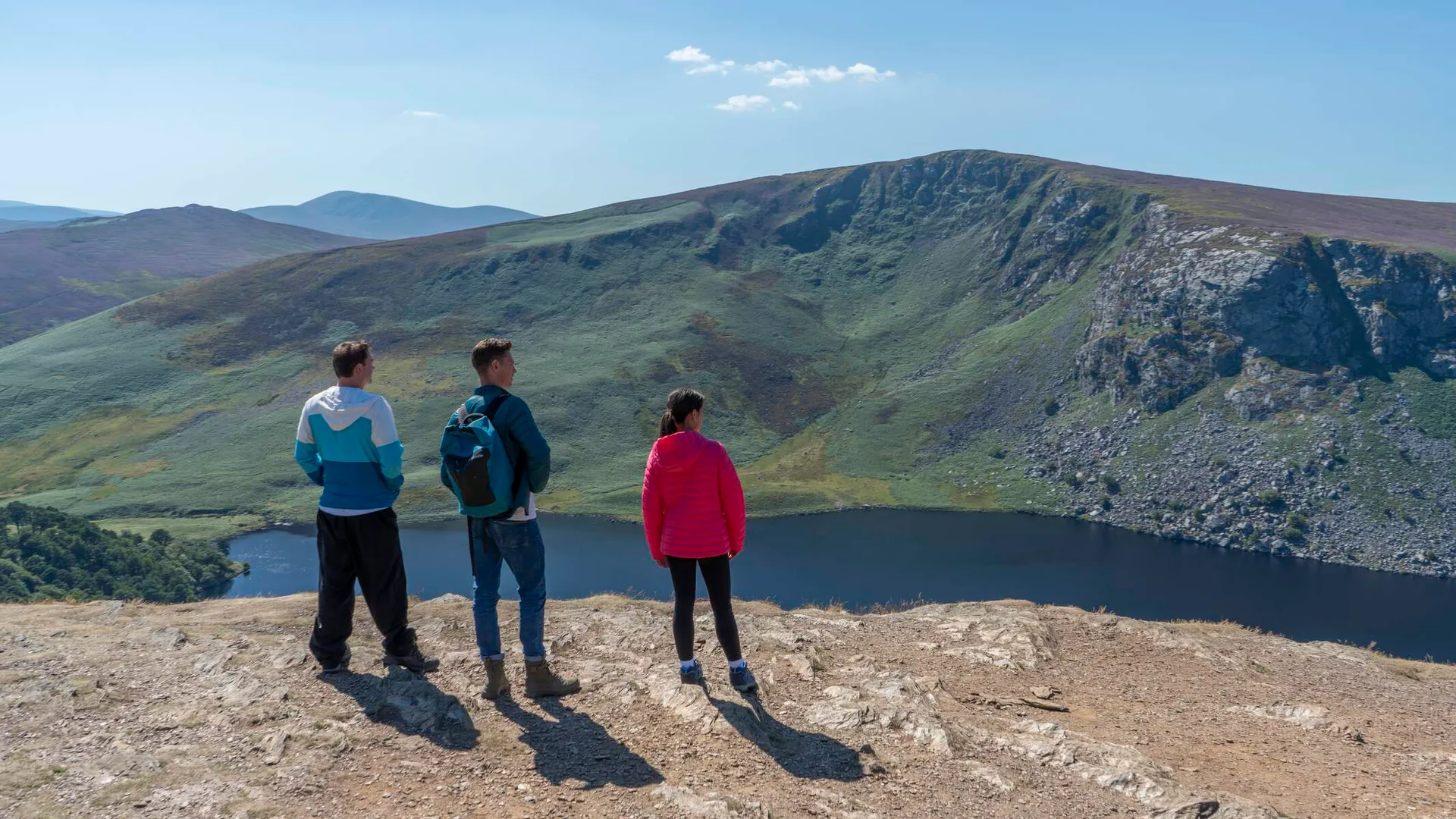
The Wicklow Mountains are the largest continuous upland area in Ireland. The granite spine runs north to south, rising to 925 metres at Lugnaquilla — the highest peak in Leinster and the thirteenth-highest in Ireland. The mountains are flanked by deep glacial valleys — Glendalough, Glenmalure, Glendasan, and Glencree — each with its own character.
What strikes most walkers first is how quickly you leave the city behind. Dublin's southern suburbs give way to open moorland within twenty minutes. The Sally Gap road crosses the spine of the mountains, passing Lough Tay — sometimes called the Guinness Lake for its dark water and white sand beach — and dropping into the Glenmacnass Valley with its roadside waterfall. The Military Road, built by the British after the 1798 rebellion to access rebel hideouts in the mountains, follows the ridge and gives you views across the whole range.
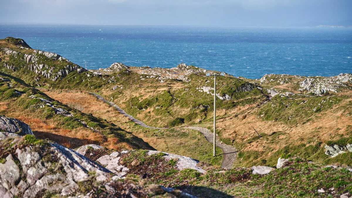
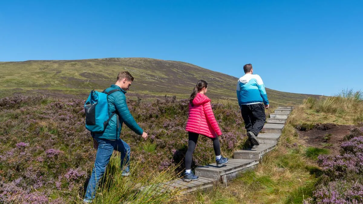
The mix of landscapes is what makes the Wicklow Mountains trails so rewarding for walkers. Blanket bog on the summit plateaux, heather-covered hillsides, native oak woodland in the valleys, and rivers that tumble over granite into dark pools. You can walk for hours and the scenery changes constantly.
Glendalough — The Heart of Wicklow
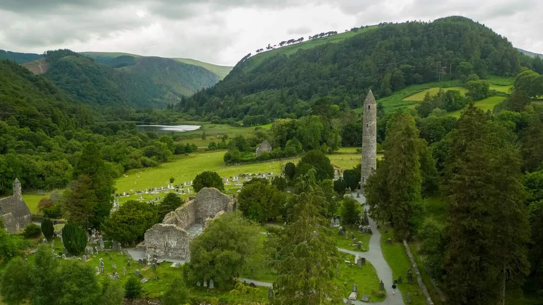
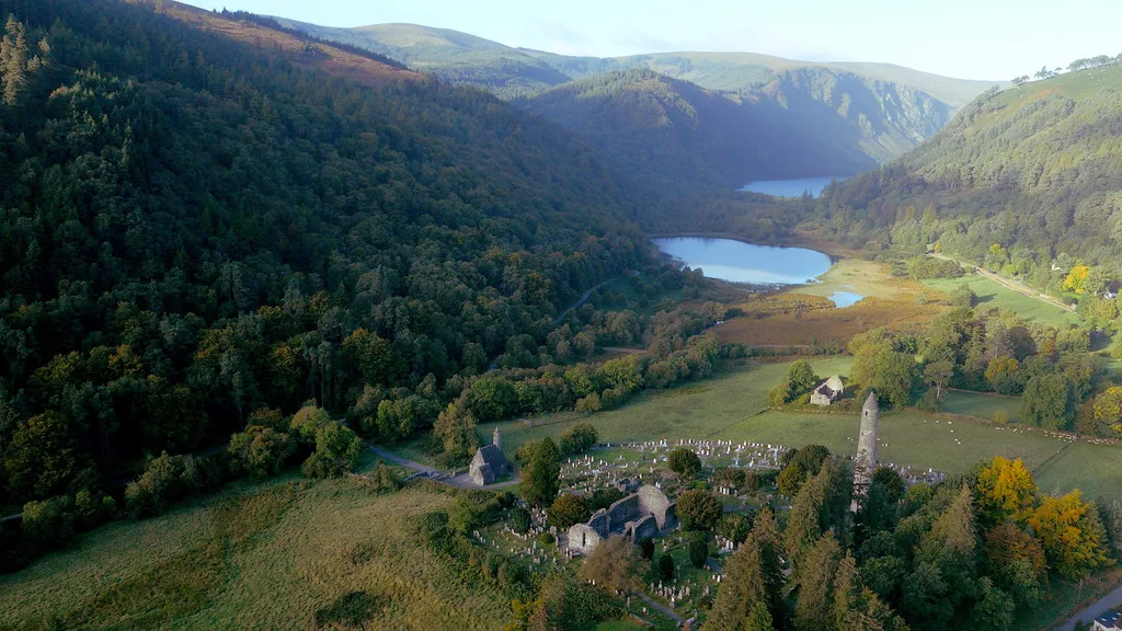
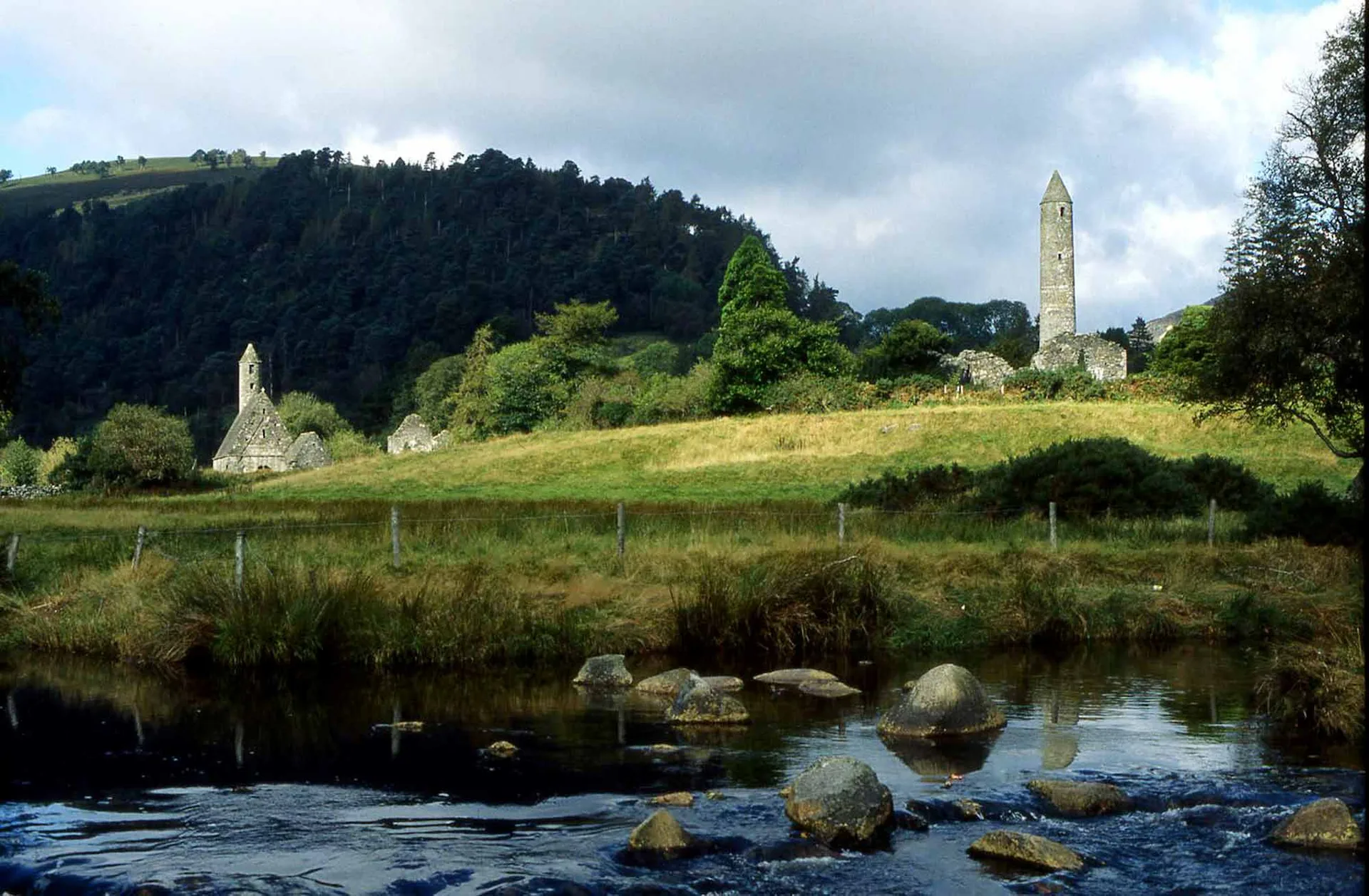
Glendalough is the most visited spot in the national park and one of the most atmospheric places in Ireland. Gleann Dá Loch — the Valley of Two Lakes — has been occupied since the 6th century, when Saint Kevin established a monastic settlement that grew into one of Ireland's most important mediaeval centres of learning. The round tower — 33 metres tall, dating to the 10th century — still stands. The cathedral ruins, the stone churches, and the Celtic crosses make this a place where history and landscape come together.
The Upper Lake is the wilder of the two — dark water between mountain walls, with the forest running down to the shore. Kevin's Bed, a small cave in the cliff face above the lake, is where the saint lived as a hermit. The Lower Lake sits beside the monastic city, with the round tower reflected in the water on still days.
The early-morning advice is worth following. The valley gets busy by 11am in summer. Before 9am — particularly on a weekday — you may have the Upper Lake largely to yourself. That experience is categorically different from the midday version.
The three best Glendalough walks:
Valley floor circuit (4.5 km, 90 min, easy) — around both lakes, past the monastic ruins, through the oak woodland. Perfect for families.
The Spinc walk Glendalough (9 km, 3–4 hrs, moderate) — the standout trail. Climbs the ridge above the south side of the valley with views down to the Upper Lake and across to Camaderry. The best half-day walk in Wicklow.
Camaderry (12 km, 4–5 hrs, challenging) — the mountain above Glendalough, with panoramic views across the park to the Irish Sea.
For full route details and maps, see my complete Glendalough visitor guide.
The Wicklow Way
The Wicklow Way is Ireland's oldest waymarked trail and one of the best long-distance walks in the country. It runs 127 km from Marlay Park in south Dublin to Clonegal in County Carlow, crossing the full length of the Wicklow Mountains.
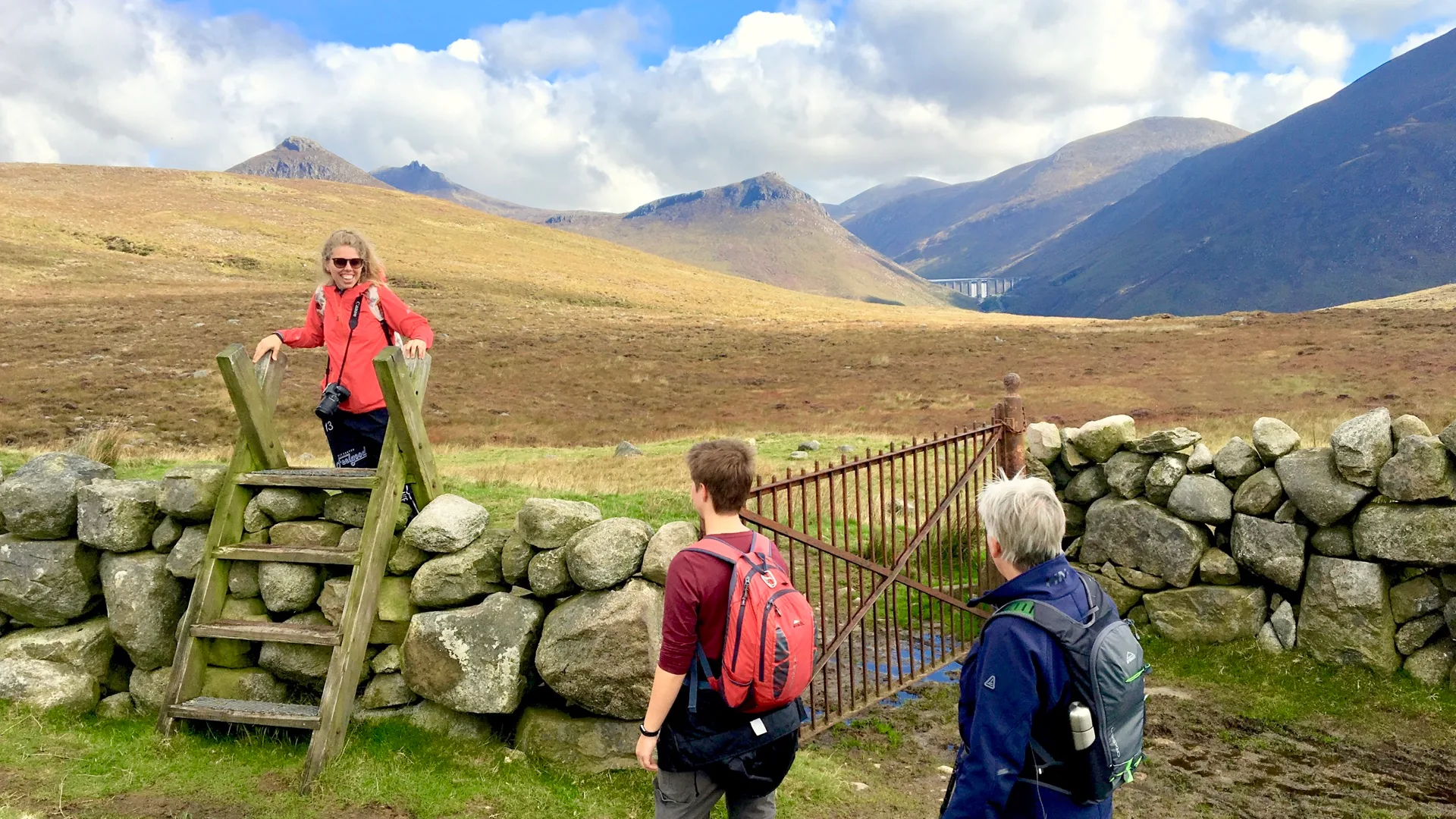
The first days take you over the Dublin Mountains and down into Glencullen, then up across the open bog of Djouce and White Hill before dropping into Roundwood and on to Glendalough. This northern section is the most dramatic — wide views from the ridgetops, boggy paths across the plateau, and the sense of leaving the city far behind. South of Glendalough, the Way crosses the Wicklow Gap and continues through Glenmalure — the longest glacial valley in Ireland — before heading into the gentler farmland of south Wicklow and Carlow.
Most people don't walk the whole thing. They walk sections of it, or they join a multi-day tour that covers the best parts. Both approaches work. We offer the Wicklow Way as a self-guided walking holiday in three lengths:
5-day Wicklow Way — the finest sections
7-day Wicklow Way — more of the route at a gentler pace
10-day Wicklow Way — the full route, end to end
All three include luggage transfers, handpicked accommodation, and route notes. You carry a daypack; your bags travel between the overnight stops.
Best Walks in the Wicklow Mountains: A Walking Guide by Difficulty
Level | Trail | Distance | Time |
|---|---|---|---|
Easy | Glendalough valley circuit | 4.5 km | 90 min |
Easy | Powerscourt Waterfall walk | 3 km | 60 min |
Easy | Great Sugar Loaf summit | 3 km | 90 min |
Moderate | The Spinc, Glendalough | 9 km | 3–4 hrs |
Moderate | Djouce Mountain (Crone) | 11 km | 3–4 hrs |
Moderate | Tonelagee summit | 8 km | 4–5 hrs |
Challenging | Camaderry from Glendalough | 12 km | 4–5 hrs |
Challenging | Lugnaquilla (925 m) | 16 km | 6–7 hrs |
The Big Mountain Walks
The Great Sugar Loaf is the most recognisable mountain in Wicklow — a cone-shaped quartzite peak that stands apart from the granite range. Forty-five minutes from the car park to the summit, with views from Dublin Bay to the Wicklow ridges. At 501 metres, it's a short climb but the panorama is one of the best in the county.
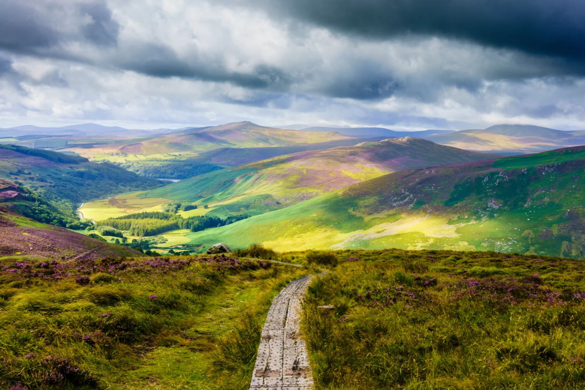
Djouce Mountain rises to 725 metres above Powerscourt and is one of the finest ridge walks near Dublin. The route from Crone car park crosses boardwalks over blanket bog before climbing to the summit ridge, where the views take in the sea, the Sugar Loaf, and the main Wicklow range. Allow 3 to 4 hours.
Lugnaquilla is the big one. At 925 metres, it's a serious mountain walk. The Lugnaquilla summit route from Glenmalure is the most popular approach for this challenging peak, and the round trip takes 5 to 7 hours. The summit plateau is broad and featureless, so navigation skills and proper equipment are needed. On a clear day, the views extend to Wales across the Irish Sea. This is a walk for experienced hillwalkers — not a casual day out.
The Waterfalls
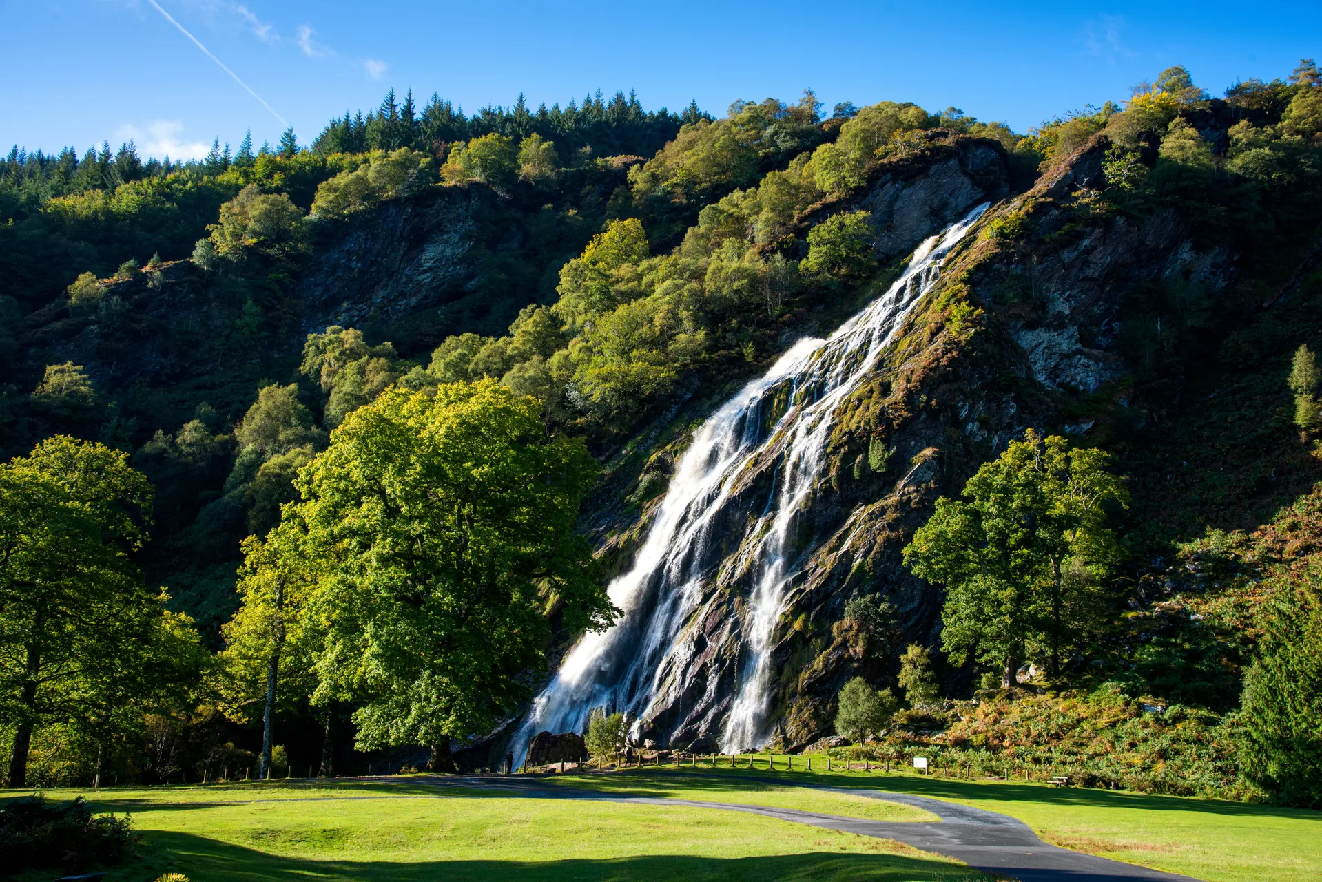
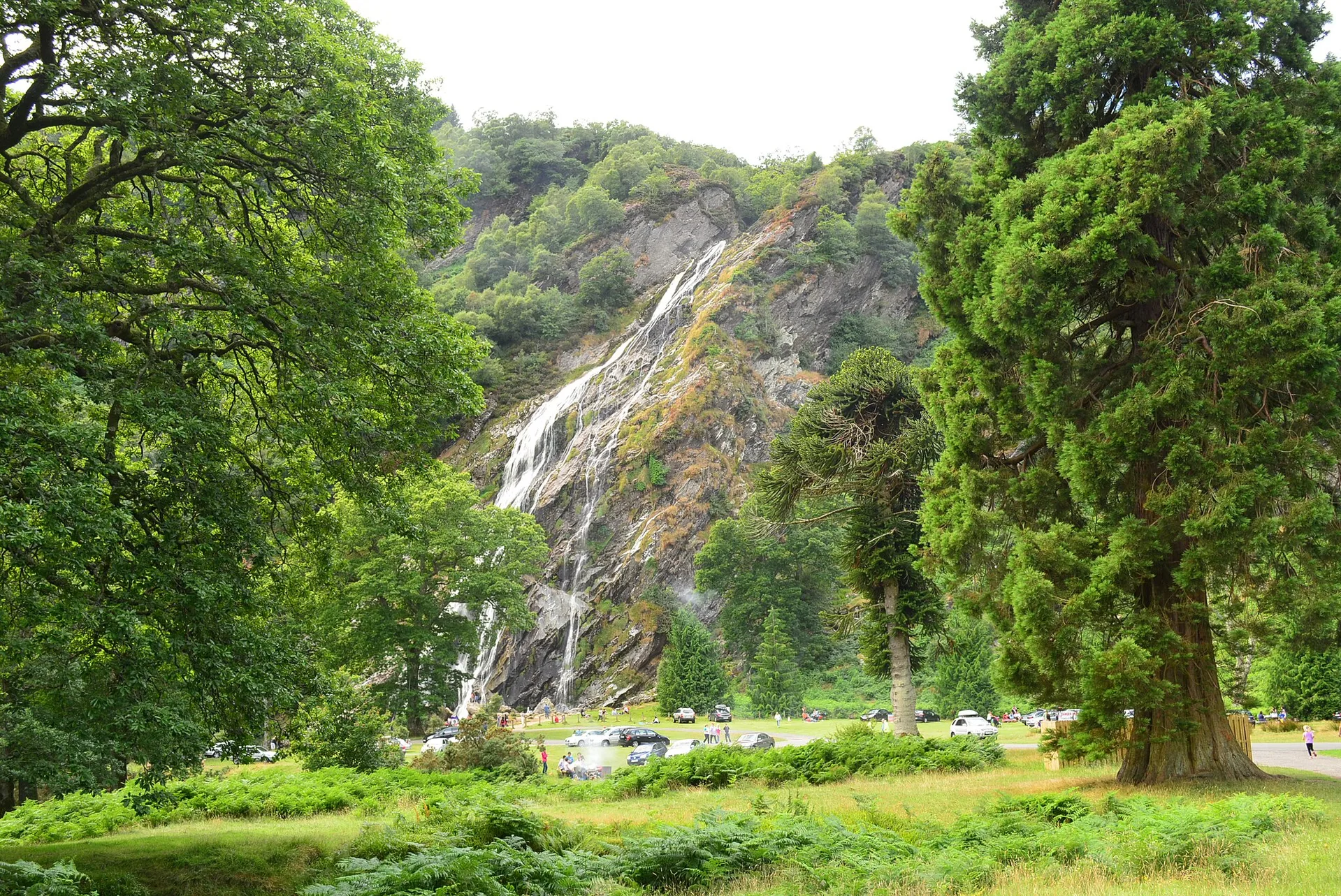
Powerscourt Waterfall is the highest in Ireland at 121 metres. It sits in the Powerscourt Estate grounds near Enniskerry — a separate entity from the national park, with a small admission fee. The Wicklow waterfalls hike from the car park takes about 20 minutes through mature woodland. Most impressive in winter and spring when water levels are high. In a dry August, it can be underwhelming.
Glenmacnass Waterfall is a 50-metre cascade dropping into a dark plunge pool on the Military Road. It's roadside-visible with a small car park, but the approach via the Glenmacnass Valley walk is far better. The valley above the falls is one of the quieter, less-visited sections of the park: open moorland, the Glenmacnass River, and the sense of genuine upland remoteness.
The Glenealo Valley behind the Upper Lake at Glendalough leads to a series of cascades — not a single waterfall but a wild mountain river working its way down through the valley. Quiet, dramatic, and almost entirely missed by the day-trip visitor.

Wildlife and Landscape
The park's moorland is the defining habitat — vast stretches of blanket bog and heather-covered upland, one of the largest continuous expanses of this habitat in Ireland. In late summer (August to September) the heather turns purple across the ridges, a transformation that can make even a grey day worthwhile.
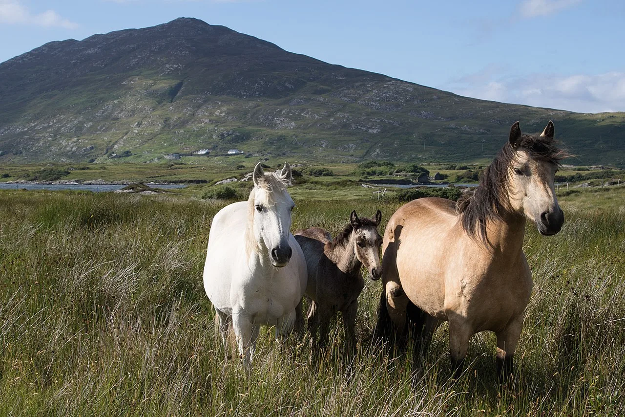
Red grouse breed on the moorland — you're more likely to hear the explosive go-back, go-back call before you see one. Peregrine falcons hunt the cliff faces above Glendalough and along the Wicklow ridges. Sika deer are common across the park, particularly at dusk in the valley areas. Keep a quiet eye on the lakes and rivers for otter — sightings are more frequent than most visitors expect.
The oak woodland at Glendalough is one of the few surviving fragments of ancient native woodland in Ireland — the 200-year-old sessile oaks along the Upper Lake path are genuinely ancient and the ecology of the woodland is distinct from planted commercial forest.
Beyond Walking
Powerscourt Estate in Enniskerry has gardens regularly voted among the finest in the world. The Italian Garden, Japanese Garden, and the views toward the Sugar Loaf make this a perfect rest-day visit.
Avondale House near Rathdrum was the home of Charles Stewart Parnell, one of the key figures in Irish political history. The surrounding forest park has waymarked trails through mature woodland.
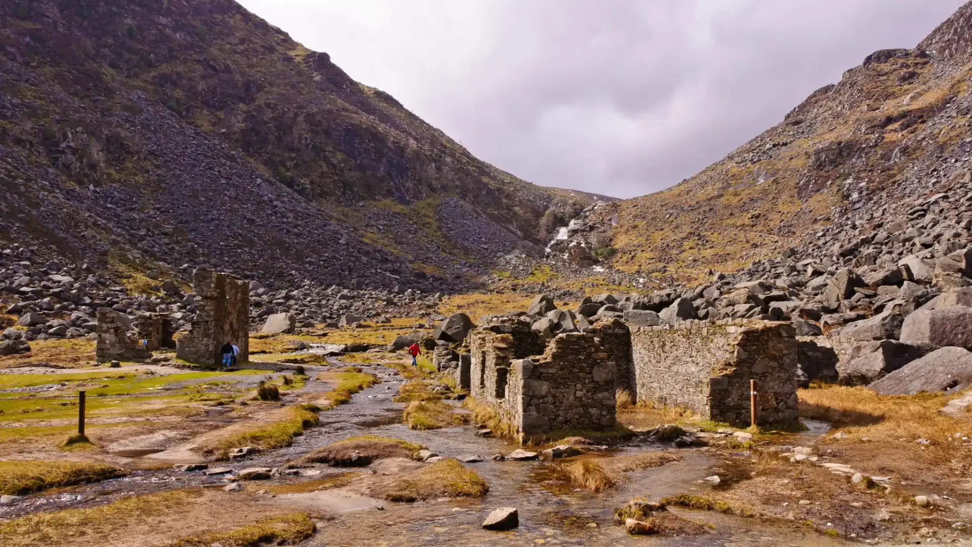
Glenmalure is the longest glacial valley in Ireland and one of the wildest spots in Wicklow. The valley was a stronghold for rebels in 1798, and it still feels remote. A walk up the valley from the Glenmalure Lodge takes you past waterfalls and into real mountain country.
The Sally Gap is one of the great mountain roads in Ireland. It crosses the blanket bog at about 500 metres, passing Lough Tay with its striking dark water. Park and walk — even a short stroll from the road puts you into wild, empty country.
When to Visit
May and June — the heather and gorse in full bloom, long evenings, manageable crowds. My preferred months. The park shows its best green in May after the winter rains.
September and October — the second-best window. Stable weather, golden light, autumn colour beginning in the valley woodlands from mid-October. The Spinc walk in October morning light is exceptional.
July and August — reliable weather but the park is at its busiest. Glendalough sees peak visitor numbers in these months. Start early and head to the Upper Lake sections if you want space.
Winter — the mountains are quiet and can be strikingly beautiful. The lower valley walks are fine year-round. High moorland routes require proper preparation: ice, short days, and limited visibility on the summits are real considerations.
The Irish weather in Wicklow can change fast, especially on the summit plateaux. Pack layers and waterproofs for any walk above the valley floors.
Getting There and Practical Notes
By car: Glendalough is 53 km from Dublin city centre — about an hour via the N11 and R755. Parking fills early in summer; the upper car park is often better than the visitor centre car park for access to the Upper Lake walks.
By public transport: The 133 St Kevin's Bus runs from Dublin city to Glendalough — about 90 minutes, two departures per day. Genuinely viable for a day walk. Check current timetables as services change seasonally.
What to bring: Good hiking boots, full waterproofs, layers, water and snacks. Our packing list covers everything you need. The park's elevation means weather can be significantly colder and wetter than Dublin even on the same day.
Cost: This Wicklow National Park guide covers free access — entry to the park is free and it's open year-round. Glendalough has a visitor centre with exhibitions, information, and parking. Powerscourt Estate charges admission.
Using This Wicklow Mountains Walking Guide
The Wicklow Mountains National Park gives you wild mountain country within reach of the capital. I've covered the essential Wicklow mountain routes in this guide — from Glendalough's monastic ruins to the Wicklow Way's ridgetop paths, the Spinc Walk's views, Powerscourt Waterfall, and the empty summit of Lugnaquilla. Together they make this one of the most rewarding walking areas in Ireland.
County Wicklow earned its name as the Garden of Ireland, and walking through the national park shows you why. Get in touch with Walking Holiday Ireland and we'll help you plan a trip that takes in the best walks this park has to offer.
Frequently Asked Questions
Are the trails well-marked?
How long is the Wicklow Way?
What is the best walk in Wicklow for beginners?
What kind of boots should I wear?
Is Wicklow Mountains National Park free to enter?
Are Ireland's national parks free to visit?
How do I get to Wicklow Mountains National Park from Dublin?
What should I bring for walking in the Wicklow Mountains?
How many national parks are there in Ireland?
Can I climb Lugnaquilla without a guide?
Photo Gallery