The Complete Wicklow Way Trail Guide: 127km Planning & Tips
Should you walk the Wicklow Way south-to-north or north-to-south? I've guided dozens of groups along this 127km Wicklow Way, and the answer changes everything about your experience on this iconic trail.
This Wicklow Way trail guide breaks down the full route into manageable stages, covers exactly what to expect each day, and shares the Wicklow Way planning tips I've learned over fifteen years of organising self-guided tours across the Wicklow Mountains.
Wicklow Way Summary
Distance: 127 km (79 miles), typically 6–8 days
Direction: South-to-north (Clonegal to Marlay Park) is easier
Difficulty: Moderate, with two tough mountain stages
Best months: May–September
Essential gear: Waterproofs, map, broken-in boots
Baggage transfer: Highly recommended
Book accommodation: 8–10 weeks ahead in summer
What Is the Wicklow Way Trail?
The Wicklow Way is Ireland's oldest waymarked long-distance trail. Opened in 1980, this 127km Wicklow Way runs through County Wicklow and Dublin, connecting Clonegal in the south to Marlay Park in the capital.
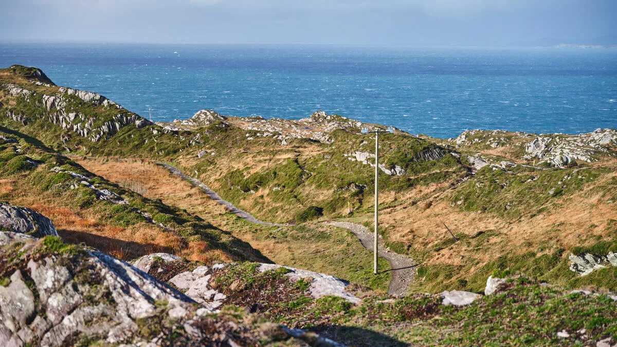
The route passes through the Wicklow Mountains, ancient forests, glacial valleys, and high moorland. You'll walk past monastic ruins at Glendalough, over boardwalks across blanket bog, and along military roads built by the British after the 1798 Rebellion.
Most walkers complete the trail in 6–8 days. It's graded moderate, with some steep climbs and long exposed sections where weather matters.
Wicklow Way Route Planning: Which Direction Should You Walk?
This is the most important decision in your Wicklow Way route planning.
South-to-north (Clonegal to Marlay Park) is what I recommend. You start gently in farmland, build fitness through the middle mountain stages, and finish with an effortless descent into Dublin. The prevailing south-west wind is at your back, not in your face on exposed ridges.
North-to-south has one advantage: you end in a village (Clonegal) rather than a suburban park. But you'll face two tough climbs—White Hill and Djouce Mountain—in your first 48 hours, which isn't ideal whether you're carrying a few extra pounds or haven't trained.
Most of the walkers on our Wicklow Way Full 7 Days tour choose south-to-north. I've yet to hear anyone regret it.
Wicklow Way Stage Breakdown: 7-Day Itinerary
Here's a realistic Wicklow Way itinerary for fit walkers covering the full route in seven stages. This Wicklow Way stage breakdown balances daily distance with terrain difficulty and is based on my trail guide recommendations.
Day | Stage | Distance | Terrain |
|---|---|---|---|
1 | Clonegal – Shillelagh | 16 km (10 mi) | Gentle farmland, forest tracks |
2 | Shillelagh – Moyne | 20 km (12.5 mi) | Mixed forest, some road walking |
3 | Moyne – Glenmalure | 18 km (11 mi) | Mountain ascent, open moorland |
4 | Glenmalure – Glendalough | 16 km (10 mi) | High bog, steep descent to valley |
5 | Glendalough – Roundwood | 20 km (12.5 mi) | Forest, lake views, moderate climbs |
6 | Roundwood – Enniskerry | 19 km (12 mi) | Moorland, Djouce Mountain, descent |
7 | Enniskerry – Marlay Park | 18 km (11 mi) | Forest paths, suburban finish |
You can also walk the trail in five days if you're comfortable with 22–25 km stages, or stretch it to eight days for a more relaxed pace.
Day 1: Clonegal to Shillelagh (16 km)
You'll start in the quiet village of Clonegal, where the trail is marked from the main street. The first day is deliberately easy according to this Wicklow Way trail map: rolling farmland, country lanes, and conifer plantations.
The route crosses the Derry River twice and climbs gently through Shillelagh Forest. Shillelagh itself is a small village with one pub and limited accommodation—book ahead.
Day 2: Shillelagh to Moyne (20 km)
This stage involves more forestry and some stretches on quiet tarmac roads. You'll pass through Tinahely, where you can stock up on snacks or stop for coffee.
The landscape is still lowland here—green fields, hedgerows, the occasional sheep staring at you. Moyne is tiny; most walkers stay in Aughrim, 3 km off-trail.
Day 3: Moyne to Glenmalure (18 km)
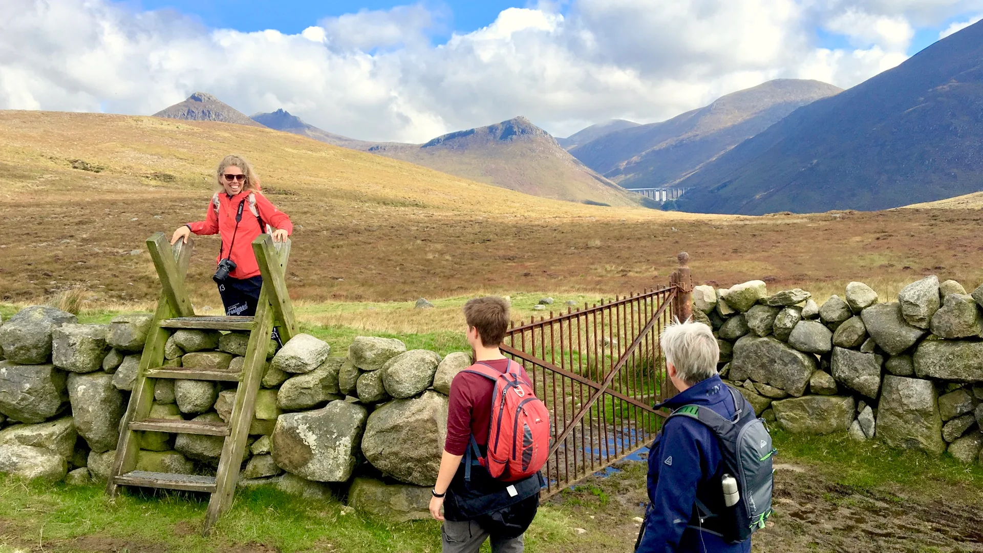
This is where the terrain changes tone in my Wicklow Way trail guide. You'll climb steadily out of the farmland and onto an open mountainside. The trail crosses the Slieve Maan plateau—exposed, boggy, and beautiful.
On clear days you'll see the granite dome of Lugnaquilla (Ireland's third-highest peak) to the west. In mist, navigation requires attention; the waymarkers are spaced further apart here.
You descend steeply into Glenmalure, a glacial valley with one of Ireland's most remote pubs (no mobile signal, cash only).
Day 4: Glenmalure to Glendalough (16 km)
The toughest climb of the entire trail. You'll ascend 400 meters out of Glenmalure onto a high bog, passing the remains of British barracks and mine workings.
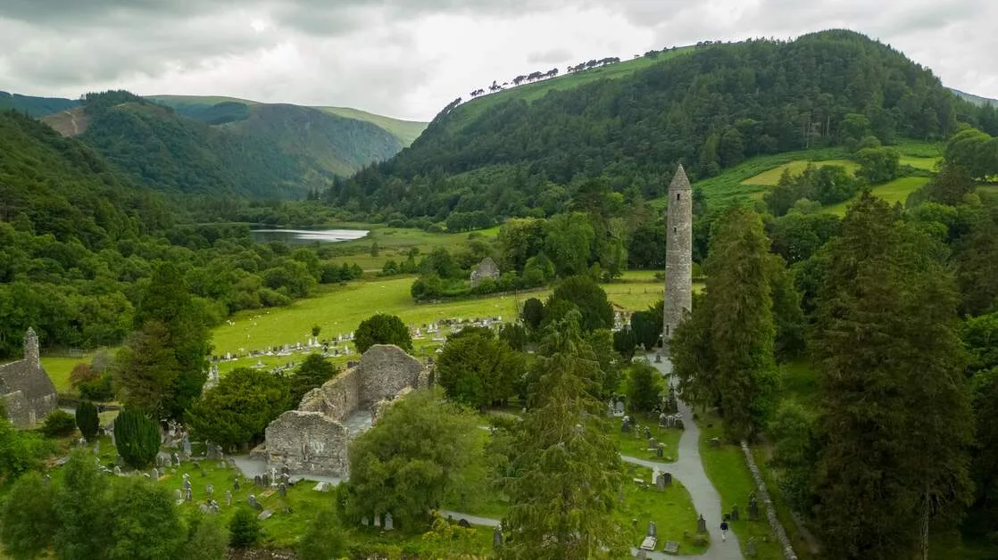
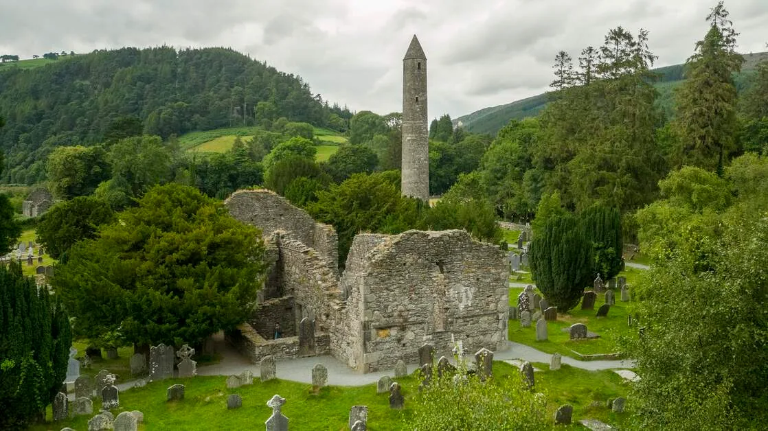
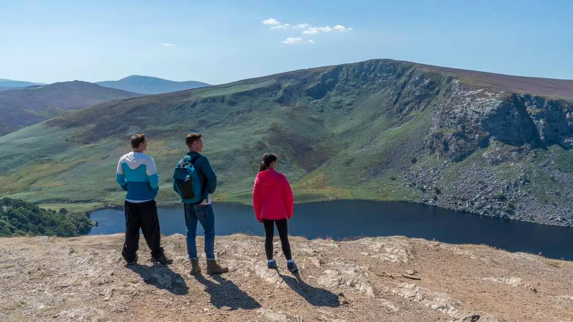
The descent into Glendalough is steep and rocky—watch your footing, especially if it's wet. Your reward is one of Ireland's most iconic monastic sites: a round tower, stone churches, and two dark glacial lakes.
Glendalough has multiple accommodations, cafés, and a visitor center. It's also the most crowded spot on the trail—coach tours arrive by mid-morning.
Day 5: Glendalough to Roundwood (20 km)
You'll leave Glendalough's crowds behind and climb through oak and pine forest. The trail skirts the southern shore of Lough Dan, then crosses boardwalks over blanket bog.
Roundwood claims to be Ireland's highest village (not quite, but it's up there). It has pubs, shops, and ATMs—stock up if you need supplies.
Day 6: Roundwood to Enniskerry (19 km)
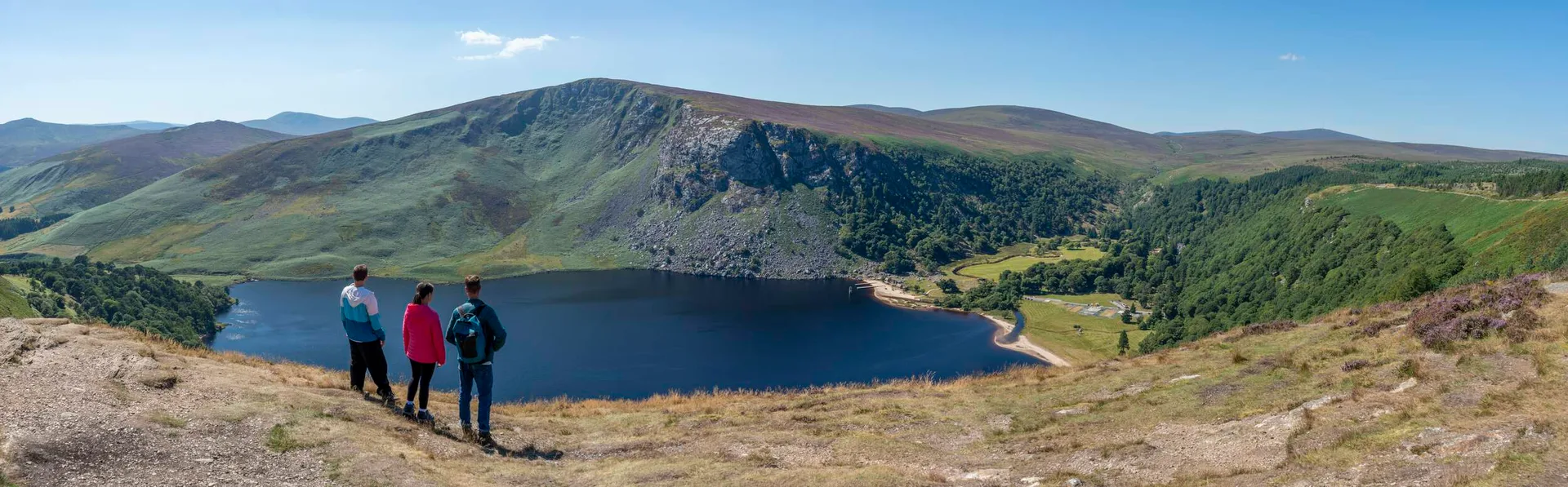
Another high-mountain day. You'll climb to the shoulder of Djouce Mountain (725 m), with stunning views over the Irish Sea if the weather cooperates.
The descent to Enniskerry passes the Powerscourt Waterfall (Ireland's tallest at 121 metres—there's an admission fee if you detour). Enniskerry is a picturesque village at the edge of the Wicklow Mountains, with excellent food and accommodation.
Day 7: Enniskerry to Marlay Park, Dublin (18 km)
The final stage is mostly downhill through mature woodland. You'll pass the grounds of several estates, cross a couple of suburbs, and emerge at Marlay Park—a pleasant green space but an anticlimactic finish compared to the mountains behind you.
Dublin's city center is 30 minutes away by bus (route 16 from the park gate). Most walkers either spend a night in Dublin or head straight to the airport.
Wicklow Way: What to Expect – Terrain, Weather & Conditions
The Wicklow Way what to expect question comes up in every pre-trip email I send. Here's the reality based on my trail guide experience.
Terrain Variety
Forest tracks: 40% of the trail, mostly well-drained gravel.
Open moorland: 30%, with boardwalks over the wettest sections but plenty of bog elsewhere.
Paved roads: 20%, mostly quiet country lanes.
Rocky mountain paths: 10%, steep and loose in places.
Weather
Wicklow's weather is famously changeable. I've seen all four seasons in a single afternoon on Djouce Mountain.
The best time to visit Ireland for this trail is May to September, when daylight lasts until 22:00 and temperatures sit between 12 and 18°C. But even in the summer, pack waterproofs and a warm layer.
Winter walking (November–February) is possible but requires experience. Daylight ends by 16:30, and the high sections can be impassable in snow or ice.
Navigation
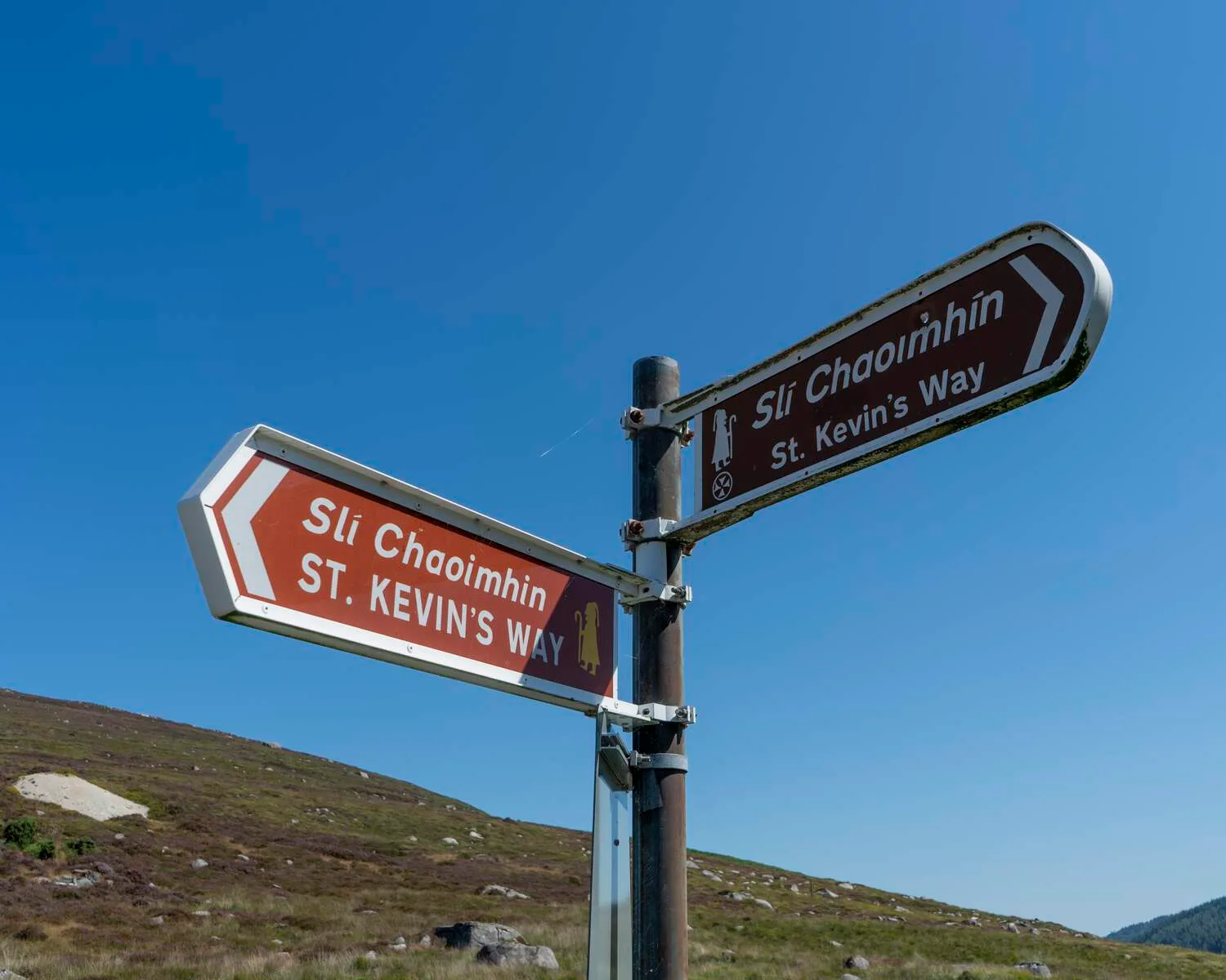
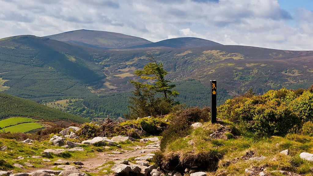
The trail is waymarked with yellow walking-man symbols on posts and stones. In forests and on roads, they're frequent and clear. On open moorland—especially in mist—they can be hard to spot.
Carry a detailed Wicklow Way trail map. I recommend the Ordnance Survey Ireland 1:50,000 sheets (56 and 62) or the Harvey Superwalker map, which covers the entire 127km route on one waterproof sheet.
A GPS device or smartphone with downloaded offline maps is a sensible backup.
Essential Wicklow Way Planning Tips: Logistics & Practicalities
These Wicklow Way planning tips cover the questions I answer most often.
Accommodation
There's B&B or guesthouse accommodation near every stage endpoint—but not in large supply. Glenmalure has just one lodge. Moyne has no accommodations; you will stay in nearby Aughrim.
Book at least 8–10 weeks in advance in the summer. If you're walking in May or late August (Irish bank holidays), book earlier.
Baggage Transfer
Most self-guided walkers use a baggage-transfer service. You leave your main bag at breakfast; it's delivered to your next accommodation by late afternoon. You carry only a daypack.
This transforms the experience—especially on the climbs out of Glenmalure and up Djouce. Our 8-Day Wicklow Way Walking Tour includes daily baggage transfer, along with pre-booked accommodation and route notes.
Wicklow Way Transport Tips
Getting to the start and back from the finish requires planning.
Clonegal (start): No public transport. Most walkers take a taxi from Bunclody (12 km away, served by Bus Éireann route 379 from Dublin) or arrange a private transfer.
Marlay Park (finishing): Dublin Bus Route 16 runs every 20 minutes to the city center. The stop is at the park's main entrance.
Intermediate access: Glendalough and Enniskerry have daily bus services to Dublin (St. Kevin's Bus and Dublin Bus 185). Useful if you need to shorten your walk or resupply.
My Wicklow Way transport tips for route planning also include this: if you're driving, leave your car in Dublin and take a transfer to Clonegal. Trying to retrieve a car from the start after you finish is a logistical headache.
Food & Supplies
Shillelagh, Tinahely, Glendalough, Roundwood, and Enniskerry all have shops or cafés. The stages through Glenmalure and between Glendalough and Enniskerry have nothing available, so carry lunch and snacks.
Most B&Bs will prepare a packed lunch if you ask the night before. Evening meals are available in larger villages, but some smaller stops require booking dinner at your accommodation.
Fitness & Difficulty
The Wicklow Way is graded moderate. You need to be comfortable walking 16–22 km per day, with ascents of 400–600 metres on mountain stages.
If you're unsure about your fitness, read our tour grading guide or start with a shorter trail like the Barrow Way, which is flatter and easier.
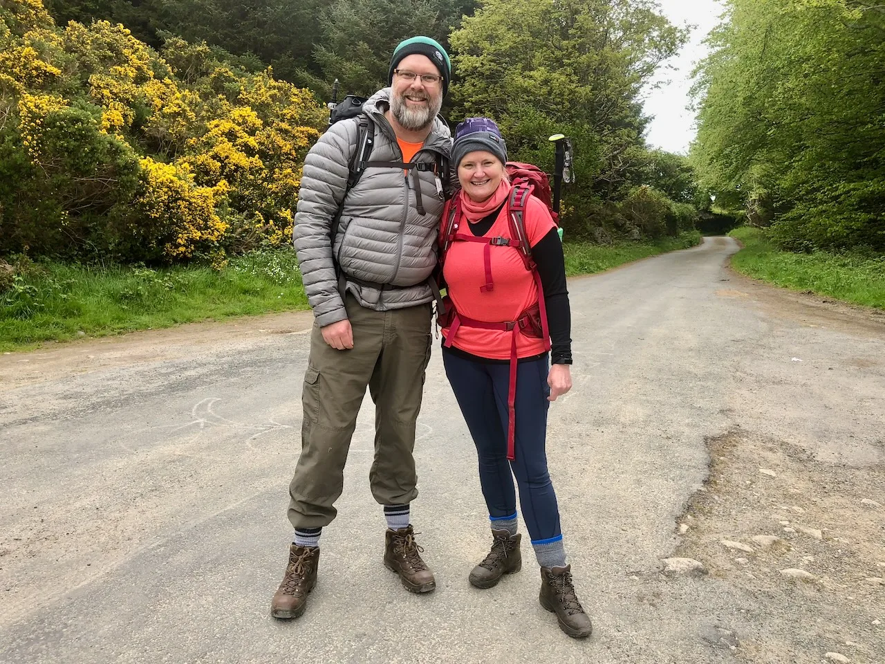
What to Pack for the Wicklow Way
If you're using baggage transfer, you'll carry a daypack (20–30 litres) with:
Waterproof jacket (essential—choose breathable, not a plastic poncho)
Insulating layer (fleece or down jacket for the mountains)
Waterproof trousers (optional but recommended May–September, essential October–April)
Hat and gloves (even in summer for the high stages)
1–1.5 litres of water
Lunch and high-energy snacks
Sunscreen and sunglasses
Basic first-aid kit (blister plasters, pain relief, any personal medications)
Phone or GPS with offline maps
Cash (some pubs and accommodations don't take cards)
For more detail, see our packing list for self-guided walking holidays.
Alternative Wicklow Way Itineraries
Not everyone has seven days. Here are two shorter options.
5-Day Fast Wicklow Way
If you're fit and comfortable with longer days, you can complete the trail in five stages (23–27 km each). You'll combine Clonegal–Moyne and Glendalough–Enniskerry and skip a rest day.
Our Wicklow Way five-day walking holiday follows this itinerary.
Glendalough to Dublin (3–4 Days)
The most scenic half of the trail. Start in Glendalough (easy access by bus from Dublin), and walk to Roundwood, Enniskerry, and Marlay Park. You'll cover 57 km and experience the best mountain stages without the long southern approach.
Why Walk the Wicklow Way with Walking Holiday Ireland?
I'm Cliff, and I've been organising self-guided walking tours across Ireland since 2009. The Wicklow Way was the first trail I ever walked end-to-end, back in 1998, and it's still one of my favourites.
When you book a complete Wicklow Way trail guide package with us, you get:
Pre-booked accommodation in carefully selected B&Bs and guesthouses
Daily baggage transfer
Detailed route notes and maps
24/7 phone support while you're on the trail
Transport from Dublin to Clonegal on Day 1
Emergency backup plans (weather, injury, or logistics issues)
We're members of the Adventure Travel Trade Association, and we've helped thousands of walkers complete the Wicklow Way safely and comfortably.
You can read reviews from past guests or get in touch if you'd like to discuss your trip.
Final Wicklow Way Planning Tips
Three last pieces of advice from fifteen years of organising this trail:
Don't underestimate the mountain stages. Glenmalure to Glendalough and Roundwood to Enniskerry are tough. If the forecast is dire, consider taking a rest day or skipping a stage by bus.
Break in your boots. The rocky descents will punish new footwear. Aim for at least 50 km of walking before you arrive.
Visit Glendalough early or late. The monastic site is magical at 07:00 or 19:00 and crowded and noisy at midday.
If you'd like help planning your Wicklow Way itinerary, or if you're trying to decide between the Wicklow Way and the Kerry Way or Dingle Way, I'm happy to talk through your options. Contact us or browse our full list of walking areas across Ireland.
Wicklow Way FAQs
How long does it take to walk the entire Wicklow Way?
Most walkers complete the full Wicklow Way in seven to eight walking days, plus a night either side for arrival and departure. Fitter, faster walkers manage it in six. We rarely recommend compressing it further — the trail is far more enjoyable when you have time to look around.
Can beginners walk the Wicklow Way?
Yes, if you train ahead. We send first-time long-distance walkers on the Wicklow Way every year and they almost always finish. Build up to walking six hours in a day at least once before you come, and make sure your boots are broken in.
Do I need a guide?
No. The Wicklow Way is well waymarked with yellow arrows and walker symbols, and our route notes and maps cover everything you need. Most walkers prefer the freedom of going at their own pace.
Is the Wicklow Way safe to walk solo?
For most of the route, yes. The trail is quiet but rarely deserted in season — you will usually meet other walkers each day. The high mountain sections, particularly the Djouce–White Hill ridge, need care in poor visibility. Solo walkers should leave their daily plan with someone and carry a fully charged phone.
What is the difference between the Wicklow Way and the Kerry Way?
Both are exceptional. The Wicklow Way is closer to Dublin, easier to access and shorter. The Kerry Way is in the wild south-west, longer (214 km), with more dramatic coastal and mountain scenery. We have written a full comparison for walkers choosing between the two.
Are there guided tours of the Wicklow Way?
We offer self-guided walking holidays only on the Wicklow Way, with accommodation, luggage transfer, route notes and a support line. The trail's clear waymarking and our detailed notes mean a guide is not needed — and walkers consistently tell us they prefer the freedom.
The Wicklow Way was Ireland's first National Waymarked Way. See how it compares with every other long-distance trail in our complete guide to Ireland's National Waymarked Ways.
Frequently Asked Questions
Are the trails well-marked?
What kind of boots should I wear?
What are the most essential items to pack for a walking holiday in Ireland?
What is the most popular route?
Photo Gallery