The Bangor Trail: Mayo's Most Remote Long-Distance Walk
There is a stretch of County Mayo where you can walk for six hours and never see a house. No farm gate, no telegraph pole, no roof breaking the horizon — just bog, mountain and the sound of your own boots. The Bangor Trail runs straight through the middle of it, and it has been described as the loneliest place in Ireland. Depending on the kind of walker you are, that is either a warning or an invitation.
This is not a gentle introduction to Irish long-distance walking. It is the wildest waymarked route in the country, and it asks a lot of you. But for walkers who have already done the famous trails and want to know what Ireland looked like before anyone drained it, fenced it or paved it, there is nothing else quite like it.
What the Bangor Trail actually is
The Bangor Trail is a waymarked route of roughly 39 km running between Newport and Bangor Erris in north-west Mayo, crossing the Nephin Beg mountain range and the great Owenduff blanket bog. You will see the distance quoted anywhere from 35 km to 45 km depending on the source — the official Wild Nephin National Park leaflet uses 39 km, and that is the figure we would plan around.
It follows an old drover's path, a route used for moving cattle and sheep between the two towns. Parts of it are thought to be genuinely ancient, possibly Iron Age, and it was the main road between Bangor Erris and Newport well into the modern era. Walking it, you are not on a recreational path laid down for tourism. You are on a working road that the country simply stopped using.
The trail sits inside Wild Nephin National Park, which protects one of the largest intact blanket bogs left in western Europe. The highest point is only around 230 m, so this is not a mountain walk in the climbing sense. The difficulty comes from somewhere else entirely.
The route, in two very different halves
Newport to Letterkeen — the easy part
Starting from Newport, the first stretch of about 10 km is mostly on quiet country roads, climbing gently away from Clew Bay and into forestry. It is pleasant, straightforward walking, and it lulls you a little. You reach Letterkeen Woods and the Brogan Carroll bothy — a simple walkers' shelter that marks the boundary between the ordinary and the serious.
If you want a taste of the Bangor Trail without committing to the whole thing, this is where you turn around. Many walkers do exactly that.
Letterkeen to Bangor Erris — the real thing
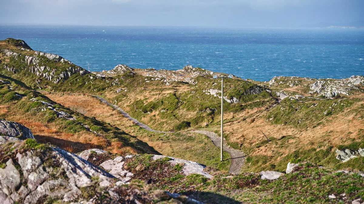
North of the bothy, the remaining 24 km or so are as remote as walking in Ireland gets. The path threads between the Nephin Beg hills on one side and the Owenduff bog on the other, deliberately holding a line that is high enough to stay out of the worst of the wet ground but low enough to avoid the summits.
The surface is bog. Sometimes it is a firm old track, sometimes it is a churned peat trough, and sometimes it disappears entirely and you are navigating between waymarks across open ground. There are rivers to ford. After heavy rain some of them are not crossable at all, and there is no bridge and no alternative — you turn back or you wait.
You will pass the ruins of pre-Famine settlements: low stone walls, the outlines of houses, old field boundaries running out into ground that no one has farmed in nearly two hundred years. It is a quiet reminder that this emptiness is comparatively recent.
How hard is it, honestly
Hard. The Bangor Trail is a full day out for a strong, experienced walker — allow ten hours, and be entirely unsurprised if it takes twelve. That is not because of the ascent. It is because bog walking is exhausting in a way that mileage does not capture: every step sinks, every step has to come back out, and you never get into a rhythm.
Add to that the navigation. Waymarking exists but is sparse, and in low cloud the landmarks vanish. Mobile coverage is patchy to non-existent for most of the route. There is no shop, no café, no house to knock on and nowhere to bail out between Letterkeen and Bangor Erris.
Our honest advice: this is a route for walkers who are already comfortable with map and compass on open mountain ground, walking in a pair or a group, in settled weather, with a firm cut-off time and someone at home who knows the plan. It is not a route to attempt as a first Irish long-distance walk.
What you will actually see out there
Bog, in every mood it has. Sphagnum moss in reds and golds, bog cotton shivering in acres, dark pools reflecting the sky. Purple moor-grass turning the whole valley tawny in autumn. On a clear day the Nephin Beg ridge rises to your right and the light moves across it for hours.
The wildlife is a genuine highlight. Irish hares are common, red deer move through the valleys, and red grouse burst out of the heather with a clatter that will take a year off your life. Frogs are everywhere in wet weather. Overhead you may catch peregrine, merlin or a hen harrier quartering the bog. It is one of the best places in the country simply to be a long way from other people and watch what shows up. If wildlife is what draws you, our guide to wildlife on Irish trails covers what to look for elsewhere too.
The darkest skies in Ireland
Wild Nephin is the heart of Mayo Dark Sky Park, Ireland's first International Dark Sky Park and one of the very few holding gold-tier status — the classification reserved for genuinely pristine night skies. Letterkeen bothy is one of the park's signature viewing points.
If you are already coming this far, it is worth timing your visit around a new moon and staying a night nearby. The Milky Way over the Nephin Begs is something people travel a long way for. We wrote more about this in our guide to stargazing walks in Ireland.
A shorter way in: the Letterkeen Loops
If the full trail is more than you want, the Letterkeen Loop walks are the sensible answer. The main loop is around 12 km and stitches together a section of the Bangor Trail with a section of the Western Way through the pass known locally as the Sheep Pass. You get the bog, the silence and the mountain views, and you are back at your car in an afternoon.
It starts from Letterkeen Woods, and there are shorter variants if you want an easier day. For most visitors, this is honestly the better introduction to Wild Nephin.
Planning practicalities
Best time to go: late May to early September. You want long daylight and the driest ground of the year. Even then, expect wet feet.
Direction: most people walk south to north, Newport to Bangor Erris, getting the road section done first. Walking north to south means finishing on tarmac when you are tired, which some walkers prefer.
Logistics: this is a linear route with no public transport link between the two ends, so you will need to arrange a pick-up or leave a second car. Sort this out before you start, not on the day.
Maps: OS Discovery sheets 23 and 31. Bring both, on paper, plus a compass, and know how to use them. Do not rely on a phone.
Kit: proper waterproof boots, full waterproofs, spare warm layers, at least two litres of water, more food than you think you need, a head torch, and a whistle.
If the Bangor Trail is a step too far
We will be straight with you: this is not a trail we run walking holidays on. The terrain, the river crossings and the total lack of accommodation along the route mean it does not work as a self-guided trip with luggage transfers, and we would rather say so than pretend otherwise.
If what appeals to you is the wildness — big empty landscape, few other walkers, real Atlantic weather — the closest thing we do run is the Burren Way in County Clare, which crosses a limestone landscape every bit as strange and open, with proper places to stay at the end of each day. Walkers who want mountains and remoteness together usually get on best with the Beara Way in west Cork.
And if you have your heart set on Mayo specifically, get in touch. We can put together a tailor-made week built around Wild Nephin, the Letterkeen loops and the Great Western Greenway, with somewhere comfortable to sleep each night. We would enjoy planning it.
Frequently Asked Questions
How long is the Bangor Trail?
About 39 km between Newport and Bangor Erris, though you will see figures from 35 km to 45 km quoted. The official Wild Nephin National Park material uses 39 km.
How many days does the Bangor Trail take?
It is normally walked as a single very long day of ten to twelve hours. There is no accommodation along the route, so splitting it means camping or arranging a pick-up at Letterkeen and restarting the next day.
Is the Bangor Trail suitable for beginners?
No. It needs solid hill fitness, confident navigation, and experience of rough bog ground. Beginners looking for wild Irish scenery are much better served by the Letterkeen Loops or a waymarked trail with accommodation along it.
Can you camp on the Bangor Trail?
Wild camping is possible in the national park, and the Brogan Carroll bothy at Letterkeen is a basic open shelter. Follow Leave No Trace principles — this is a protected blanket bog and it damages very easily.
What is the best time of year to walk the Bangor Trail?
Late May to early September, for the long daylight and the driest underfoot conditions. Winter attempts are for experienced groups only, and the short days make the timings unrealistic.
Are there river crossings on the Bangor Trail?
Yes, several, and they are unbridged. After heavy rain they can become impassable. Check the forecast and the preceding few days of rainfall before you commit to the route.
Does Walking Holiday Ireland offer the Bangor Trail?
We do not — there is nowhere to stay along the route, so a self-guided walking holiday with luggage transfers is not possible. We are always happy to talk through Mayo alternatives if it is that part of the country you want to see.