Wild Atlantic Way Walking Guide: 10 Best Sections on Foot
My name is Cliff, and I run Walking Holiday Ireland. The Wild Atlantic Way stretches 2,500 km along Ireland's western seaboard from Kinsale in County Cork to Malin Head in Donegal. It passes sea cliffs, empty beaches, fishing villages, mountain passes, and some of the finest walking country on the planet. This wild Atlantic way walking guide covers the best sections to explore on foot.
A Wild Atlantic Way road trip is the best way to see Ireland's west coast. But the real rewards come when you park the car and walk. Every section has trails that take you to places the road can't reach — cliff edges, island headlands, mountain summits, and hidden beaches. This guide covers both the driving route and the best walks the Wild Atlantic Way has to offer, from south to north.
Why Walk the Wild Atlantic Way (Not Just Drive It)
Driving the Wild Atlantic Way takes 10–14 days. Walking it section by section? That's where real memory gets made. The distinction is important because it explains why walkers love the Wild Atlantic Way, while many drivers find it monotonous.
In a car, cliffs are scenery. On foot, you touch basalt, limestone, and quartzite. You understand how ancient geology created the landscape. Photographs and car windows compress distance and size — walking beneath cliffs 600 metres High teaches you actual scale in ways driving cannot. The car creates its own sound environment; walking offers silence and landscape sounds – wind, water, waves, and birds. And weather becomes part of the experience rather than something you're protected from. Mist obscuring cliffs teaches you visibility's importance. Rain transforms the landscape moment to moment.
When you walk a coastal cliff, your legs feel the wind, your lungs get the sea air, and you notice details a car window misses: the specific gold of gorse in bloom, the way light hits sea stacks, and the sound of waves below your feet. Driving allows scenic speeds. Walking forces extended time in landscapes. That time investment creates memory that brief observation cannot match.
The Route — South to North
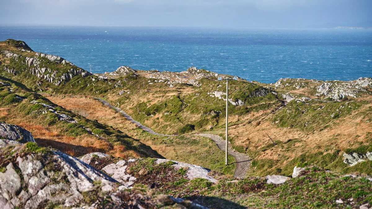
The Wild Atlantic Way runs through six counties and dozens of communities. It starts at Mizen Head in Cork—the most southwesterly point of mainland Ireland—and finishes at Malin Head in Donegal— the most northerly point. Between them lies a coastline of extraordinary variety.
The route is waymarked, with blue and white signs showing a stylised wave. You can drive it in either direction, but south to north takes you into increasingly wild and dramatic scenery. Most walkers allow at least a week to cover the highlights — two weeks if you want to walk properly and not just drive past. The full 2,500 km would take 8–10 weeks end-to-end on foot. Most visitors choose 2–4 walking sections over 6–14 days.
Best Walks Wild Atlantic Way: 10 Top Sections
1. Mizen Head to Sheep's Head (County Cork) — 30 km
Ireland's most southwesterly walk starts your Mizen Head to Malin Head walk journey. The path crosses moorland, rounds headlands, and dips into valleys filled with fuchsia. I walked this in September when the light turns golden around 4 p.m. At Sheep's Head, the land narrows to a point barely 100 meters wide, with cliffs falling away on both sides. Difficulty: moderate. Duration: 2–3 days.
2. Beara Way Coast Sections (Cork/Kerry) — 10–15 km day walks
The Beara Peninsula is the first major highlight heading north from Mizen Head. The Beara Way coastal sections are dramatic and quiet — the walk from Allihies toward Ballydonegan Bay passes abandoned copper mining villages, high sea cliffs, and views of the Skellig Islands. These western Ireland coast walking routes attract few walkers, which is part of the appeal. Difficulty: moderate to hard. Duration: 4–6 hours per day walking.

3. Kerry Way — Glenbeigh to Cahersiveen (County Kerry) — 20 km
The Kerry Way is a 215 km trail circumnavigating the Iveragh Peninsula, incorporating the famous Ring of Kerry but venturing into mountain terrain that coach tours miss. The coastal section between Glenbeigh and Cahersiveen is as excellent as coastal walking gets in Ireland — mountains to your back, ocean ahead. Near Kells Bay, you'll find an ancient woodland of oak, ash, and birch. Walk from Killarney through the Black Valley to Glenbeigh for a taste of what the full Kerry Way offers. Difficulty: moderate.
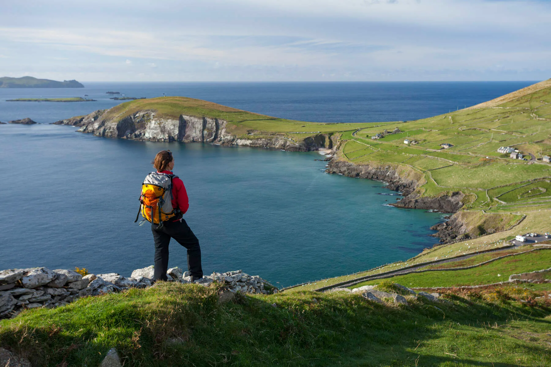
4. Dingle Way — Dunquin to Dingle Town (County Kerry) — 16 km
Pure Atlantic coast. From Dunquin on the western tip, the walk curves east along cliffs and green lanes toward Dingle town, passing Ventry Beach and views of the Blasket Islands. The Dingle Way loops around the peninsula, and the Slea Head Drive gives you cliffs, beehive huts, and views that arguably make the most dramatic coastal viewpoint in Ireland. Dingle town has some of the best traditional music sessions in the country. Difficulty: moderate. Duration: 5–6 hours.

We offer walking holidays on the Kerry Way and the Dingle Way with accommodation booked, luggage transferred, and route notes provided.
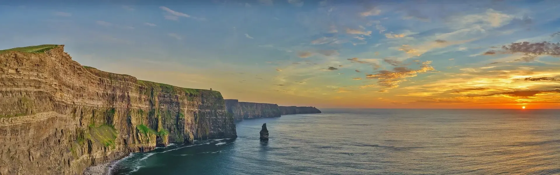
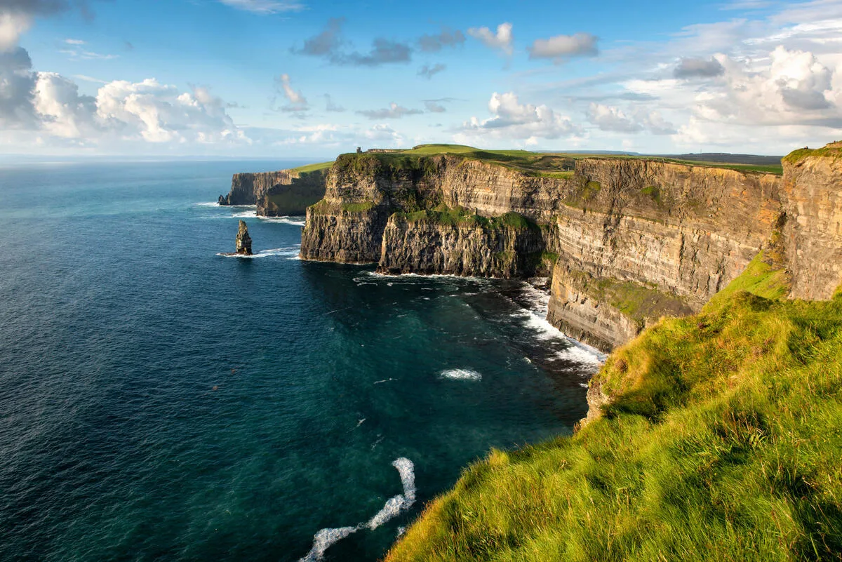
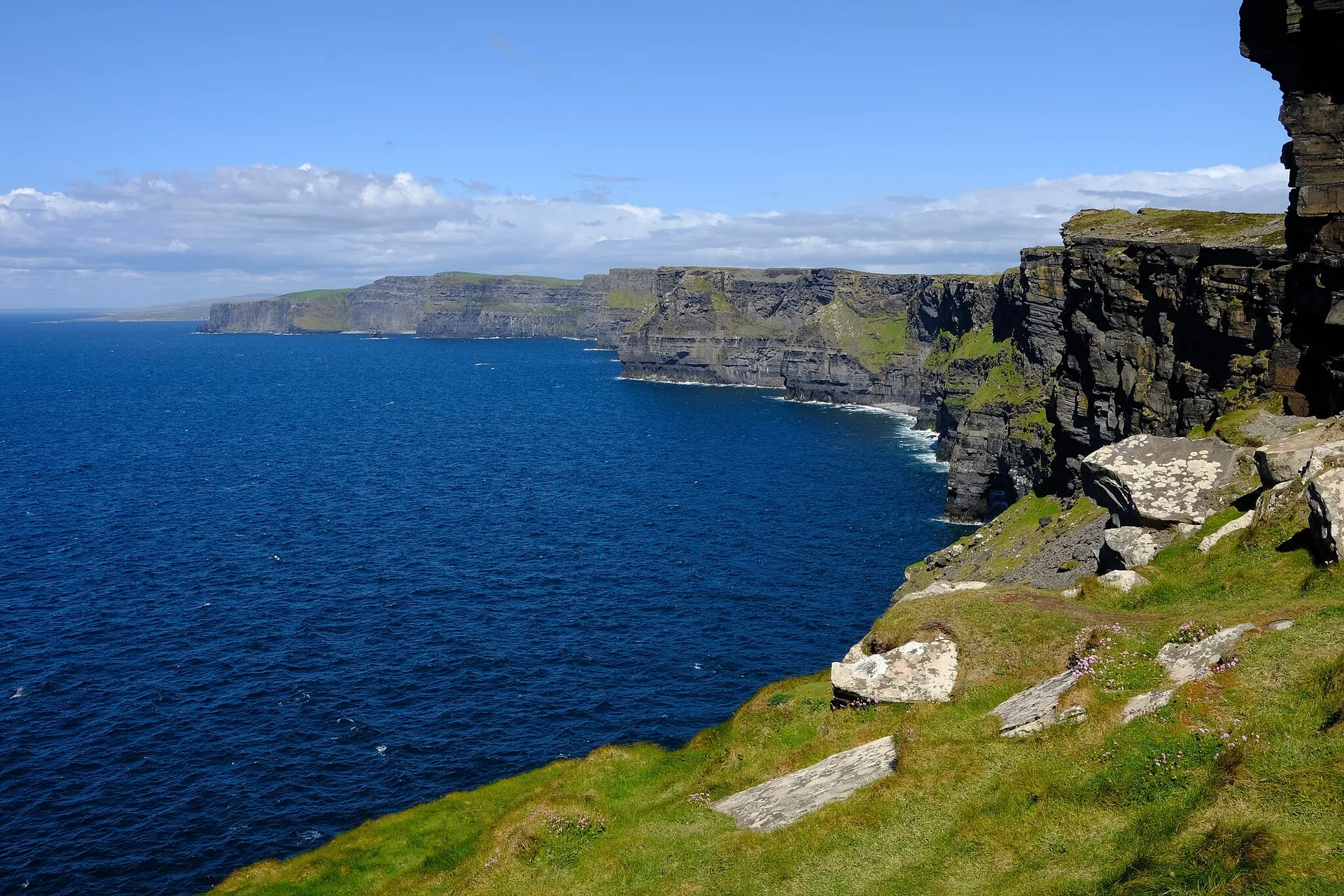
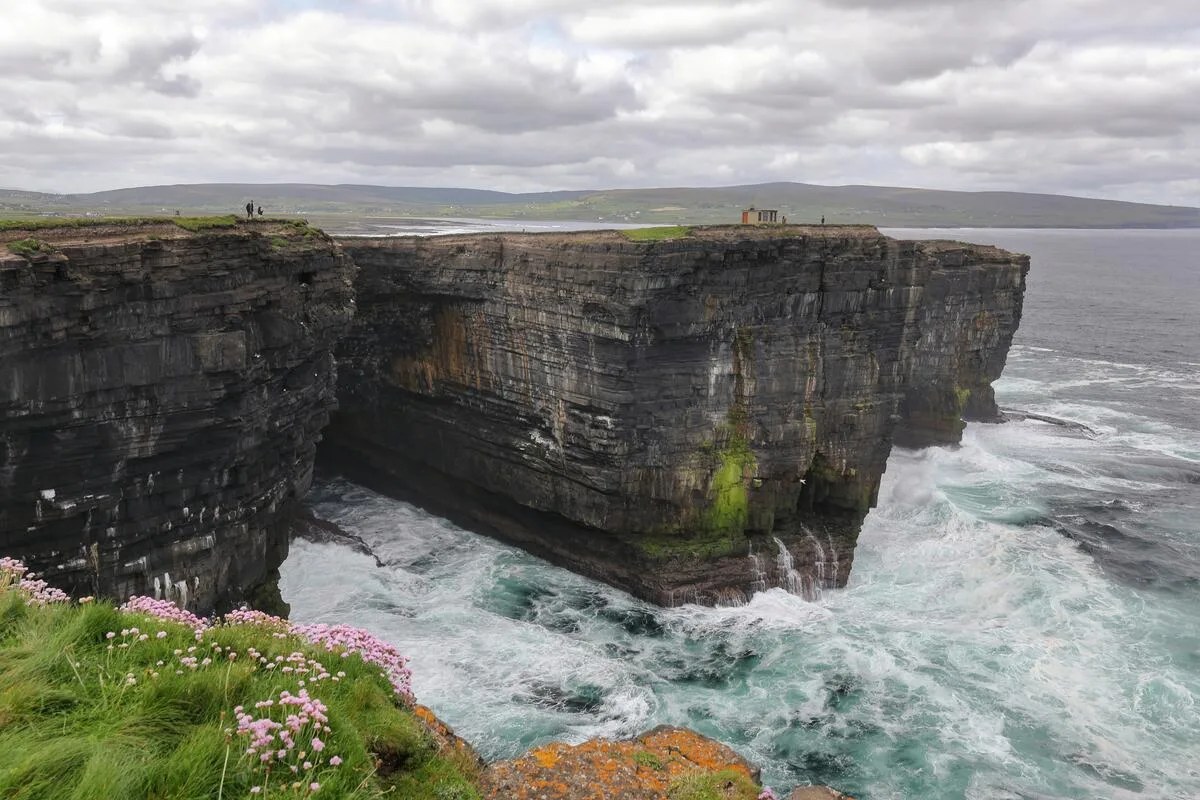
5. Cliffs of Moher Coastal Path (County Clare) — 8 km
Walk east from Doolin toward Hags Head, and the crowds thin immediately. This 8-kilometre path follows the cliff edge 200+ metres above the Atlantic. I've walked this twice: once in calm September light, once in March with a gale that made forward progress deliberate. Both were worth every step. Hags Head is actually higher than O'Brien's Tower. The Cliffs of Moher rise 214 metres from the Atlantic and stretch for 14 km along the Clare coast — one of the best wild Atlantic Way cliff walks in Ireland. The views stop you in your tracks. Difficulty: easy to moderate.
6. Burren Way — Ballyvaughan to Doolin (County Clare) — 15 km
Limestone country that looks like another planet. The Burren Way crosses 250 square kilometres of bare limestone pavement, where wildflowers grow from the rock. In May, wild orchids bloom in the cracks. The local saying is, "The Burren has no water above ground and no earth underground. " The Poulnabrone Dolmen—a 5,800-year-old portal tomb standing on open limestone—is worth a stop alone. Doolin is the unofficial capital of traditional Irish music and a wonderful base for both the Cliffs and the Burren. Difficulty: moderate. Duration: 5–6 hours.
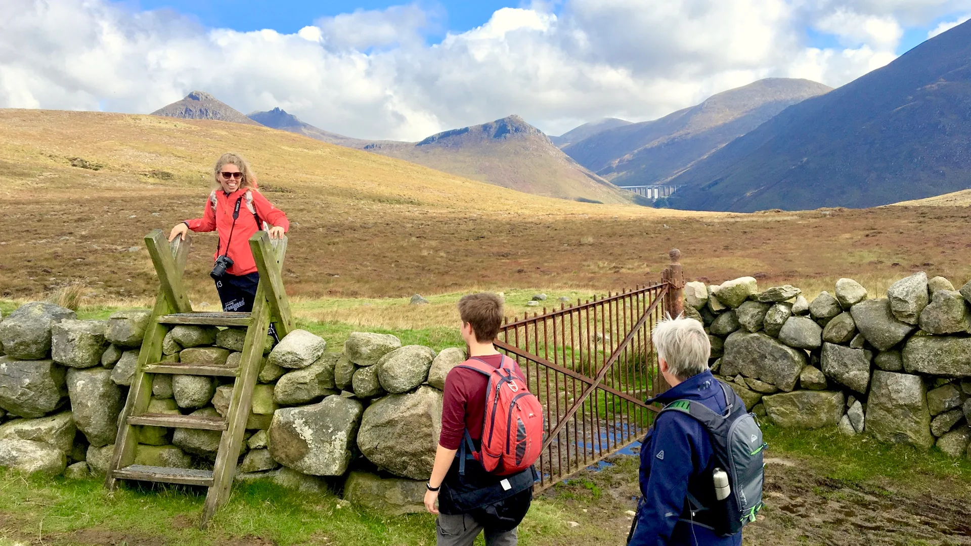
7. Diamond Hill and Killary Harbour, Connemara (County Galway) — 6 km + 8 km
The Wild Atlantic Way passes through Galway's city before heading into Connemara, one of the wildest corners of Ireland. Diamond Hill is a short, sharp walk — 6 km with 500 m elevation — with panoramic views over Killary Harbour (Ireland's only fjord) and the Atlantic. Connemara National Park is centred on the Twelve Bens mountain range, and the Connemara Way takes you deeper through bogs, past lakes, and under mountains that feel like they belong to a bigger country. I hiked Diamond Hill in the winter when snow lay on the upper slopes and the harbour below was steel-grey. Difficulty: moderate. Duration: 2–3 hours.
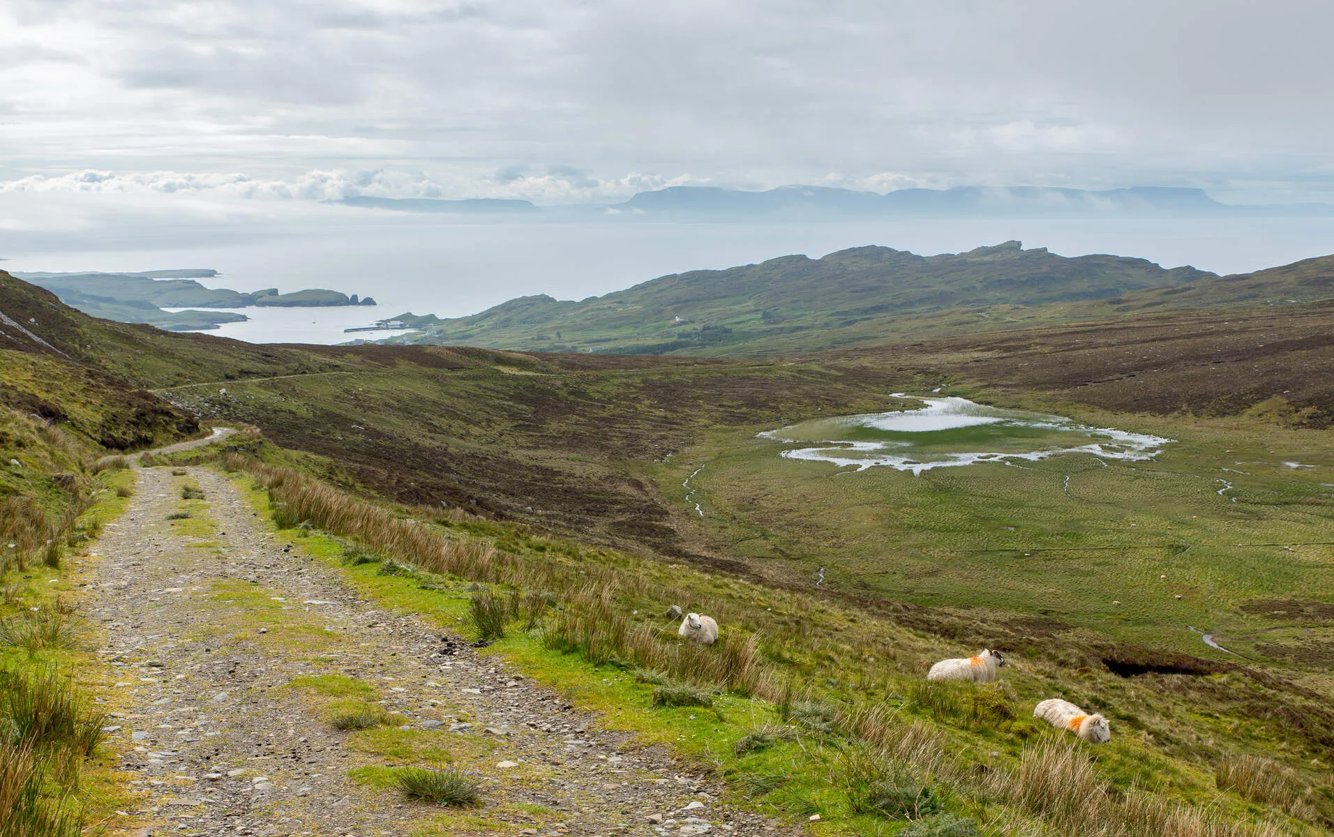
8. Killala to Downpatrick Head (County Mayo) — 12 km
North Mayo is quiet. The coast path runs through Ballycastle toward Downpatrick Head—a dramatic sea stack rising over 40 meters. Achill Island, connected to the mainland by bridge, offers some of the most dramatic coastal scenery on the entire route. The cliff walk at Croaghaun — the highest sea cliffs in Ireland at 688 metres — is a serious mountain walk and one of the essential Wild Atlantic Way hiking stops. Westport is a handsome base for climbing Croagh Patrick, Ireland's holy mountain, with views across Clew Bay's 365 islands. The light in Mayo is peculiar: driven by clouds and sudden clearings that change the landscape every 10 minutes. Puffins nest on the Downpatrick stack in the summer. Difficulty: easy to moderate. Duration: 4–5 hours.
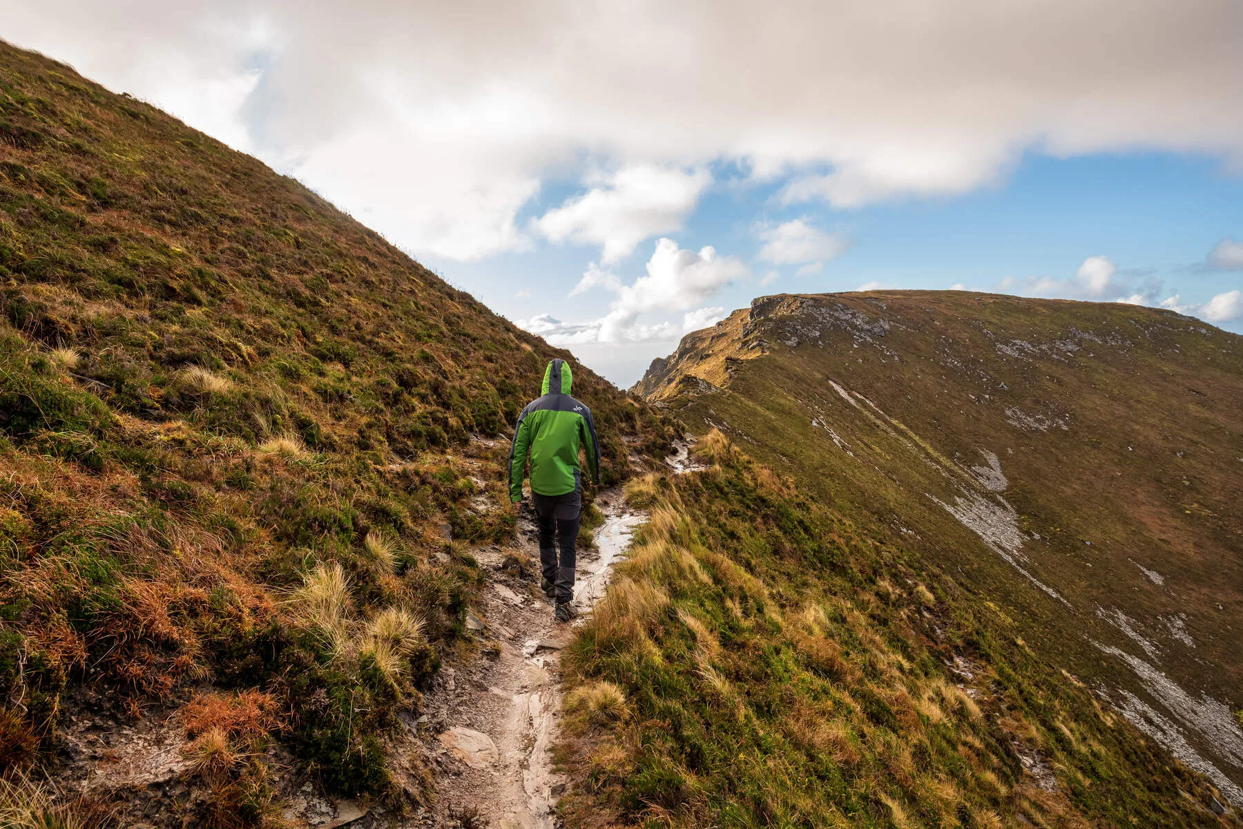
9. Slieve League Cliffs (County Donegal) — 10 km
Some of the highest sea cliffs in Europe—nearly 600 meters of rock faces dropping to the Atlantic. The walk from Bunglass crosses heather, reaches a narrow ridge called One Man's Pass, and arrives at a panoramic summit. The less-visited Pilgrim's Path approaches from the south and provides you the full sense of the mountain's scale. In October, I walked it while the coast lay shrouded in mist below, and the cliffs emerged like a dream. Not for walkers afraid of heights. Difficulty: hard. Duration: 3–4 hours.
10. Malin Head Coastal Loop (County Donegal) — 7 km
Ireland's most northerly point — the end of the route from Mizen Head to Malin Head. The coastal loop passes dramatic cliffs, coves, old signal towers, and dramatic rock formations. At Bánba's Crown, there's a small stone hut from the 1800s and a view that's purely wild — no human construction is visible, just rock and ocean facing nothing but open Atlantic until you hit Iceland. Horn Head near Dunfanaghy is also worth the detour — sheer sea cliffs and spectacular seabird colonies with a 3-hour loop. Difficulty: easy to moderate. Duration: 2.5–3 hours.
How to Use This Wild Atlantic Way Walking Guide
There are several ways to approach walking the Wild Atlantic Way sections covered in this guide, depending on your time and ambition.
A regional deep dive is the most popular approach: spend 7–14 days exploring one area thoroughly. A week exploring the Wild Atlantic Way on foot via the Dingle Way or 10–14 days combining the Kerry Way with surrounding walks delivers a complete experience without excessive time commitment.
A connected multi-region tour combines two established routes — like 7 days on the Dingle Way plus 7 days on the Kerry Way — for comprehensive south coast experience. You could also combine Dingle or Kerry with Connemara sections.
A single-region sampler works well for a first trip. Even a week spent in one region, mixing longer walks with shorter daily options, provides a meaningful experience with this wild Atlantic way walking guide. For wild Atlantic way trail recommendations, start with Sections 5 and 6 (Cliffs of Moher + Burren Way). Add Section 4 (Dingle Way) if you have time. For wild country and dramatic wild Atlantic way cliff walks, head to Sections 2, 8, or 9.
Planning Your Wild Atlantic Way Trip
A Wild Atlantic Way map is available from tourism offices along the route and online. The route is well signposted throughout. A car is the best way to travel between ireland west coast walking routes — the coast road connects the trailheads, and you can stop whenever the scenery demands it.
The best time to visit Ireland for walking the Wild Atlantic Way is May to October. Summer brings the longest days and warmest weather but also the most visitors. September and early October are ideal — quieter roads, warm golden light, and good walking conditions. Spring offers beautiful wildflower displays and increasingly stable weather. Winter brings dramatic skies and empty trails but short daylight hours — only for experienced walkers with proper equipment.
The Irish weather on the west coast is changeable. Atlantic weather systems arrive regularly, so pack waterproofs and layers regardless of season. Our packing list covers everything you need. Wear sturdy hiking boots for cliff walks and mountain trails. Carry a detailed walking map, as a mobile signal is unreliable in remote sections.
We offer self-guided walking holidays along the Wild Atlantic Way with accommodation, luggage transfers, and detailed route notes – you walk with a daypack only. For walkers who want local knowledge, our guided walking holidays pair you with guides who know every path on the coast. Check our tour grading to find the right level.
Frequently Asked Questions
How long does it take to drive the Wild Atlantic Way?
A full Wild Atlantic Way road trip covering 2,500 km takes at least 5–7 days of driving. Most visitors allow 10–14 days to enjoy the stops properly. If you want to walk the trails along the route, two weeks or more is ideal.
Can I walk the entire Wild Atlantic Way on foot?
The full 1,600 km of walkable coastline would take 8–10 weeks. There is no single continuous trail for walking wild Atlantic way sections, but each area has waymarked trails — the Kerry Way, Dingle Way, Burren Way, and Western Way all follow parts of the coast. The 10 sections in this wild Atlantic way walking guide represent the best walks wild Atlantic way offers. Most visitors choose 2–4 sections over 6–14 days.
What is the best section for walking?
The Kerry and Dingle sections offer the most walking trails and are among the best walks the Wild Atlantic Way offers. County Clare has the Cliffs of Moher and Burren Way. Donegal's Slieve League cliffs and Horn Head are outstanding for experienced walkers. For a first trip, start with the Cliffs of Moher coastal path and Burren Way.
Are the walks marked and easy to navigate?
Most are marked with yellow or red arrows. The Cliffs of Moher, Dingle Way, and Kerry Way are well-marked. Remote sections like Beara or Mayo need detailed maps. We provide route notes for all our walking holidays.
What is the best time to walk the Wild Atlantic Way?
May to October offers the best weather and longest days. September is ideal — quieter roads, warm golden light, and comfortable walking temperatures. Summer is the warmest but busiest, especially in Kerry and Clare.
Do I need to be very fit?
Sections 5 (Cliffs of Moher) and 10 (Malin Head) are easy. Sections 3 (Kerry Way) and 4 (Dingle Way) are moderate. Sections 2 (Beara), 8 (Mayo), and 9 (Slieve League) require excellent fitness and mountain experience. Check our tour grading to match your fitness level.
Where should I base myself?
Dingle town is included in Sections 3–4 (Kerry and Dingle). Doolin for Sections 5–6 (Cliffs and Burren). Galway for Section 7 (Connemara). Donegal town is the location for Sections 9–10 (Slieve League and Malin Head). Or move villages every 2–3 days for variety. You can also start from Shannon or Galway airports to reach the middle sections.
Making the Most of Your Wild Atlantic Way on Foot
The Wild Atlantic Way gives you Ireland's west coast in all its moods — wild sea cliffs, empty beaches, mountain passes, and village pubs with a fire and a fiddle session. The road is spectacular, but exploring these ireland west coast walking routes is what stays with you. Step off the road and onto the cliff path, the mountain trail, or the beach, and you see the Ireland that the road can't show you. Get in touch with Walking Holiday Ireland and we'll help you plan a wild Atlantic way walking guide experience that combines the best driving with the finest walking on Ireland's western edge.
Frequently Asked Questions
Are the trails well-marked?
What kind of boots should I wear?
What are the most essential items to pack for a walking holiday in Ireland?
What is the most popular route?
Photo Gallery