Burren Way: 123km Coastal Trail Through Limestone
Ready to walk it? See our self-guided Burren Way walking holidays with luggage transfer, hand-picked B&Bs and 24/7 support.
The Burren Way: Walking Through an Ancient Landscape
There's a moment on the Burren Way when you realise you're walking on another planet—or, at least, you imagine what other planets might feel like. If you're using a Burren Way walking guide to plan your journey, no description can truly prepare you for this experience. Your boots crunch on grey limestone pavement that stretches in every direction like some vast, ancient mosaic.
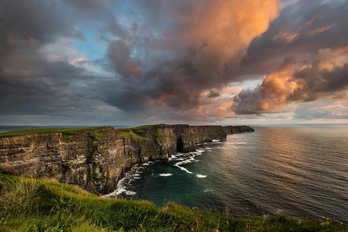
Wildflowers you've never seen before—and probably can't pronounce—bloom impossibly between the stone cracks. On one side, the land drops away to reveal the Cliffs of Moher, those dramatic sentinels that guard the Clare coast. On the other, the soft green hills of Galway roll toward the horizon.
This is the Burren Way, one of Ireland's most captivating long-distance walks and a route that rewards careful Burren Way route planning. Unlike the crowded coastal paths or the more famous Kerry Way, the Burren offers something rarer: solitude, wonder, and a landscape so distinctive that it feels like stepping backward in time.
I fell in love with this region years ago, and I keep returning—sometimes with walkers, sometimes just to wander alone and breathe in that particular Burren air. Whether you're planning a multi-day walking holiday with luggage transfers or tackling sections at your pace, this walking guide will help you understand what makes the Burren Way truly special and provide practical walking Burren Way tips you won't find elsewhere.
What is the Burren, Really?
Before we talk about walking the route itself, it's worth understanding the landscape you're moving through. The Burren (Boireann in Irish, meaning "rocky place") isn't like anywhere else in Ireland. It's a 520-square-kilometre limestone plateau that rises gradually from the coast and stretches across County Clare to Galway and Offaly.
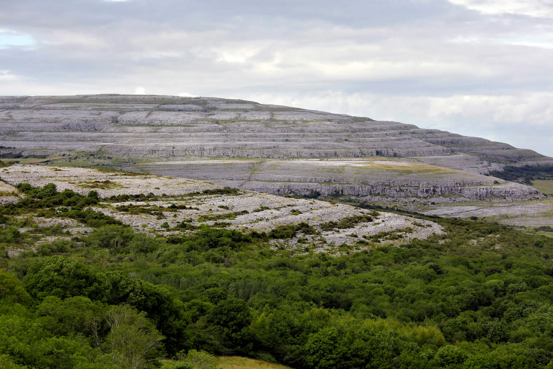
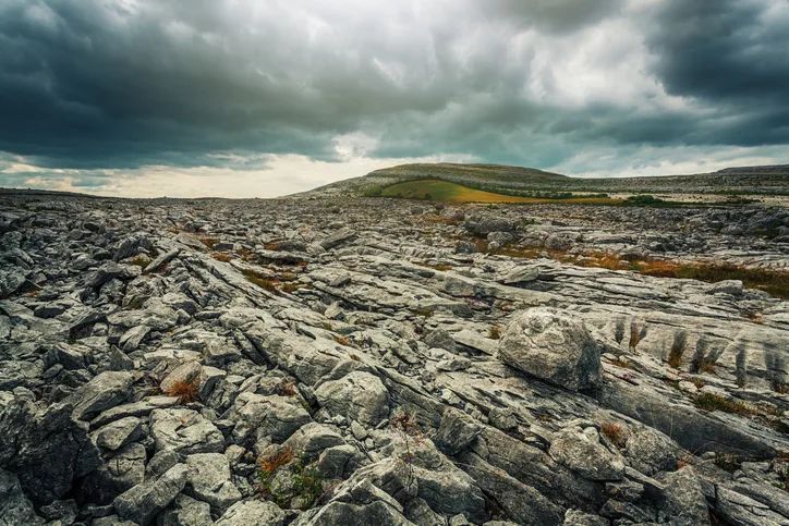
Glaciers shaped this land during the ice age, scraping away soil and exposing the raw bedrock beneath. What remains is karst topography—limestone that's been weathered, dissolved, and fractured into a stunning natural sculpture. There are no trees up here on the exposed uplands, just stone, low scrub, and sky. It's bleaker than the green, pastoral Ireland of postcards and infinitely more intriguing.
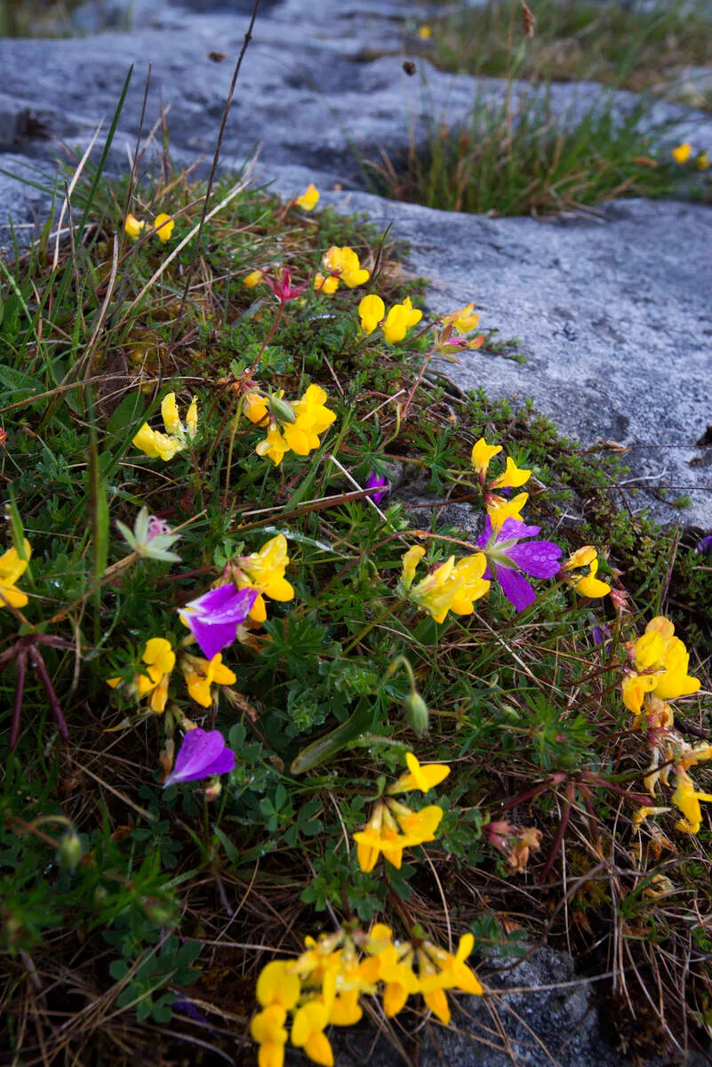
The climate here creates an ecological miracle. The limestone bedrock, despite looking barren, holds moisture and nutrients that feed rare alpine and Mediterranean plants. You'll observe bloody cranesbill, spring gentian, and hoary rock-rose blooming alongside arctic alpines—a plant community you'd expect to be scattered across vastly different latitudes, all thriving together in this small corner of County Clare. The best time to see wildflowers in bloom is May through July, when the limestone becomes a tapestry of colour.
Beneath the surface—quite literally—lies another world. The Burren is riddled with caves and sinkholes created by water dissolving the porous limestone. Ailwee Cave is the most famous, but cavers and geologists are still exploring dozens more.
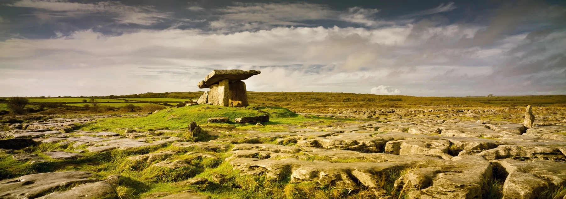
And everywhere you look, there are monuments to the people who came before us: stone circles, dolmens, ring forts, and ancient walls that crisscross the landscape like a three-dimensional map of history.
Burren Way Walking Guide: The Route at a Glance
The Burren Way is a 35-kilometre (22-mile) waymarked trail that typically takes walkers five to seven days to complete at a leisurely pace—which is the only way to truly experience this karst limestone walking Ireland adventure. The route starts in Corofin in the south and finishes in Ballyvaughan on the northern coast, moving generally northward through the heart of the Burren.
The walk is graded as easy to moderate. There are no technical climbs, and the terrain is mostly on established paths and farm tracks. That said, the exposed nature of the landscape means weather can change rapidly, and navigation can be tricky on misty days (and there are often misty days). The elevation gain is gentle but cumulative—you're rarely climbing steeply, but you're often climbing.
This isn't a coastal cliff walk, despite what some marketing might suggest. You won't have the sea constantly in view. Instead, the Burren Way winds through the interior landscape, with ocean views reserved for particular vantage points. The Cliffs of Moher section, which adjoins the Burren Way, offers exactly what you desire if you're eager for dramatic clifftop walking. But if you want something more mysterious and less touristy, the Burren Way itself is the better choice.
Most walkers planning their Burren Way itinerary complete the route with luggage transfers, moving to a new base each night. This enables you to walk at your own pace without the weight of carrying everything on your back. Handpicked guesthouses and small hotels are scattered along the way—the sort of places where the owner knows the local history and the breakfast includes homemade brown bread.
Stage 1: Corofin to Leamanagh Castle (12 km) — Beginning Your Burren Way Itinerary
Starting Point: Corofin Village
Your journey begins in the village of Corofin, a place that somehow feels like the gateway to the Burren. This first stage of the Corofin to Ballyvaughan walk sets the tone for everything that follows. The village sits at the southern edge of the limestone plateau, where the landscape transitions from green pastoral to grey and wild.
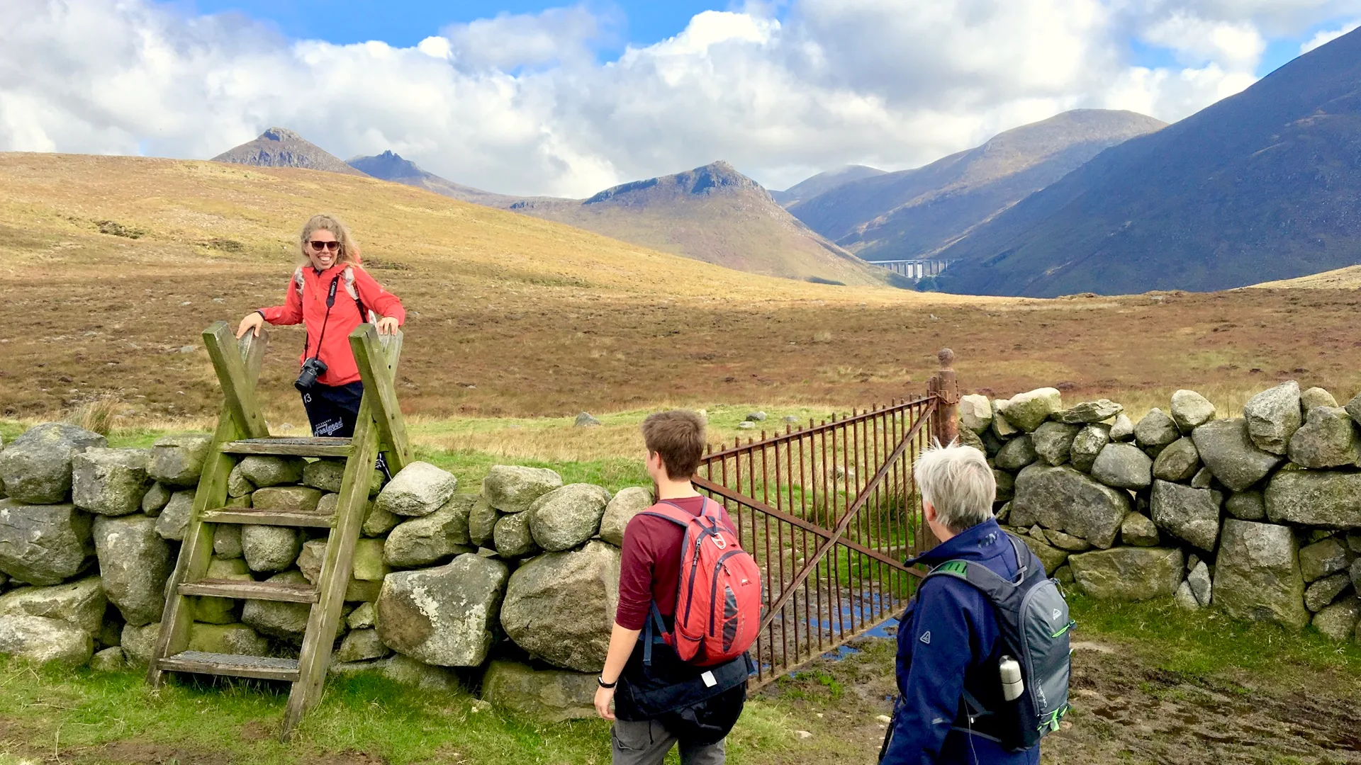
From Corofin, the Burren Way heads northeast through gently rolling countryside dotted with stone walls and scattered ruins. The walk takes you through farming land—the Burren isn't just wilderness; it's a working landscape where farmers have grazed cattle and sheep for centuries, their presence marked by countless dry-stone walls.
Leamanagh Castle: A Sentinel in the Stone
After about five kilometres, you'll reach Leamanagh Castle, a substantial ruin that stands like a sentinel on a hillside. Conor O'Brien built the castle in the 1640s, despite the O'Briens' long-standing control over this territory. Today, it's partially restored and makes for a perfect rest point. The views from here begin to expand—you're starting to climb, and the Burren's distinctive character becomes unmistakable.
Entering the Real Burren
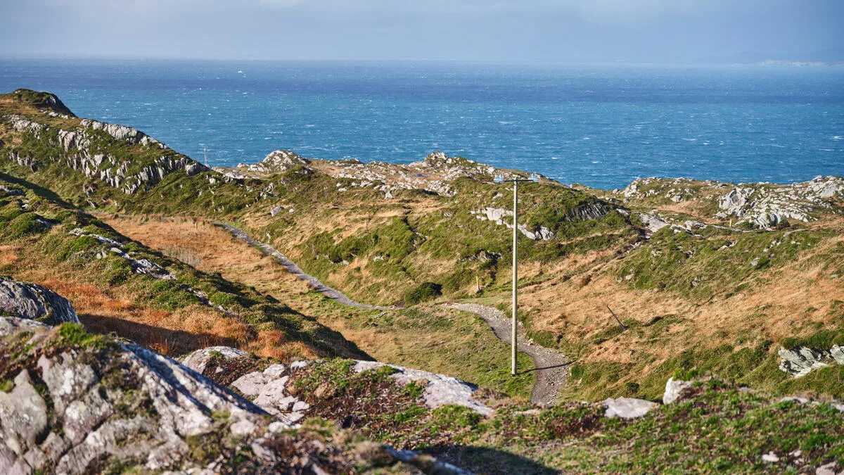
Continue eastward, and the terrain becomes more obviously karst. This is where walking Burren Way tips from your guide really come into play—the landscape shifts dramatically. You'll notice the absence of trees, the way the stone rises up in pavement-like formations, and the dryness despite regular Irish rain (it drains straight through the limestone). This landscape is the real Burren now, and something shifts in how the light falls and how the wind feels.
By evening, you'll reach your accommodation near Leamanagh or push on toward Kilfenora if you're moving at a faster pace. Either way, settle in, have a pint in the local pub, and let the strangeness of the landscape seep into you.
Distance: 12 km | Elevation Gain: 200 m | Terrain: Farm tracks and country lanes | Difficulty: Easy
Stage 2: Leamanagh to Lisdoonvarna (13 km)
Entering the Heart of Karst Country
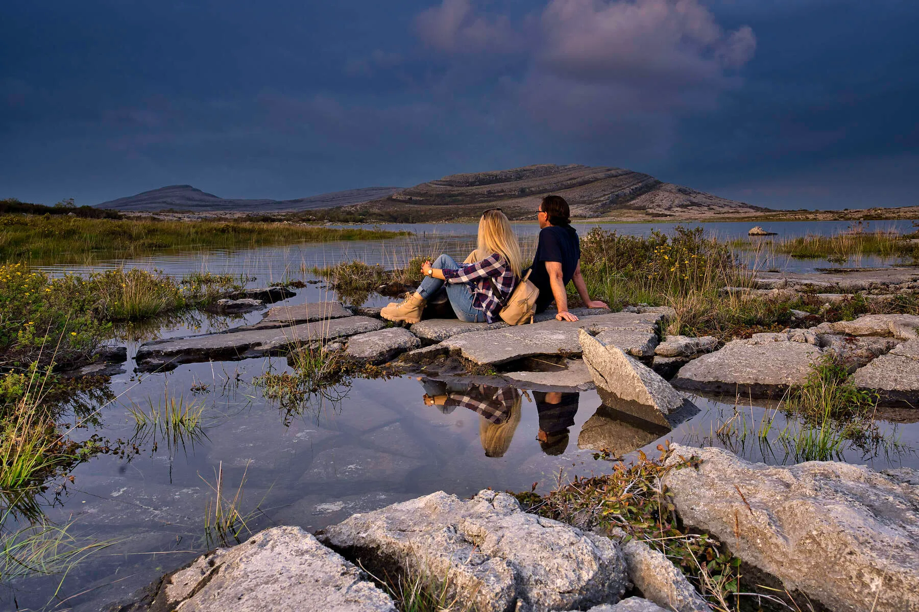
This area is where the Burren landscape, for which Ireland is famous, truly reveals itself. From Leamanagh, the route continues northeast toward the heart of the limestone plateau. You're now properly in karst country—the landscape becomes more dramatic with each kilometre. Stone walls crisscross the hillsides in patterns that seem almost architectural. Small lakes appear and disappear (the Burren's water simply vanishes underground through sinks and swallow holes). Wildflowers proliferate in season, and birdwatchers often spot choughs, rare red-billed birds that nest in the cliff faces.
The walking is straightforward, mostly on established farm tracks, with some stretches on quiet country roads. The pace of the landscape unfolds slowly—which is precisely what makes it special. You're not rushing to the next dramatic viewpoint; you're absorbing the subtle texture of this ancient terrain.
Bronze Age Monuments and Ancient Mysteries
Around midway, you'll pass near Leamenagh Stone Circle and other Bronze Age monuments. These aren't the grand, obvious stone circles of other Irish regions—they're more understated, nestled into the Burren's folds—but they're deeply evocative. Walking past them, you can't help but wonder what the people who built them were thinking and what they believed about this same landscape four thousand years ago.
Arriving at Lisdoonvarna
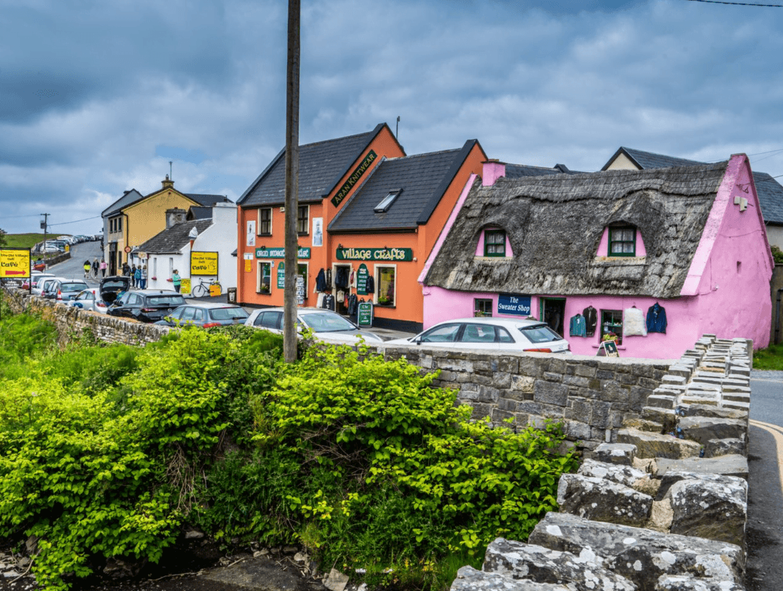
Lisdoonvarna, your evening destination, is a small spa town that's been attracting visitors for centuries due to its mineral springs. There's something pleasantly eccentric about Lisdoonvarna—it has a bohemian, slightly time-warped quality. The town is famous (or infamous, depending on your perspective) for the annual Matchmaking Festival in September, where single people gather in hopes of finding love. It's a bit quirky but entirely genuine, and after a day's walking, the warm hospitality and excellent food make it feel like exactly the right place to rest.
Distance: 13 km | Elevation Gain: 250 m | Terrain: Tracks and country lanes | Difficulty: Easy to Moderate
Stage 3: Lisdoonvarna to Doolin (10 km)
Spa Time and Plateau Ascent
This shorter stage of your Burren Way trail guide allows you to explore Lisdoonvarna in the morning (the spa facilities are worth trying after several days of walking), then make your way northwest toward Doolin, a village that's become synonymous with traditional Irish music.
From Lisdoonvarna, the route climbs gradually onto the higher Burren plateau. This is some of the most otherworldly karst limestone walking Ireland has to offer—you're crossing open limestone pavement with 360-degree views. On clear days, you can see the Aran Islands in the distance. On misty days (which are common), the landscape becomes even more ethereal, stone walls appearing and vanishing like thoughts in fog.
Descending into Doolin's Music Scene
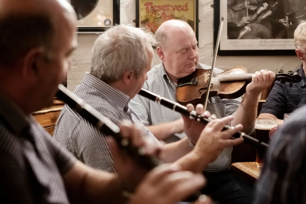
The route descends toward Doolin, which sits on the northwestern edge of the Burren where it meets the sea. Doolin is renowned for its music scene—several pubs in the village have nightly traditional sessions, and musicians from around Ireland (and the world) come here to play. After days of solitude on the Burren, Doolin offers a different kind of magic: human connection, conversation, and the chance to listen to fiddles and bodhráns in a room filled with the kind of joy that only comes from people sharing something they love.
That said, Doolin has become quite touristy recently. If you prefer quietness and solitude, you might decide to stay a few kilometres away and visit the village in the evening.
Distance: 10 km | Elevation Gain: 150 m | Terrain: Open moorland and tracks | Difficulty: Easy to Moderate
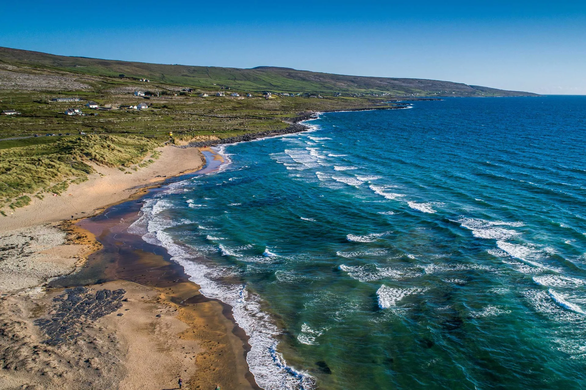
Stage 4: Doolin to Ballyvaughan (9 km) — Completing the Corofin to Ballyvaughan Walk
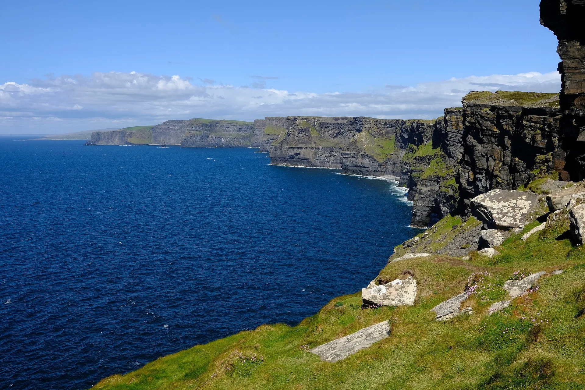
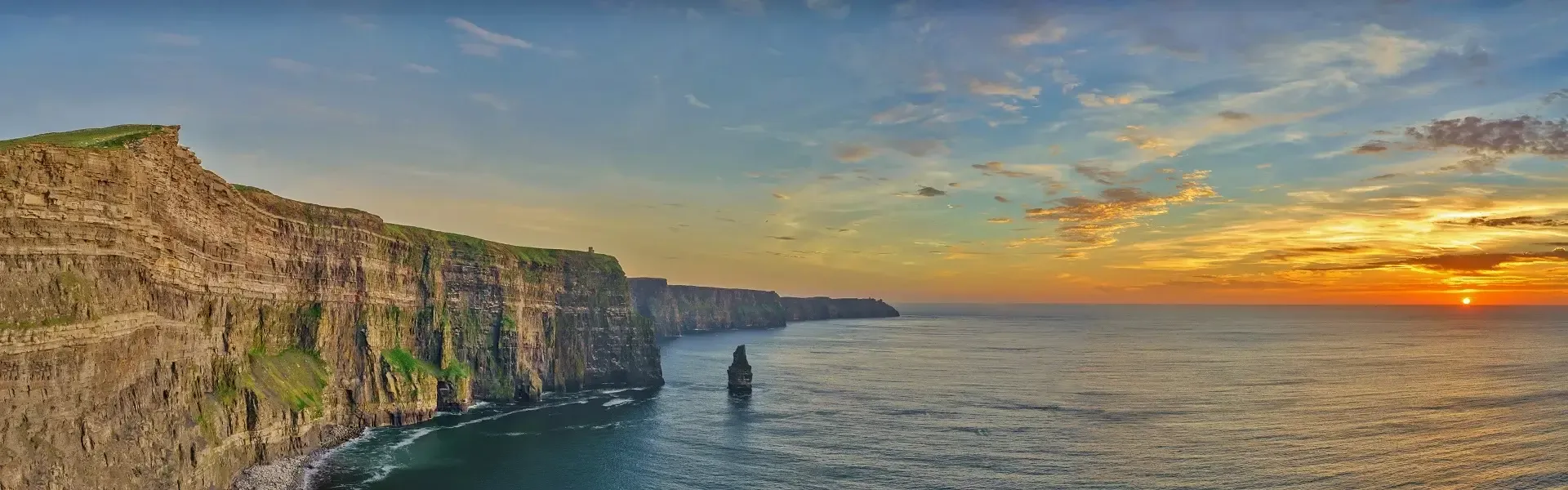
The final stage can be quite short if you head directly from Doolin to Ballyvaughan. However, most walkers choose to make a detour to the Cliffs of Moher, one of Ireland's most visited natural wonders.
If you take a Cliffs of Moher detour, you'll add five kilometres to your day, but the experience is worth it. These cliffs are genuinely spectacular—they rise 214 metres at their highest point and stretch for 14 kilometres along the coast. Unlike other Irish cliff walks, Moher's aren't narrow or technical; there are substantial pathways, and while they can be crowded (especially around the visitor center), the sheer scale of the landscape is humbling.
The cliffs are home to thousands of seabirds—guillemots, razorbills, puffins, and kittiwakes nest in the rock faces. If you're there in late spring or early summer, you might see puffins, those endearing little birds with their bright orange beaks. On clear days, you can see the Aran Islands and even the Twelve Bens mountains in the distance.
From the cliffs, the path drops down toward the coast and works its way north toward Ballyvaughan. This final section has a triumphant, arrival-at-the-end-of-a-journey feeling. You're coming down from the high Burren; the landscape is becoming greener and softer, and civilisation is waiting just ahead.
Ballyvaughn, your final destination, is a charming coastal village with a harbour, excellent restaurants, and a few traditional pubs. It's the sort of place where you can arrive dusty and exhausted, shower, change clothes, and spend the evening reflecting on what you've seen.
Distance: 9 km (14 km with Cliffs of Moher) | Elevation Gain: Minimal | Terrain: Coastal paths and farm tracks | Difficulty: Easy
Burren Way Walking Stages Summary Table
Stage | Route | Distance | Elevation Gain | Difficulty | Highlights |
|---|---|---|---|---|---|
1 | Corofin to Leamanagh | 12 km | 200 m | Easy | Leamanagh Castle, limestone emerging |
2 | Leamanagh to Lisdoonvarna | 13 km | 250 m | Easy-Moderate | Open plateau, stone circles, wildflowers |
3 | Lisdoonvarna to Doolin | 10 km | 150 m | Easy-Moderate | High limestone pavement, coastal views |
4 | Doolin to Ballyvaughan | 9-14 km | Minimal | Easy | Cliffs of Moher (optional), final descent |
Total | Corofin to Ballyvaughan | 35-40 km | 600-650 m | Easy-Moderate | Complete Burren experience |
Geological Wonder: Understanding the Landscape
What you're walking through is a geology textbook come alive. The limestone that forms the Burren was laid down in warm, shallow seas roughly 320 million years ago during the Carboniferous period. Countless tiny organisms died and settled on the seafloor, their shells accumulated into thick layers of sediment that eventually became stones.
When those seas retreated and the land rose, the limestone was exposed to weathering. Rainwater—which is slightly acidic due to dissolved carbon dioxide—seeps into tiny cracks in the stone and dissolves it over millennia. This process has created the distinctive pavement landscape you see today, where limestone appears as horizontal slabs separated by vertical fissures called "grikes." These grikes are often several meters deep, and the microclimates within them allow rare plants to thrive while protected from wind and grazing animals.
If you want to learn more about the Burren's geology, the Geological Survey of Ireland has excellent resources. But you don't need to be a geologist to feel the ancientness of this place. It speaks for itself.
Ancient History and Stone Monuments
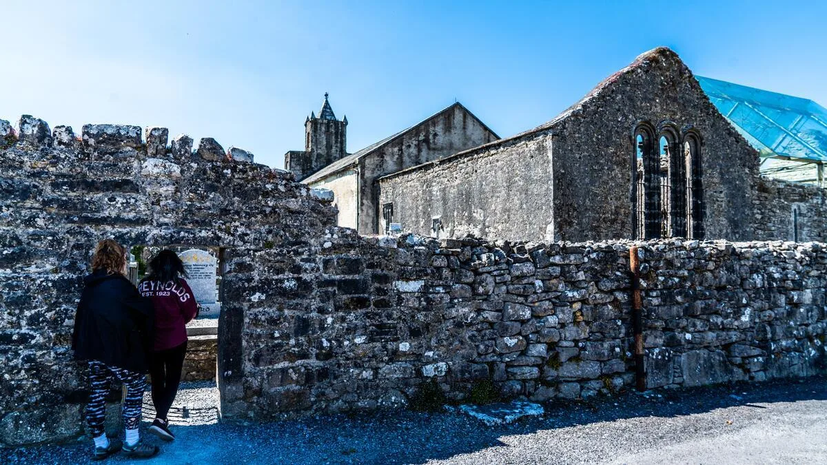
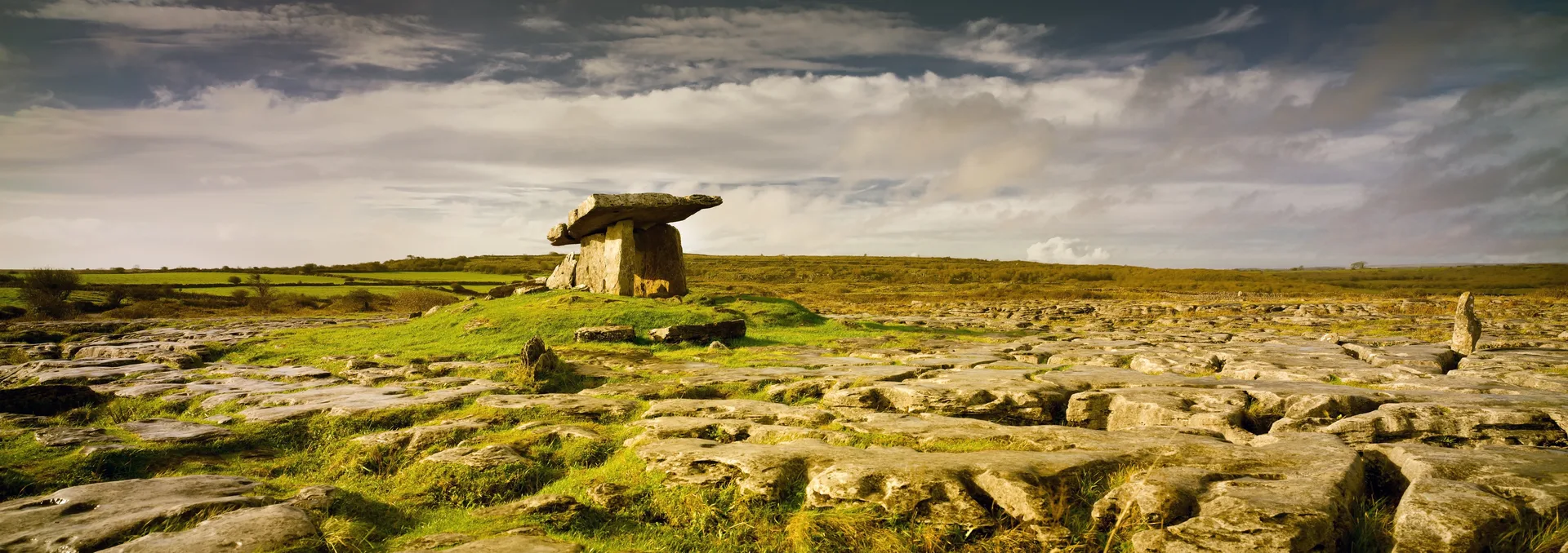
The evidence of habitation in the Burren for at least 4,500 years is everywhere, provided you know where to look. Stone Age people left scattered flint tools. Neolithic farmers built the earliest structures—the dolmens you'll see are passage tombs, collective burial chambers built between 4000 and 3000 BCE.
Bronze Age people (roughly 2000-500 BCE) left their marks too: the stone circles and standing stones scattered across the landscape. Then came the Celts, and later the Christian monks who established monastic settlements.
The Burren is unusual in that you don't need to visit a museum to understand its history—the landscape itself is a museum. Every wall, every monument, every ruin tells a story. The best approach is to walk slowly, notice what you see, and let the landscape speak to you. If certain monuments pique your interest, your accommodation hosts or a local guide can offer more in-depth context.
Essential Burren Way Route Planning: What to Bring
Footwear: Sturdy walking boots with excellent ankle support. Waterproof is essential for walking on karst limestone in Ireland.
Layers: Waterproof jacket and warm layer.
Navigation: Map or walking app.
Sun Protection: Sunscreen, hats, and sunglasses.
Supplies: Water and snacks.
Camera: For capturing the landscape.
Best Time to Walk the Burren Way: Route Planning Essentials
May-June: Wildflowers and fewer walkers.
July-August: Warm weather, more crowded.
September: Pleasant weather and fewer crowds.
Avoid October-April due to weather and closures.
Luggage Transfers and Accommodation
Most walkers planning their Burren Way itinerary use luggage transfers and stay in guesthouses or small hotels along the route—this is where having a reliable trail guide becomes invaluable for booking ahead.
Connected Walks and Day Excursions
Cliffs of Moher Walk
Aran Islands Day Trip
Ailwee Cave
Fanore Beach Walk
Connecting to Other Irish Walking Routes
The Burren Way connects well with other routes such as the Kerry Way and the Causeway Coast.
Safety Considerations
Navigation: Carry a map.
Ankle Hazards: Watch footing.
Weather: Prepare for change.
Isolation: Limited shelter.
Cliff Edges: Stay on paths.
Gates: Close behind you.
The Real Burren Experience: Final Thoughts from Your Burren Way Walking Guide
The Burren Way offers solitude, geological interest, and cultural depth that few other walks in Ireland can match.
It suits walkers who enjoy quiet landscapes, slow travel, and the unique Burren landscape Ireland provides.
Walk it over several days and take your time.
The Burren stays with you long after you leave.
Further Reading and Resources
Geological Survey Ireland
Official Burren Way Website
"The Burren: Limestone, Life and Legends"
Walk with purpose, and may the Burren's unique magic touch you.
Frequently Asked Questions
Are the trails well-marked?
What kind of boots should I wear?
What are the most essential items to pack for a walking holiday in Ireland?
What is the most popular route?
Photo Gallery