Best Walking Trails Near Dublin: Day Hikes and Coastal Walks
The best hikes near Dublin are the Howth Cliff Walk, the Bray Head Loop, Dalkey and Killiney Hill, the Great Sugarloaf, Glendalough and the Dublin Mountains Way. My name is Cliff, and I run Walking Holiday Ireland. The capital sits right on the doorstep of some of the best walking in the country. Within an hour of the city centre, you can be on cliff-top coastal paths, mountain ridges, forest trails, and ancient glacial valleys. Many of the best walks near Dublin are reachable by public transport, making them perfect for visitors and locals alike.
I've walked every trail on this list many times. Whether you're after a gentle coastal stroll, a challenging mountain hike, or a full day exploring the Wicklow Mountains, there's something here for every level of fitness and ambition. Dublin is unusual among European capitals — few cities offer such a range of high-quality walks within easy reach of the centre.
Dublin Walks at a Glance
| Walk | Distance | Difficulty | Access |
|---|---|---|---|
| Howth Cliff Path Loop | 7.8 km, about 2 hours | Moderate, with some steep sections and uneven ground | DART to Howth |
| Bray Head Loop | 5.9 km, about 1.5 hours | Moderate, around 120 m of climbing | DART to Bray, then about 2 km to the start |
| Dalkey and Killiney Hill | About 4 km | Easy to moderate, with a few steep steps | DART to Dalkey, back from Killiney |
| Glendalough Green Road | About 4 km | Easy, flat lakeside path | St Kevin's Bus or car |
| Glendalough Spinc Walk | 9 km, 3 to 4 hours | Challenging, with steep climbing | St Kevin's Bus or car |
| Great Sugarloaf | 45 minutes to an hour to the summit | Moderate, with a rocky scramble at the top | Car (poor public transport) |
| Hellfire Club: Montpelier Loop | 4 km, about an hour | Moderate | Hell Fire Wood car park |
Coastal Walks Near Dublin
If you want sea views, three walks on this list are coastal, and all three are on the DART line. The Howth Cliff Walk loops around the headland on the north side of Dublin Bay. To the south, Dalkey and Killiney Hill look out over Killiney Bay, and the Bray Head Loop climbs above the sea further down the line. You can join the last two by walking along Killiney Beach to the Bray seafront. The Bray to Greystones cliff walk is still closed, so for now Bray Head is as far south as the coastal walking goes.
Howth Cliff Walk
The howth cliff walk is the most popular walk near Dublin and one of the finest coastal walks in Ireland. The loop trail takes you around the headland of Howth Head, with dramatic cliff views over the Irish Sea, Dublin Bay, and the distant Wicklow Mountains. On a clear day, you can see all the way to Wales.
The waymarked Cliff Path Loop is 7.8 km and takes about 2 hours at a comfortable pace, with around 130 m of climbing. It starts at Howth DART station and follows the cliff edge round the Nose of Howth, with the Baily Lighthouse coming into view, up to the Summit, then back to the village on a higher path. The path is well maintained but has some steep sections and uneven ground near the cliffs — sturdy footwear is recommended.
What makes the howth cliff walk so accessible is the DART train. Howth station is at the end of the line, just 30 minutes from Dublin city centre. After your walk, the village of Howth has excellent seafood restaurants, pubs, and an atmospheric harbour where you can watch the fishing boats come in. It's the perfect half-day outing from Dublin.
Bray Head Loop – Bray to Greystones Cliff Walk Closed
The bray to greystones walk is a classic coastal trail, but it has been closed since 2021 because of landslides on the Greystones side and a rock fall near Bray. Wicklow County Council says it stays closed until repair work is done, with no reopening date yet, so please check the council's updates and don't plan on walking between the two towns along the cliffs for now.
The good news is that Bray Head itself is open. The waymarked Bray Head Loop is 5.9 km, takes about an hour and a half and has around 120 m of climbing. Follow the red arrows up through woodland to the cross on top of Bray Head, then south along the hillside with the sea below you, before a gravel track leads inland to Windgates and a roadside footpath brings you back into Bray. The views are outstanding — Bray and Dublin Bay at your feet and the Sugarloaf Mountain inland. Cattle graze on the hill, so keep dogs on a lead.
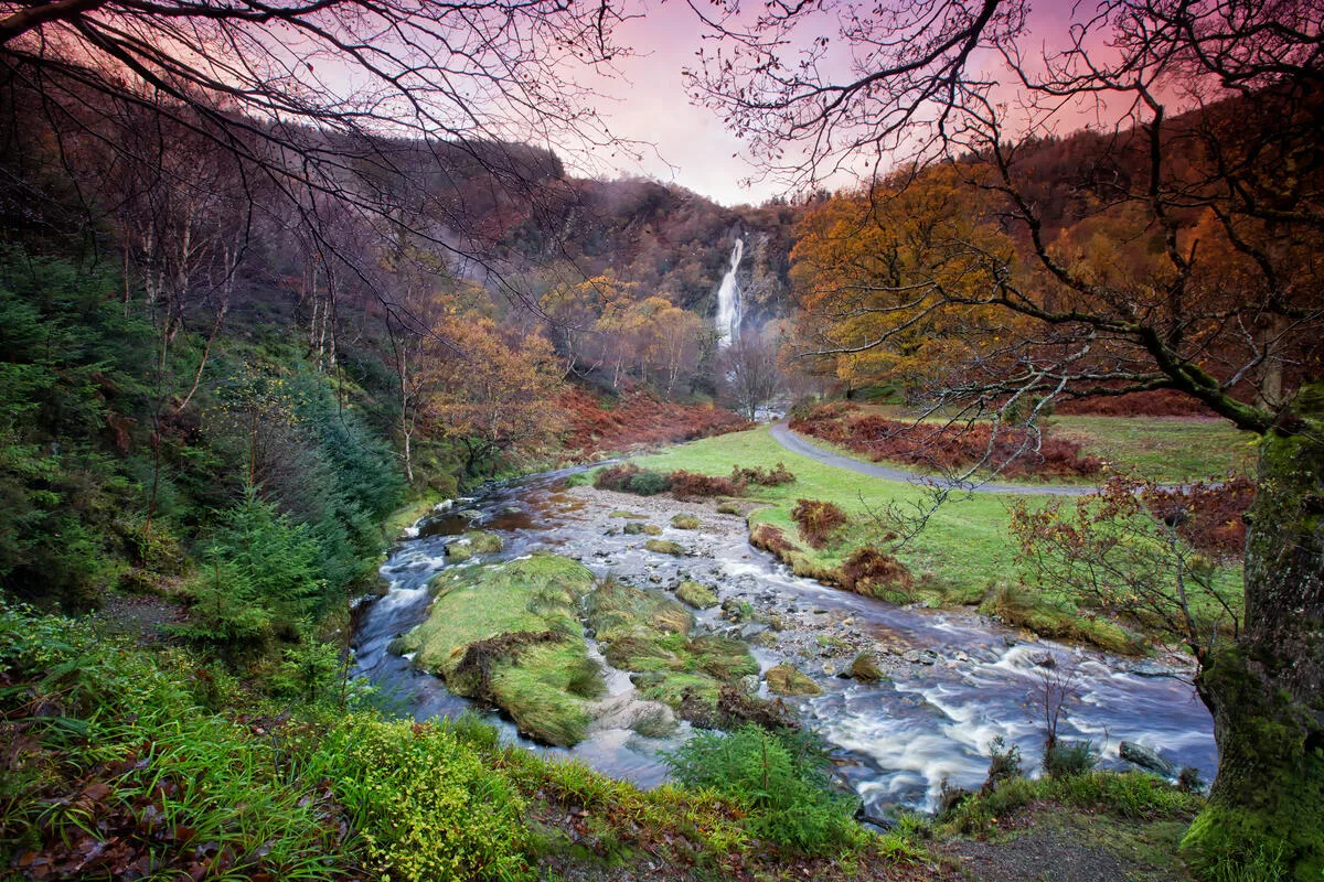
Bray itself is worth exploring before or after the walk. The seafront promenade, the amusement arcades, and the selection of cafes and restaurants make it a great base for a day trip from Dublin. The Bray Head Loop starts about 2 km from Bray DART station, at the Wilton Hotel roundabout on Vevay Road.
Greystones, the next stop south on the DART, has grown into one of the most appealing small towns on the east coast. The harbour area has been developed with good cafes and restaurants, and the beach is a lovely spot to rest your legs. Until the cliff path reopens, a perfect day looks like this: DART to Bray, the Bray Head Loop, a few minutes on the train to Greystones for lunch, then DART home.
Wicklow Mountains: Glendalough and Beyond
The Wicklow Mountains are Dublin's backyard wilderness, and Glendalough is the jewel in the crown. This ancient monastic valley sits between two lakes, surrounded by steep wooded hillsides and granite peaks. The combination of history, scenery, and walking trails makes it one of the most visited places in Ireland — and one of the most rewarding for walkers.
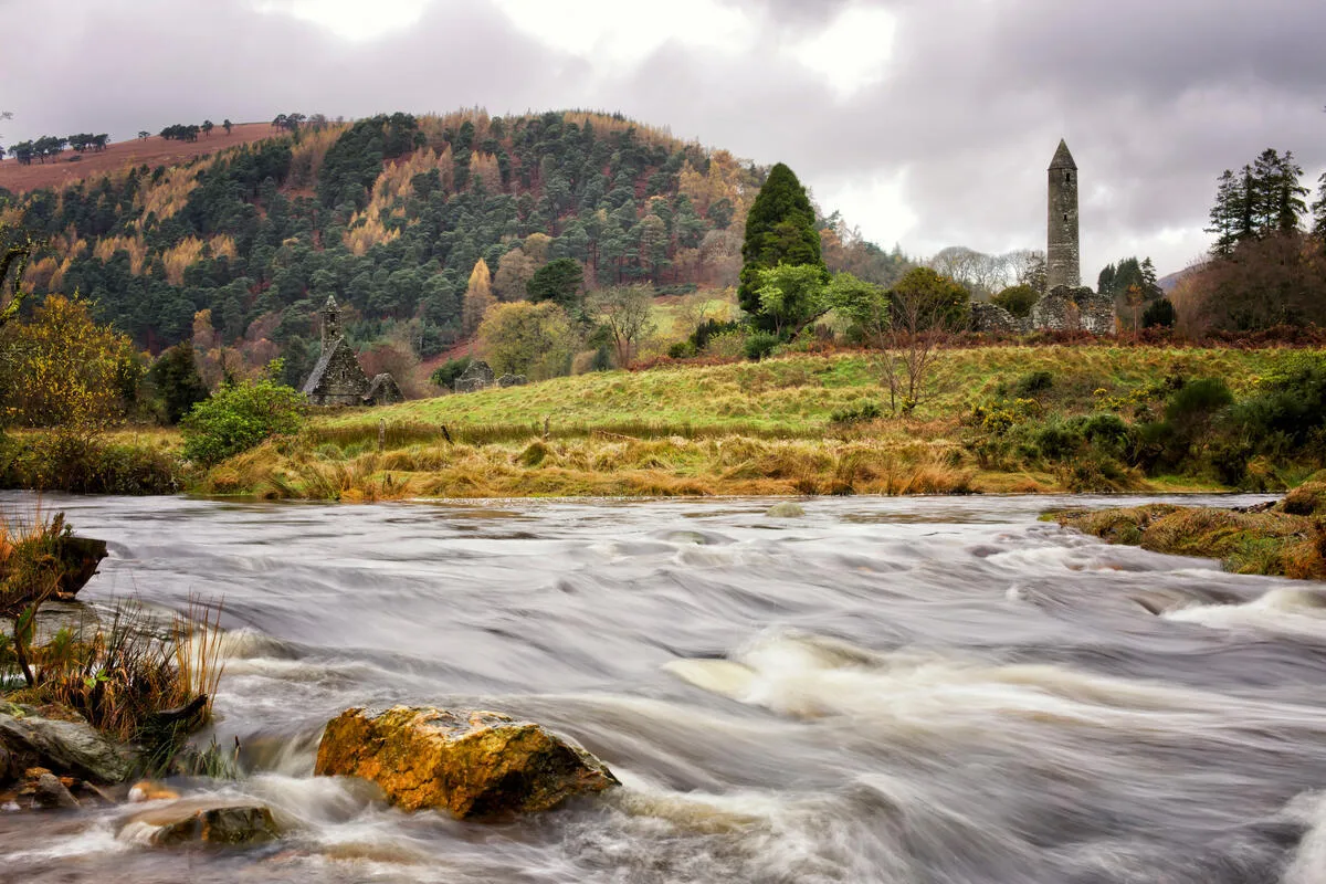
The easiest walk is the Green Road, a flat lakeside loop of about 4 km that takes you past the monastic ruins, the Upper Lake, and into the oak woods. For more of a challenge, the Spinc Walk is a stunning 9 km circuit that climbs above the valley to a ridge with views down to both lakes and across the mountains. It takes 3 to 4 hours and involves some steep climbing, but the views from the top are among the best you'll find anywhere near Dublin.
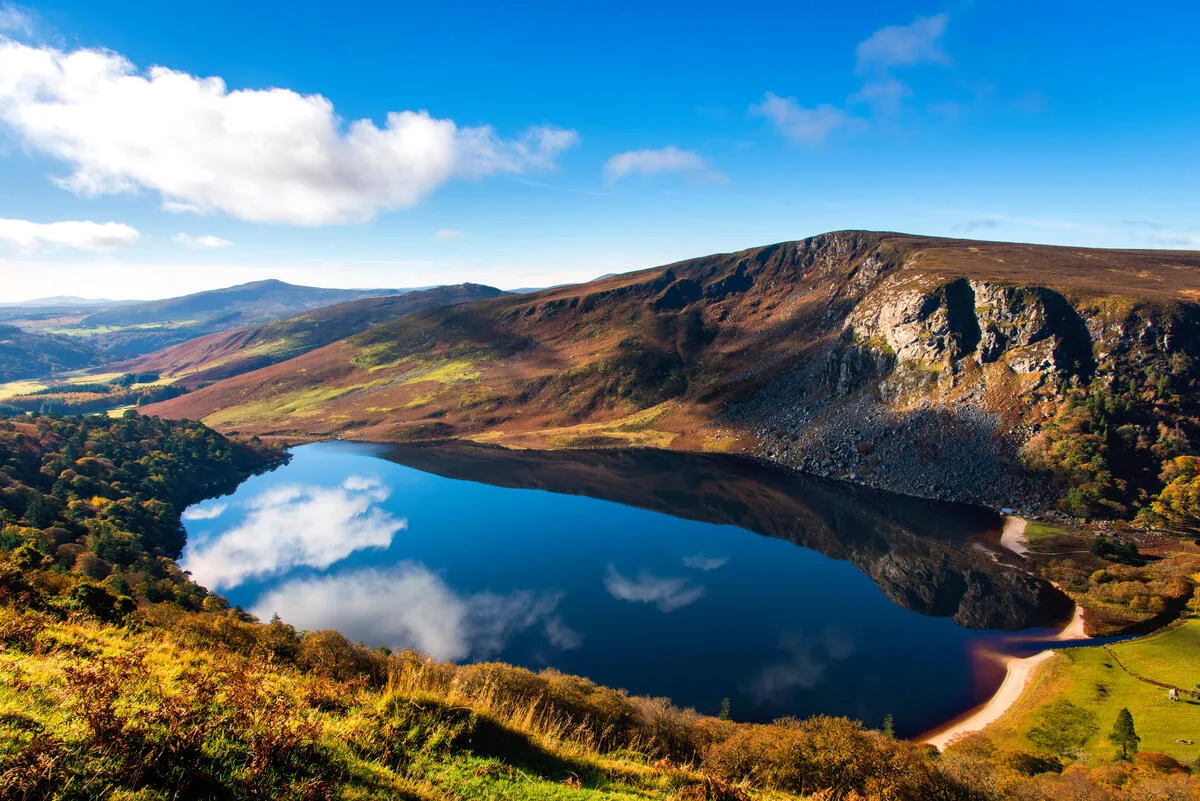
Glendalough is about 50 km south of Dublin. There's no direct public transport, but St Kevin's Bus runs a daily service from the city centre. If you're driving, the route through the Sally Gap and past Lough Tay — the famous Guinness Lake — is one of the most scenic drives in Ireland.
For walkers who want to go deeper into the Wicklow Mountains, the Wicklow Way is Ireland's oldest and most famous long-distance trail. It runs about 128 km from Marlay Park in the Dublin suburbs through the heart of the mountains. Our self-guided Wicklow Way walking holiday covers most of the trail over eight days, with luggage transfer and handpicked accommodation, and you can see all our routes on our self-guided walking holidays page.
Great Sugarloaf
The Great Sugarloaf is one of the most recognisable mountains near Dublin — a conical peak of quartzite that stands apart from the surrounding landscape like a miniature Matterhorn. At 501 metres, it's not the tallest mountain in the Wicklow area, but the steep final scramble to the summit gives it a proper mountain feel.
The main route from the car park takes about 45 minutes to an hour to reach the top. The lower slopes are grassy and gentle, but the last section involves scrambling over loose quartzite rock. Good footwear with grip is essential. From the summit, the 360-degree panorama takes in Dublin city, the Irish Sea, the Wicklow Mountains, and the plains of Kildare.
The Sugarloaf is a popular choice for families and fitness walkers, though the rocky summit section requires care with children. It's about 30 km south of Dublin, easily reached by car but not well served by public transport. The mountain is also a favourite with trail runners who use the steep ascent as a training workout. On a busy weekend, you'll share the summit with dozens of other walkers — proof of how popular hiking near Dublin has become. Despite the crowds, the views never disappoint, and the sense of achievement from standing on a proper summit so close to the city is something special.
Dublin Mountains Way
The Dublin Mountains Way is a 42.6 km waymarked trail that runs from Shankill to Tallaght through the hills immediately south of the city. You don't need to walk the whole thing — individual sections make excellent half-day hikes. The stretch through Ticknock and the Fairy Castle at the top of Two Rock Mountain gives you sweeping views over Dublin Bay from just 20 minutes south of the city centre. The pine forests of Tibradden and Cruagh are also on the route, offering quiet woodland walking that feels far from the city despite being so close.
Hellfire Wood, on an optional spur near the Tallaght end of the trail, is another favourite. The atmospheric forest paths lead up to the ruins of the Hellfire Club, a hunting lodge with a dark local legend. The views from the top stretch from Howth Head to the Wicklow Mountains. The direct climb from the Hell Fire Wood car park to the ruin and back is only about 2.3 km, though steep in places, and the waymarked Montpelier Loop (4 km, about an hour, moderate) works well for an afternoon outing. The Dublin Mountains Partnership has improved trails throughout the area, making the whole range more accessible than ever for dublin hiking.
Dalkey and Killiney Hill
For a shorter walk with outstanding views, the trail from Dalkey village to the top of Killiney Hill is hard to beat. The climb through the park takes about 20 minutes and rewards you with one of the most photographed views in Dublin — the sweep of Killiney Bay, the Sugarloaf in the background, and the sea stretching south towards Wicklow.
Dalkey itself is a charming village with good restaurants, independent shops, and a harbour where you can take a boat to Dalkey Island. The DART stops in Dalkey, making this an easy and rewarding half-day trip from the city.
You can extend this walk by continuing along Killiney Beach to the Bray seafront, turning a 30-minute hilltop visit into a 2-hour coastal exploration. The combination of village character, sea views, and easy transport links makes this one of the most satisfying short outings near Dublin.
Walks Near the Royal Marine Hotel, Dún Laoghaire
If you're staying at the Royal Marine Hotel in Dún Laoghaire, you're well placed for the coastal walks on this list without needing a car. Dún Laoghaire is on the DART line. Dalkey is just a few stops south, so the walk over Dalkey and Killiney Hill is the easiest choice. Stay on the train to Bray for the Bray Head Loop, or head north through the city to Howth for the cliff walk. For something bigger, the Great Sugarloaf and Glendalough are an easy drive south into Wicklow.
Map of walking trails near Dublin
Elevation profile
Distances and times: Sport Ireland, Fáilte Ireland, Wicklow Uplands Council and the Dublin Mountains Partnership; Dalkey, Sugar Loaf summit and Hellfire Club measured on the map. Route lines: © OpenStreetMap contributors (ODbL), drawn along mapped paths. A guide only: follow the waymarks on the ground.
Planning Your Dublin Walks
The best time to visit Ireland for walking near Dublin is April to October, though these trails are walkable year-round. The Irish weather is changeable — pack a waterproof jacket even on days that start sunny.
Good hiking boots are recommended for mountain walks like Glendalough and the Sugarloaf. For coastal walks like Howth and Bray Head, sturdy walking shoes are sufficient. Check our packing list for the full gear rundown.
Flat and easy from the city: the Royal Canal towpath starts in Dublin's Docklands and runs west past Maynooth, with train stations along the way. Read our Royal Canal Way guide, or walk the whole route from Strokestown on the National Famine Way.
If these day walks leave you wanting more, consider extending your trip into a multi-day walking holiday. The Wicklow Way starts right on Dublin's doorstep, and our self-guided walking holidays let you experience the mountains properly. Check our tour grading to find the right level of challenge for your fitness and experience.
Frequently asked questions
A few of the questions our walkers most often ask about hiking near Dublin.
What's the best hiking trail near Dublin for beginners?
The Howth Cliff Path is the one we recommend first — it's well-signposted, around 7.8 km (about 2 hours), and the views across Dublin Bay are lovely. It's rough in places, so wear proper walking shoes. You can reach it from the city centre by DART in about 25 minutes, so no car needed.
Can you go hiking near Dublin without a car?
Yes, easily. The DART line serves Howth and Bray, both with beautiful coastal walks (the Bray to Greystones cliff path itself has been closed since 2021), and the 44 bus runs to Enniskerry if you want to walk into the Wicklow Mountains. We cover all the no-car options in our Dublin by public transport guide.
How far is Howth Cliff Walk from Dublin city centre?
About 15 kilometres — or a 25-minute DART ride from Connolly or Tara Street station. The trailhead is a short walk from Howth DART, so door-to-trail is genuinely under an hour.
Are there multi-day walking trails starting near Dublin?
The Wicklow Way begins in Marlay Park in south Dublin and runs about 128 km to Clonegal in Carlow. Most of our guests walk it over 7 nights. If you'd rather day-hike from a base, we can arrange that too — just get in touch.
What should I pack for a hike near Dublin?
Waterproof jacket (the weather turns quickly), broken-in walking shoes, a warm layer even in summer, water, and snacks. A printed or offline map is always sensible — phone signal can drop in the Wicklow hills.
What are the best hikes near Dublin?
Our favourites are the Howth Cliff Walk (7.8 km), the Bray Head Loop (5.9 km), Dalkey and Killiney Hill, the Great Sugarloaf, the Spinc Walk at Glendalough (9 km) and sections of the Dublin Mountains Way, such as Ticknock and the Hellfire Club. Between them you get sea cliffs, a proper summit, forest and a glacial valley.
Which Dublin walks are coastal?
The Howth Cliff Walk, the Bray Head Loop and Dalkey and Killiney Hill are all coastal, and all three are on the DART line. You can link Killiney and Bray by walking along Killiney Beach.
Are there scenic walks near the Royal Marine Hotel?
Yes. The Royal Marine Hotel is in Dún Laoghaire, on the DART line. Dalkey and Killiney Hill is a few stops south, the Bray Head Loop is further down the line, and Howth is at the end of the northern line.
Is the Bray to Greystones cliff walk open?
No. It has been closed since 2021 because of landslides and a rock fall, and Wicklow County Council has not given a reopening date. The Bray Head Loop is open, and you can take the DART on to Greystones afterwards.
What is the easiest walk near Dublin?
The Bray to Greystones cliff walk used to be the usual answer, but it has been closed since 2021 because of landslides. Today our pick is Dalkey and Killiney Hill: about 4 km from Dalkey DART station over the two hills and down to Killiney DART station, with a few steep steps and one of the best views over Killiney Bay.
What is the best time to visit for hiking near Dublin?
The best time for walking near Dublin is April to October, when weather is more stable and daylight hours are longer. However, these trails are walkable year-round. Always pack a waterproof jacket as Irish weather is changeable.
Is Glendalough worth visiting for a day trip from Dublin?
Absolutely. Glendalough is one of Ireland's most rewarding walking destinations, combining ancient history, stunning scenery, and excellent trails. The Green Road is an easy 4 km lakeside walk, while the Spinc Walk offers a challenging 9 km circuit with panoramic views. St Kevin's Bus runs daily from Dublin city centre.
What footwear do I need for Dublin walking trails?
For coastal walks like Howth and Bray Head, sturdy walking shoes are sufficient. For mountain walks like Glendalough, Great Sugarloaf, or the Wicklow Mountains, proper hiking boots with good ankle support and grip are recommended, especially for steep sections and scrambling terrain.
Photo Gallery